Country:
 City:


The car park is located at La Tonnelle, overlooking the Route de Tillou, which leads to it.
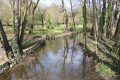
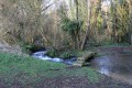
(S/E) Leave the car park and cross the Route de Tillou with care. Opposite, take the grassy path at the bottom of the valley, which heads towards the Berlande on the left-hand side. Cross the Berlande via a small wooden bridge, then head back towards the Route de Tillou, following the river on your left.
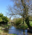
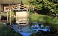
(1) Walk carefully for about fifty metres along the road, then take the small path that runs alongside a property wall and leads to the source of the Berlande, where there is a beautiful wash house.
In front of the wash house, the path turns at a right angle to the left and climbs a small hill towards the Puyberland house. Follow the Chemin de la Source until you reach the Route de Mérilly. There, turn right and walk for just under fifty metres.
(2) Turn left onto Rue de la Mosaïque. Follow this road and, just before rejoining the Route de Mérilly, turn right onto a street heading south, which quickly gives way to a farm track once you’ve passed the last houses.
(3) When you reach the track known as the Chemin des Romains, turn right. Three hundred metres further on, cross the Route de Saint Génard with care, and continue straight ahead along a good farm track that runs through the Plaine du Pistolet.
(4) At the next junction of four farm tracks, turn right to reach, about three hundred metres further on, a crossroads with four roads and a track. Take the second road on the left, which heads north-west towards La Pinaudière. At the next ‘Y’-junction, take the left-hand road, then, a little further on, turn right to head for La Pinaudière.
(5) In La Pinaudière, turn left onto the road known as Chemin de la Pinaudière, which winds down in a hairpin bend towards a bridge crossing the Berlande. Continue until you reach the Paizay-le-Tort road (D44).
(6) Turn left and follow the road carefully for about one hundred and fifty metres. Then turn right onto a small, uphill road, which quickly turns into a shaded track. Follow this until it joins a small road. There, turn right and follow the road carefully to the junction with the Route de Mont.
(7) Cross the Route de Mont and, opposite, take the road leading to the Marais de Mont, slightly to the left. Pass between the farm buildings and turn right onto the first path leading downhill, under the trees. The path joins the Ruisseau des Coudrières. Cross it via an old stone bridge and continue straight ahead along the farm track, known as the Chemin du Bois, uphill through the Bois de Saint-Génard, to reach La Malvauderie and the D44.
(8) Turn left and follow the road carefully as far as the church of Saint-Génard, surrounded by the cemetery. Once there, take the path on the right which passes in front of the main entrance to the cemetery and the church, before skirting them on your left. Go to the far end of the car park, then continue straight ahead along the hillside path to join the small road leading to the Minoiterie du Prieuré. Along the way, there is a lovely view of the valley where the River Marseillaise flows on the right-hand side.
(9) At a place known as the Minoterie du Prieuré, take a look at the mill and, above all, the washhouse on the banks of the Marseillaise, which flows from the springs at Marcillé. Cross the two branches of the river and continue along the road that climbs up the other side of the valley to the Route du Vignolet.
(10) Take this road carefully, veering to the right, until you reach the first houses in Montabert. Turn left onto the small road, with grass in the centre, which heads south, opposite No. 13, Route de Vignolet. Continue to the T-junction with the Route de Lié. Turn right and walk about a hundred metres to reach a triangular junction.
(11) Turn slightly left and take the farm track opposite, which heads south-west. After a wide bend to the right, the track leads to the Tonnelle housing estate. Continue along the small road through the housing estate, known as Chemin du Chétif Bois, with the houses on your left. As you approach the junction with a small road sloping down to the left, turn onto it briefly, before continuing along a footpath that leads to the car park below. (S/E)

 Visorando Member


 Moderate