The founding of a convent
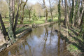
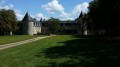
Four or five kilometres from Melle, in the commune of Saint-Génard, stands a picturesque site, surrounded on all sides by valleys, whose history is closely linked to that of the region. This is Puyberland, which owes its name ‘Puy’ to the Latin *Podium* – the mound or hillock on which it stands in isolation – and to the Berlande, which rises in the neighbouring commune of Chail and, together with other streams, surrounds it on all sides. One of these valleys is crossed by the Roman road from Saintes to Poitiers, via a substantial stone embankment that still survives. Might Puyberland—a sort of promontory—not have been one of those fortified sites which, under the Gallo-Roman Empire, monitored and protected the public roads?
What might suggest this is a raised, debris-covered area situated on one of the highest points to the south of the present-day buildings, which the locals call the ruins of the Castelle. Furthermore, what lends our Puyberland a rather respectable air of antiquity is a charter dating back to around the year 947, by which Airaldus, his wife Constance, and their son Goscelin granted to the Abbey of Saint-Jean-d’Angély an allod situated in the villa of Pebernant and in the Vignerie de Tilloux.
Clearly, the name ‘Peberlant’ has been mangled, like so many others, by the medieval scribes, whose records are to be treated with caution. If necessary, all doubts would be dispelled by the simple fact that Puyberland was, and remains, adjacent to Tilloux (Tillou), on which it depended according to this charter. Be that as it may, a place of great renown was in store for this ancient villa in the future and closer to our own time. Maboul would come to call it the ‘Holy Mountain’. From the early years of the 17th century, a young married couple lived in Puyberland.
Gabriel de Lezay de Lusignan and Suzanne de Céris
Equal in birth to one another, but both Huguenots, having been brought up in the heresy of Calvin, like almost all the nobility of Poitou at that time. Legend has it that Gabriel de Lezay fell into disgrace and left the country. Driven by his early religious convictions, might this descendant of the Lusignans not have served under Rohan, that famous Protestant leader, and might he not have followed the example of his commander who, defeated in Provence following the capitulation of Allais and the treaty of 28 June 1629, took refuge in Venice? What might suggest this is that, on his return to the kingdom, Gabriel de Lezay de Lusignan made his abjuration at Sainte-Baume, that cave in the mountains of Provence. Another legend states that Madame de Circé also renounced her faith on the same day. This couple are said to have had two children, two daughters, including:
Françoise-Marie de Lezay de Lusignan (First Abbess of Puyberland)
Marie de Lezay de Lusignan (Sub-Prioress of Notre-Dame de Saint-Sauveur de Puyberland). She probably died before 1692.
Deed of foundation of the convent of Puyberland (26 July 1653)
Among the noble young ladies who had the good fortune to be educated at this school of wisdom was the daughter of Jean-Baptiste-Gaston de Vernou de Bonneuil, Lord of Melzéard, and Dame Elizabeth de Sainte-Maure. The ‘little one of Bonneuil’, as her mother called her in an attached certificate, was born in Paris on 31 October 1691, where she was merely sprinkled with holy water due to her state of health. But nearly twelve years later, on 26 May 1703, her baptism was performed in the church of the Puyberland convent, where she was a boarder. Her godfather, Jacques de Nossay, Lord of Tilloux, and her godmother, Dame Marie-Françoise de Vernou—her aunt, a nun in that community—gave her the first names Jeanne-Baptiste-Charlotte. It was this boarder who, at the age of 17, just a few days before the death of the abbess who had raised her, became the wife of André-Josephe d’Aubusson, Lord of Castel-Nouvel
Perpetual Prioresses of the Convent of Puyberlant...
Françoise Marie de Lezay de Lusignan (Madame de Puyberland)
Born around 1633; died between 10 July 1708 and 15 July 1708 at the age of 75
Madame Suzanne de la Rochefoucault
Born around 1667; died between 1 September 1741 and 25 April 1742, aged approximately 75
Madame Clémence Vignon Dartas de Ternezieux
Not much is known about her, except that she was a relative of Mgr Jérôme-Louis de Foudras de Courcenay and that she was a native of the Lyon region.
Madame Bénigne-Elisabeth de Saint Gelais de Lusignan
Daughter of Mire Léon de Saint-Gelais de Lusignan, Marquis de Séligné (1638–1700) and Madame Elizabeth Poussard d’Anguitard. She had a brother, Charles Auguste de Saint-Gelais de Lusignan (1695–1763), and also a brother-in-law, Jean de Condé.
Born around 1696; died 13 May 1774 at the age of 78
Madame Marie Beaupoil de Saint-Aulaire
Sister of Bishop Beaupoil de Saint-Aulaire of Poitiers, a professed nun at the Royal Abbey of Ligueux, in the Diocese of Périgueux.
† between late 1784 and early 1787
Madame Sophie-Elizabeth Foucher de Circé
Daughter of François-Mathurin-Henri Foucher, Marquis de Circé, and Dame Marie Gazeau de la Brandanière.
According to a deed drawn up by Minot, notary of Melle, dated 20 November 1755
† 24 July 1819 in Saint-Romans at the age of 85
(Historical sources: Puyberland Monastery) R-F Rondier.
Saint-Génard
The commune of Saint-Génard comprises a scattered settlement spread across several hamlets, mainly situated along the watercourses: La Marseillaise and La Berlande.
The main village was originally called Nossay (villa Nauciacus). It was the birthplace of a family of the Poitou nobility, well documented from the 12th century onwards: the de Nossay family, lords of Mont (a ruined castle situated not far from the village).
The name Saint-Génard derives from the parish church: over the centuries, the name gradually evolved from ‘Nossay’ to ‘Saint-Génard-de-Nossay’ and then simply to ‘Saint-Génard’.
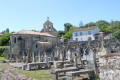
The church is situated in the open countryside, about 500 metres from the village. It was probably originally a hermitage founded during the Merovingian period. A vast necropolis developed around this sanctuary during the Carolingian period. Later, a priory belonging to Nouaillé-Maupertuis Abbey was established in the middle of the old cemetery, next to the sanctuary. This priory was destroyed during the Wars of Religion. The present church, built in the Romanesque style, probably dates from the 12th century and contains two 15th-century recumbent effigies.



 Country:
 City:
City:






 Visorando Member
 Moderate