La Marseillaise and the wash house at the Minoterie du Prieuré

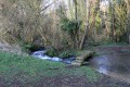
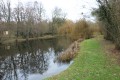
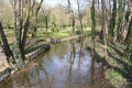
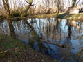
A pleasant walk around the Marseillaise valley, exploring the built heritage in Montabert and Le Vignolet, as well as the natural surroundings. This route takes in the Minoterie du Prieuré and its wash house, and passes by the Marcillé springs, which also have a wash house.

Details

n°997246
Creation:
Last update:
Last review:
  • Walking
    Activity: Walking
  • ↔
    Distance: 2.53 mi
  • ◔
    Average duration: 1h 15 
  • ▲
    Difficulty: Easy

  • ⚐
    Back to start: Yes
  • ↗
    Ascent: + 141 ft
  • ↘
    Descent: - 138 ft

  • ▲
    Highest point: 423 ft
  • ▼
    Lowest point: 322 ft

Photos

Description of the walk

(S/E) Leave the car park and take the path leading downhill at the slight bend in the lane leading to the car park.
At the bottom of the descent, cross the River La Marseillaise via a bridge and begin the fairly steep climb towards the hamlet of Montabert.
On arrival, you’ll find a fine example of old architecture. The path leads out onto Impasse des Lampes.
Turn left and head for the nearby Route du Vignolet.

(1) Turn left and follow the Route du Vignolet with care until you reach the first junction with a road on the left.
Turn left onto Chemin du Prieuré and walk alongside the Balaudrie on your right.
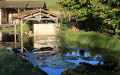
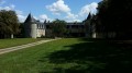
Continue to the Minoterie du Prieuré, situated at the bottom of the descent just after crossing the River Marseillaise. You’ll see the Prieuré washhouse opposite.

(2) Turn back and take the farm track that runs alongside a branch of the Marseillaise on the left.
Further on, the track climbs towards Le Vignolet.
On reaching it, after turning right at the corner of the first building, the track becomes a small road.
Continue to the junction with the Chemin de la Verdière.

(3) Turn left into Impasse des Broies. Walk to the end of this cul-de-sac. Turn right in front of the last house, and at the corner of the house, turn left and immediately take a narrow passage on the right marked with a sign reading ‘Access permitted to walkers’!
This path winds its way through some gardens before descending a steep slope towards a farm track. Take care in wet weather as the stones can be slippery.
As you come out onto the farm track, you’ll see the fountain directly opposite and a very beautiful property on the left.

Turn right and take the farm track known as Impasse de Marcillé, which runs alongside a poplar grove.
Continue to the Marcillé pumping station.
When you arrive, go through the gate on the left to see the Marcillé spring and the beautiful covered wash house below the pumping station.
Go back out through the same gate and continue left along Impasse de Marcillé until you reach a road that runs above the pumping station.

(4) At the junction with the road, turn left and carefully follow the small road north-west.
Carry on to the first junction.
Turn left and follow the D44 road carefully towards Saint-Génard.
Carry on to the first junction with a road on the left.

(5) Turn left onto this small road leading towards the Minoterie du Prieuré.
About two hundred metres further on, turn right onto an almost flat farm track overlooking the valley through which the Marseillaise flows.
The track leads out onto a clearing below the church, where you’ll find the car park marking the end of this walk (S/E).

Waypoints

  1. S/E : mi 0 - alt. 381 ft - Car park at Saint-Génard Church
  2. 1 : mi 0.24 - alt. 390 ft - Crossroads
  3. 2 : mi 0.64 - alt. 331 ft - The Prieuré mill and wash house
  4. 3 : mi 0.96 - alt. 394 ft - Crossroads
  5. 4 : mi 1.34 - alt. 354 ft - Crossroads
  6. 5 : mi 2.3 - alt. 400 ft - Crossroads
  7. S/E : mi 2.53 - alt. 381 ft - Car park at Saint-Génard Church

Notes

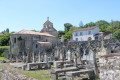
The car park is situated next to the church of Saint-Génard. It can be reached via the D44 road. Park below the church and the cemetery.

This walk, which covers varied terrain, requires suitable footwear.
Most of this route runs across the Mellois plateau between Saint-Génard and Pouffonds. Only the descent and ascent to cross the Marseillaise stream are fairly steep, on narrower but well-maintained paths. The same applies to the climb towards Le Vignolet and the descent towards the Marcillé springs.

This route is unmarked. Consequently, it is advisable to follow the directions in the description and on the map, whilst also paying attention to the landscape.

Hike undertaken by the author on 5 October 2018

Worth a visit

The Romanesque church of Saint-Génard
The12th-century church stands in the middle of a small cemetery.
The building’s layout is simple: a single-nave church opens onto a straight-aisled chancel ending in
a round apse. In this respect, it is typical of the small churches of the Mellois region.

The village of Saint-Génard
Houses are scattered across the valley floor, the hillsides and the plateau.
The estates of the seigneuries (the Ousches, Bonneuil, Mont and Nossay estates, amongst others), the priory of Saint-Génard and the convent of Puyberland shaped this land use. Their owners built
dairy farms and mills for economic purposes. In the17th century, eleven mills were recorded in the parish. Sources even attest to the existence of a flour mill as early as the end of the10th century in Chancelée.
Economic activity linked to water led to the construction of mills at the foot of the village, whilst that linked to the land led to the construction of farms on the plateau.

The Puyberland Convent
Although it was dismantled during the Revolution, the17th-century complex still looks impressive and retains its
coherence: arranged around several courtyards are the prior’s quarters, the chaplain’s quarters, the chapel, the
refectory, the oven, the storeroom and, further away, the dovecote. Chapels and churches in the Mellois region house
numerous elements reused from the priory: the rood screen served as a door for the chapel at Melle Hospital, a
part of the altarpiece can be found in Tillou Church, and an architectural ensemble has been converted into an altarpiece for
the chancel of the church at Saint-Vincent-la-Châtre.

Excavations at the priory: 2004–2005
“The initial excavations revealed the remains of a necropolis and the ruins of a building attributed to the
Benedictine priory of Saint-Génard. The necropolis appears to be divided into two areas. Near the present-day church, there are burials in monolithic sarcophagi, whose trapezoidal shape suggests a broad dating range from the7th to the10th century. Further away, burials took place mainly in the ground. All age groups are represented. Physical differences have been noted between the individuals buried in these two areas, a probable indication of socio-economic differences. A second phase of burial is evident in this area, which may correspond to the late Middle Ages.
The priory is rectangular in plan and has been carefully constructed. It comprises two rooms on the ground floor, as well as
latrines, and likely has a first floor. It dates from the first half of the16th century. Its foundations rest partly on sarcophagi from the early Middle Ages, but also on the remains of an earlier building, probably the priory mentioned in the12th century.
This site presents a coherent complex rarely seen in the Mellois region, comprising a church (12th century), priory buildings (12th? and16th centuries) and three cemeteries (two from the Middle Ages and one from the modern era) within a limited geographical area and spanning a period from the 7th century to the present day.
Sylvie Gaiguand, archaeologist.

This information is taken from the ‘Sur les pas du Chasseron’ information sheet published by the Syndicat Mixte du Pays Mellois

Reviews and comments

4.7 / 5
Based on 1 review

Reliability of the description
5 / 5
Ease of following the route
4 / 5
Route interest
5 / 5
User 16286808

Overall rating : 4.7 / 5

Date of your route : Dec 08, 2025
Reliability of the description : ★★★★★ Very good
Ease of following the route : ★★★★☆ Good
Route interest : ★★★★★ Very good
Very busy route : No

A very beautiful walk!
Please note that there are two steep descents that may be difficult for elderly or disabled people.
Very pleasant.

Machine-translated

Other walks in the area

For more walks, use our search engine .

The GPS track and description are the property of this route's author. Please do not copy them without permission.