Aujon viewpoint and chalets from Flaine

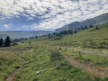
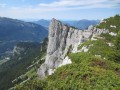
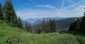
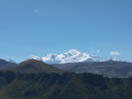
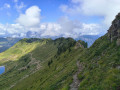
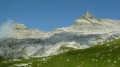
A lovely walk from Flaine to the Aujon viewpoint. Situated atop a vertiginous cliff, it offers a magnificent view of the Chamonix valley, the Aravis range and the resort’s ski area. This walk takes you through various types of terrain: forests, grassy mountain pastures and sharp limestone pavements.
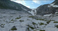
The landscape around the Aujon chalets is very pleasant and typical of alpine pastures. You may come across herds of cows there. Further up, the sharp limestone pavements, with gullies of varying depths, are a distinctive feature of the resort.

Details

n°36909177
Creation:
Last update:
Last review:
  • Walking
    Activity: Walking
  • ↔
    Distance: 4.20 mi
  • ◔
    Average duration: 3h 15 
  • ▲
    Difficulty: Moderate

  • ⚐
    Back to start: Yes
  • ↗
    Ascent: + 1,506 ft
  • ↘
    Descent: - 1,506 ft

  • ▲
    Highest point: 6,667 ft
  • ▼
    Lowest point: 5,161 ft

Photos

Description of the walk

Park in car park P1 at Flaine, which is free in summer and accessible via the D106 from Magland via Arâches-la-Frasse and Les Carroz-d’Arâches in the Grand Massif resort. Follow the road; the car park is located at the bottom of the resort.

Preliminary note: the signposting on this walk is not always very easy to follow. It consists of a mix of signposts indicating direction and distance, posts with directional arrows, and markings painted on the ground (white or red). Some paths are not very visible, particularly on sharp limestone pavements. When you reach a marking, you must make sure you can spot the next one before continuing. A few cairns also help you find your way more easily.

(S/E) Make your way to the departure station of the Aup de Véran cable car. The start of the walk is located nearby, on the edge of the forest and next to a fairly steep and stony forest track. Follow this track towards the Aujon viewpoint

(1) Continue the ascent until you reach the vicinity of the Aujon ski lift station.

(2) Walk up past the Chalets d’Aujon, either by following the markings on the rocks protruding from the grassy meadows and the posts with directional arrows, or by following the stony path.
Turn slightly to the right to reach a ditch via the designated path leading to the sharp limestone pavement section.

(3) Cross the ditch, continue following the red markings painted on the ground and the posts with arrows pointing south, and reach the sharp limestone pavement.

(4) Continue due west, taking care on certain sections, until you reach the Aujon viewpoint.

(5) Return along the path in the opposite direction, heading downhill, to get back to the Chalets d’Aujon.

(2) Turn right to reach thesecond section of the Chalets d’Aujon.

(6) Walk through these chalets and follow the stony path. Then enter a woodland and continue along a virtually flat stretch to reach the Grand Grenier ski lift station.

(7) Pass below this station and continue along the stony path. Pass under the Aup de Véran gondola lift line and continue the descent, alternating between the path and the grassy ski run. You’ll emerge at the Chalets du Michet.

(8) Turn left and head back down the slope alongside the magic carpet tubes to the P1 car park in Flaine (S/E).


Waypoints

  1. S/E : mi 0 - alt. 5,161 ft - Aup de Véran gondola lift departure station
  2. 1 : mi 0.58 - alt. 5,630 ft - Aujon ski lift station
  3. 2 : mi 0.91 - alt. 5,965 ft - Aujon Chalets
  4. 3 : mi 1.05 - alt. 6,056 ft - Ditch
  5. 4 : mi 1.41 - alt. 6,447 ft - Sharp limestone pavement area
  6. 5 : mi 1.73 - alt. 6,650 ft - Aujon Viewpoint - Belvédère d’Aujon
  7. 6 : mi 2.68 - alt. 5,981 ft - Chalets d’Aujon, Part 2
  8. 7 : mi 3.22 - alt. 5,955 ft - Grand Grenier ski lift station
  9. 8 : mi 3.77 - alt. 5,367 ft - Chalets du Michet
  10. S/E : mi 4.2 - alt. 5,161 ft - Aup de Véran gondola lift departure station

Notes

  • Wear shoes with good soles – ideally hiking boots – particularly for the rather abrasive sharp limestone pavement section.
  • Make sure you bring plenty of water; you can top up your supplies at the fountain at the Chalets d’Aujon, but this is only located in the second half of the descent. It is therefore not accessible on the way up.
  • In wet weather, the sharp limestone pavement may be quite slippery.
  • Take care on the sharp limestone pavement section; some crevices may be deep and pose a safety risk.
  • Dogs on a lead are permitted. However, be mindful of your dog’s size; smaller dogs may fall into the crevices on the sharp limestone pavement.
  • You can quench your thirst and have a bite to eat on your return at the resort’s establishments.
  • You will need to cross a few fences used to enclose livestock. Please remember to close them behind you.

Worth a visit

Between (2) and (6), take advantage of the alpine chalets to enjoy a contemplative break overlooking the Flaine valley. Take a moment to admire the sometimes ancient wooden buildings.
At (5), take in the remarkable view of the Chamonix Valley and the Aravis Range, notably featuring the Pointe d’Areu and the Pointe Percée.

Reviews and comments

3.8 / 5
Based on 2 reviews

Reliability of the description
4 / 5
Ease of following the route
3.5 / 5
Route interest
4 / 5
clucion
clucion

Overall rating : 4 / 5

Date of your route : Jul 01, 2026
Reliability of the description : ★★★★☆ Good
Ease of following the route : ★★★★☆ Good
Route interest : ★★★★☆ Good
Very busy route : No

Quite stony 4×4 tracks that aren’t very pleasant

Machine-translated

Bossus
Bossus

Overall rating : 3.7 / 5

Date of your route : Aug 31, 2025
Reliability of the description : ★★★★☆ Good
Ease of following the route : ★★★☆☆ Average
Route interest : ★★★★☆ Good
Very busy route : No

It's hard to find the markings on the ground, and I'm not talking about the sharp limestone pavement

Machine-translated

Other walks in the area

For more walks, use our search engine .

The GPS track and description are the property of this route's author. Please do not copy them without permission.