


Les points d'eau sont expliqués dans chacune des journées
Petit tour du Chambeyron

Ce circuit en boucle de 3 jours part de France et passe par l'Italie.
Details
Creation:
Last update:
Last review:
–
–
-
 Activity: Walking
-
 Distance: 26.32 mi
-
 Average duration: 3 days
-
 Difficulty: Difficult
-
-
 Back to start: Yes
-
 Ascent: + 9,554 ft
-
 Descent: - 9,564 ft
-
-
 Highest point: 10,243 ft
-
 Lowest point: 5,213 ft
-
 Country:
France
-
 Areas: Alps, Ubaye Valley
-
 City:
Meyronnes (04540|04530)
-
 Start/End: N 44.481541° / E 6.807801°
-


 Hour-by-hour weather
Photos
Stages of the route
This route needs several days, find the details below:
Notes
Worth a visit
Voir les description dans chaque journée.
Pour les refuges :
Gîte Auberge de Saint-Ours
Refuge du Chambeyron
Refuge Campo Base
Other walks in the area
La Tête de Viraysse and the military fortifications at Saint-Ours
 Visorando Member
 11.22 mi
+3,212 ft
-3,215 ft
7h 55
 Moderate
 Departure from Meyronnes (Alpes-de-Haute-Provence)
At an altitude of 2,772 metres, the Tête de Viraysse and its high military fortifications offer a magnificent panorama of Italy, the Mercantour and the Ubaye in a rugged mountain landscape between the Meyna and the rocks of Saint-Ours.
Saint-Ours – Larche
 Association / Club / Walk leader
 5.26 mi
+1,102 ft
-1,417 ft
3h 25
Moderate
Departure from Meyronnes (Alpes-de-Haute-Provence)
Return to the starting point in Larche via theGRP® de la Frontière Fortifiée.
The Rochail Circular
 5.39 mi
+1,722 ft
-1,722 ft
4h 00
Moderate
Departure from Meyronnes (Alpes-de-Haute-Provence)
A lovely circular route, facing due south, during which the sweeping panoramic views echo the rich heritage you’ll encounter along the way.
July 2024. Larche Tourist Office: the route is no longer maintained.
La Tête de Plate Longe
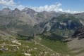 6.02 mi
+3,609 ft
-3,625 ft
5h 55
Moderate
Departure from Larche (Alpes-de-Haute-Provence)
Route starting from Larche for lovers of flora and fauna.
Circular Tête Dure starting from Larche
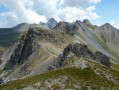 6.71 mi
+3,117 ft
-3,117 ft
5h 50
Difficult
Departure from Larche (Alpes-de-Haute-Provence)
If you’re heading to Col de Larche to see the classic lakes of Lauzanier and Oronaye, stop off at Larche; this quiet village offers numerous opportunities for circular walks, including this one which will take you up to the heights of Tête Dure, aptly named, after a moderately challenging walk through the varied landscapes of the Rouchouse valley.
Larche - Saint-Dalmas-le-Selvage
17.35 mi
+5,102 ft
-5,633 ft
12h 25
Difficult
Departure from Larche (Alpes-de-Haute-Provence)
Étape de la traversée des Alpes par le GR®5 de Larche à Saint Dalmas le Selvage. Passage dans le Parc National du Mercantour sauvage et authentique puis transition entre la Haute Tinée et le Vallon de Jalorgues avec un passage sur la plus haute route d'Europe vers le Col de la Bonnette.
Larche – Chiappera
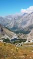 10.20 mi
+3,369 ft
-3,494 ft
7h 35
Difficult
Departure from Larche (Alpes-de-Haute-Provence)
This stage will take you to the pretty Vallon de la Montagnette, then on to the Col des Monges, which offers a stunning view of the Southern Alps.
Tour du Sautron
32.99 mi
+10,499 ft
-10,469 ft
4 days
 Very difficult
Departure from Larche (Alpes-de-Haute-Provence)
A beautiful hike between the Ubayette Valley and Italy. The Vallon de l’Oronaye, the Stroppia Waterfalls and the Lac des Neuf Couleurs are among the most stunning places to discover in the Southern Alps.
I did this hike with a group of 14 people from the Randogym club in early September 2015. In mid-June 2006, I went on a 5-day hike that followed part of this route, and there were still plenty of snowfields at that time of year.
For more walks, use our search engine .
The GPS track and description are the property of this route's author. Please do not copy them without permission.

