Petit and Grand Som circular loop

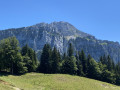
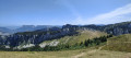
A lovely circular route taking in two peaks, across a wide variety of terrain. You’ll encounter woodland, scree slopes, rocky outcrops and mountain pastures.

Details

2556268
Creation:
Last update:
Last review:
  • Walking
    Activity: Walking
  • ↔
    Distance: 9.07 mi
  • ◔
    Average duration: 7h 55 
  • ▲
    Difficulty: Very difficult

  • ⚐
    Back to start: Yes
  • ↗
    Ascent: + 4,321 ft
  • ↘
    Descent: - 4,308 ft

  • ▲
    Highest point: 6,621 ft
  • ▼
    Lowest point: 3,684 ft

Photos

Description of the walk

Climb up to La Ruchère, heading towards the Nordic centre. Walk past the mast, and at the Cleyat lodge, turn left. Follow the road through the forest and park just before Le Habert.

(S/E) Head towards the Col de Léchaud, passing the Habert. This section is straightforward, and the path is clearly marked in yellow.

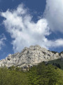
(1) Once you reach the pass, take the path to the west which climbs to the summit of the Petit Som.

(2) Take a moment to admire the view. Head back down to the Col de Léchaud.

(1) Head straight on towards the Habert de Bovinant. Here too, the path is well marked.

(3) Just past the habert, do not continue along the marked path, but head south onto a small, barely visible track which will take you to the Col de Mauvernay, which you can see directly ahead of you. Once past the pass, the path flattens out and you will soon reach a scree slope. Take care: the path is narrow and not very visible. Fortunately, you’ll be guided by a few cairns.

At the end of the scree slope, join a signposted path coming from Saint-Pierre-de-Chartreuse. Follow it uphill to the left towards the Pas de la Suiffière. On this section, take your time and keep a close eye on the signposts every so often so as not to get lost.

(4) Continue along the signposted path to Le Racapé.

(5) Turn left towards the summit of the Grand Som. This section is quite steep, so take it at your own pace.

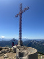
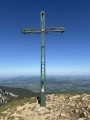
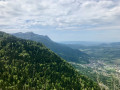
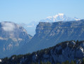
(6) At the Grand Som, take in the new panorama, which this time offers lovely views of the Belledonne and Bauges mountain ranges, and even Mont Blanc.
Follow the Sentier des Moutons to the right (north) towards the Habert de Bovinant.

(3) This time, head west towards La Correrie.

(7) At the signpost, carry on straight ahead along the path that leads downhill. You’ll come to a junction (marked ‘Bourdoire’ on the map).

(8) Turn right. After 100m, do not follow the signposted path that branches off to the left, but carry on straight ahead.
Follow the forest track to the next junction, where you’ll come across a signposted path again.

(9) Turn right. The path climbs through the forest for about 500 metres, then opens out onto a meadow. Carry on to the Col de la Ruchère.

(10) All you have to do now is head towards Le Clayet via the Oratoire Teste de Lavines. Turn right after about 200 metres, then carry on straight ahead. Just past the Habert car park, you’ll return to your starting point (S/E).


Waypoints

  1. S/E : mi 0 - alt. 3,701 ft - Car park
  2. 1 : mi 2.14 - alt. 5,577 ft - Col de Léchaud
  3. 2 : mi 2.32 - alt. 5,778 ft - Summit of the Petit Som - Petit Som (1772m)
  4. 3 : mi 2.92 - alt. 5,341 ft - Habert de Bovinant
  5. 4 : mi 4.43 - alt. 5,912 ft - Pas de la Suiffière
  6. 5 : mi 4.77 - alt. 5,886 ft - Le Racapé
  7. 6 : mi 5.11 - alt. 6,621 ft - The Grand Som cross - Grand Som (2026m)
  8. 7 : mi 6.56 - alt. 5,148 ft - Junction
  9. 8 : mi 6.88 - alt. 4,603 ft - Via Bourdoire
  10. 9 : mi 7.28 - alt. 4,193 ft - Junction
  11. 10 : mi 7.83 - alt. 4,652 ft - Col de la Ruchère
  12. S/E : mi 9.07 - alt. 3,704 ft - Car park

Notes

Alternative route:
(7) At the signpost, you can head north to reach the Col de la Ruchère via the Pas du Loup. This adds a little extra distance and elevation gain.

Reviews and comments

4.3 / 5
Based on 3 reviews

Reliability of the description
4.3 / 5
Ease of following the route
4 / 5
Route interest
4.7 / 5
Stephan69
Stephan69

Overall rating : 4 / 5

Date of your route : Aug 24, 2026
Reliability of the description : ★★★★☆ Good
Ease of following the route : ★★★★☆ Good
Route interest : ★★★★☆ Good
Very busy route : No

Hike completed on 19 August 2026, in clear, cloudless weather with a beautiful view of the neighbouring mountain ranges (including Mont Blanc).
Regarding the route:
- after setting off on the left bank of the stream, I didn’t spot the path branching off to the left into the undergrowth (the family following behind me did spot it, though), so do keep a sharp eye out
- the section at the Pas de la Suffière is steep, though not too exposed (no problem for me, even though I’m afraid of heights)
- From point 7, the detour via points 8 and 9 is of little interest (a detour, no views, a short climb). Staying on the GR9 to head straight to point 10 is also a good option
Thanks, Visorando!

Machine-translated

KANTDAVIS
KANTDAVIS

Overall rating : 4 / 5

Date of your route : Jul 18, 2025
Reliability of the description : ★★★★☆ Good
Ease of following the route : ★★★☆☆ Average
Route interest : ★★★★★ Very good
Very busy route : No

a magnificent hike, technically accessible (take your time...), quite challenging; the return after climbing the Grand Som is not easy...
A hike not to be missed if you're in Chartreuse.

Machine-translated

DamDam78
DamDam78
• Edited:

Overall rating : 5 / 5

Date of your route : May 18, 2025
Reliability of the description : ★★★★★ Very good
Ease of following the route : ★★★★★ Very good
Route interest : ★★★★★ Very good
Very busy route : Yes

A lovely circular walk with superb views.

I do, however, want to clarify the difficulty a little: at the Col de Bovinant, a sign indicates the two routes to the Grand Som and warns that the one via the Cheminée de la Suiffière and the Pas de Racapé (suggested here) is dangerous, with exposed sections (5 fatalities in 10 years…).
I was a bit on the edge myself.

Otherwise, at point 7, I would indeed have preferred to take a shortcut; the descent below the Col de la Ruchère and then the climb back up is only worth it to extend the route for those who are counting the kilometres.

Thanks for the route 🙏

Machine-translated

Other walks in the area

For more walks, use our search engine .

The GPS track and description are the property of this route's author. Please do not copy them without permission.