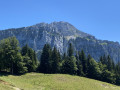
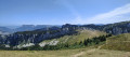
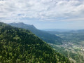
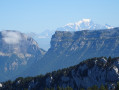
Two sections require mountain-walking skills: the chimney (take care not to dislodge any rocks) leading up to the Petit Som ridge, and the Pas du Loup, which can be tricky (a rope may provide reassurance for less experienced walkers, depending on the day’s conditions).


 Country:

 City:
City:


Start from the car park at the Fork in the Road of Habert.
(S/E) Take the track that starts on the right at the edge of the car park. Follow the wide track to the Col de la Ruchère. The ascent is straightforward.
(1) At the pass, head east towards the Petit Som until you reach a sign reading: ‘Pas du Loup’.
(2) Turn left and climb straight up the slope beneath the Petit Som. This is quite strenuous as it’s straight up the steep slope; after a few hairpin bends, you’ll reach the ‘chimney’ leading to the summit.
(3) A short break is recommended before tackling this steep section. You’ll need to use your hands, and a few loose rocks require caution for fellow walkers below.
The view from the ridge is magnificent, revealing a vast panoramic landscape. Follow the path along the ridge, which is straightforward, to the summit of the Petit Som.
(4) Descend directly and easily to the Col de Léchaud.
(5) Continue straight ahead, south-east. The route is perfectly obvious and clearly visible. Pass through a small gap (very scenic) to descend towards the Col de Bovinant, where you can take a well-deserved break.
(6) Turn right; the descent begins towards the clearly visible Habert de Bovinant.
(7) Continue towards “Notre-Dame de Casalibus” along this wide path. Shortly after entering the forest, you’ll come to a fork to the right leading to the “Pas du Loup” (clearly signposted).
(8) Follow this stony but easy path to the right, which, via a series of short but gentle ascents and descents, leads to the Pas du Loup. This section requires concentration and caution and can be very tricky in wet weather.
This short section, where you’ll need to use your hands, is exposed as it overhangs a rocky ridge to the left and the rock is very smooth from the passage of walkers.
Continue towards the bottom of the valley. Ignore a path on the right leading up to the Col de Léchaud and continue the descent at a leisurely pace until you rejoin the route you have already taken.
(2) Head down to the left towards the Col de La Ruchère, from where you can look back and appreciate the route you have taken.
(1) Carry on along the track and head back to the car park at the Fork in the Road (S/E).

 Visorando Member
 Moderate
 Very difficult