


Refine your search for walks in Parking du col de Tramassel (ou de Buraü) (1615m)
Parking du col de Tramassel (ou de Buraü) (1615m) walks


 Lac d'Ourrec from the Col de Tramassel
 Visorando Member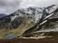
 6.65 mi
 +1,496 ft
 -1,476 ft
 4h 20
4h 20
 Moderate
 Departure from Beaucens (Hautes-Pyrénées)
Superb views of the surrounding mountains all along the route and from the Hourquette d'Ouscouaou.
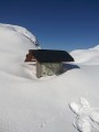
 Hautacam Ridge and Pic du Mont towards Montaigu
 6.70 mi
+1,788 ft
-1,788 ft
6 hrs
6.70 mi
+1,788 ft
-1,788 ft
6 hrs
 Very difficult
Departure from Beaucens (Hautes-Pyrénées)
Very difficult
Departure from Beaucens (Hautes-Pyrénées)
A magnificent, challenging hike along the ridges at 2,000 m facing the Pic du Midi de Bigorre.
Although off the marked trails, it is quite busy in summer. In winter, it is completely off the beaten track for hikers, particularly in the final section (see note in Practical Information below).
In winter, as in summer, save this route for a perfectly clear, sunny day, as the views are remarkable and you won’t regret the effort.
Circular walk above Lac d’Isaby
7.26 mi
+1,621 ft
-1,627 ft
4h 45
 Difficult
Departure from Beaucens (Hautes-Pyrénées)
Difficult
Departure from Beaucens (Hautes-Pyrénées)
A majestic landscape, an unmarked path that sometimes requires you to improvise. If you enjoy walking and finding your own way, this is for you.Difficult sections; not recommended for families with children.Do not attempt this hike if there is frequent fog in the area.GPX track recommended.
Walks near Parking du col de Tramassel (ou de Buraü) (1615m)
Luz-St-Sauveur – Lac d’Aubert
 15.87 mi
+6,621 ft
-1,978 ft
12 hrs
Very difficult
Departure from Luz-Saint-Sauveur (Hautes-Pyrénées)
15.87 mi
+6,621 ft
-1,978 ft
12 hrs
Very difficult
Departure from Luz-Saint-Sauveur (Hautes-Pyrénées)
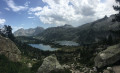
The seventh stage of the trek sets off from Luz-Saint-Sauveur, taking us to Lac d’Aubert, situated in the heart of the Néouvielle Nature Reserve.
Tournaboup - Bastan Refuge
 8.80 mi
+4,337 ft
-1,742 ft
7h 50
Difficult
Departure from Barèges (Hautes-Pyrénées)
8.80 mi
+4,337 ft
-1,742 ft
7h 50
Difficult
Departure from Barèges (Hautes-Pyrénées)
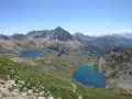
First stage of the Three Days in the Néouvielle Nature Reserve and its lakes.From the Tournaboup car park to the Bastan refuge.A fairly challenging hike due to its elevation gain and short distance.At point (6), it is possible to shorten the route and reduce the elevation gain. See Practical Information.At (7), it is possible to shorten the route and reduce the elevation gain slightly by taking a south-facing, balcony-style path.
Please note: the refuge has been closed by the authorities since May 2025
From Tournaboup to Lac de l’Oule
11.29 mi
+3,957 ft
-2,785 ft
8h 40
Difficult
Departure from Barèges (Hautes-Pyrénées)
First day of a three-day circular route, from the Tournaboup car park to Lac de l’Oule. The first section up to the Col de Madamète is quite stony and requires good footwear, but after that it’s a real pleasure to walk past the magnificent Néouvielle lakes, including, amongst others, Lac d’Aumar, Lac d’Aubert and Lac de l’Oule.
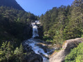
Cauterets – Wallon Marcadau Mountain Hut
 12.83 mi
+5,738 ft
-2,556 ft
10 hrs
Very difficult
Departure from Cauterets (Hautes-Pyrénées)
12.83 mi
+5,738 ft
-2,556 ft
10 hrs
Very difficult
Departure from Cauterets (Hautes-Pyrénées)
The third stage of the trek, starting from Cauterets and heading towards the Wallon Marcadau mountain hut via the high-altitude lakes (Embarrat, Pourtet and Nère), featuring in particular the magnificent climb to Pont d’Espagne alongside the waterfalls.
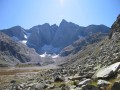
3 days in the Central Pyrenees Park from Cauterets
 30.88 mi
+10,197 ft
-10,226 ft
3 days
Difficult
Departure from Cauterets (Hautes-Pyrénées)
30.88 mi
+10,197 ft
-10,226 ft
3 days
Difficult
Departure from Cauterets (Hautes-Pyrénées)
Explore the Pyrenees National Park (central section) with a trip to Spain, lakes and mountain passes at an altitude of 2,600 metres.
With an average elevation gain of ± 1,230 m and a distance of 17 km per day, this trip is, all in all, quite strenuous.
Please take into account the cumulative elevation gain and the distance to be covered.
The trip takes place between 1000 m and 2655 m altitude.
The start of this route is accessible by public transport (coaches and shuttle bus from Cauterets in summer).
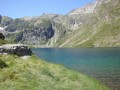
From Cauterets to Ilhéou
 9.24 mi
+4,295 ft
-1,217 ft
8h 00
Moderate
Departure from Cauterets (Hautes-Pyrénées)
9.24 mi
+4,295 ft
-1,217 ft
8h 00
Moderate
Departure from Cauterets (Hautes-Pyrénées)
First day of a three-day route in the Central Pyrenees National Park.
This circular is best done from mid-June until the first cold spells.
Ascent to Lac Noir, Col d'Ilhéou, Ilhéou Refuge and Lac d'Ilhéou.
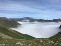
Estaing – Cauterets
 13.50 mi
+4,301 ft
-4,534 ft
9h 55
Difficult
Departure from Estaing (Hautes-Pyrénées) (Hautes-Pyrénées)
13.50 mi
+4,301 ft
-4,534 ft
9h 55
Difficult
Departure from Estaing (Hautes-Pyrénées) (Hautes-Pyrénées)
The second stage of the trek, starting from Estaing and heading towards the spa town of Cauterets, via Lakes Estaing and Ilhéou.
Aygues-Cluses Refuge - Campana de Cloutou Refuge
 4.62 mi
+2,146 ft
-1,867 ft
4h 00
Difficult
Departure from Barèges (Hautes-Pyrénées)
4.62 mi
+2,146 ft
-1,867 ft
4h 00
Difficult
Departure from Barèges (Hautes-Pyrénées)
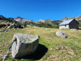
Day three of the four-day Tour du Massif de Néouvielle, the shortest route of the four days, but no less magnificent.This hike is classified as difficult due to the ascent of Pic d'Aygues-Cluses (T5 ridge). See the variants if you wish to avoid the peak or climb it in the other direction (less complicated).
The Henri IV Trail
 20.70 mi
+732 ft
-1,421 ft
10h 10
Difficult
Departure from Lourdes (Hautes-Pyrénées)
20.70 mi
+732 ft
-1,421 ft
10h 10
Difficult
Departure from Lourdes (Hautes-Pyrénées)
A beautiful route linking Lourdes to Pau along an ancient Roman road steeped in history. The Henri IV trail stretches across the Hautes-Pyrénées and Pyrénées-Atlantiques departments, along the foothills of the Pyrenees.
From the Col de Couraduque to the Col du Soulor via Lac de Soum
 5.01 mi
+1,083 ft
-738 ft
3h 15
Moderate
Departure from Aucun (Hautes-Pyrénées)
5.01 mi
+1,083 ft
-738 ft
3h 15
Moderate
Departure from Aucun (Hautes-Pyrénées)
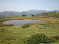
An easy walk with some lovely views. Using two cars (one at Couraduque and one at Soulor) makes this walk accessible to everyone. Otherwise, you can return via the same route in the opposite direction.