Country:

 City:



(S) From the campsite, cross the Place du 8 Mai and head towards the main road. Turn right, cross the bridge over the Bastan. Follow theGR®®10.
(1) Turn right (Eth Marcadaou) and then turn right again onto the Route de Vizos (D172). Stop at the first side street on the right.
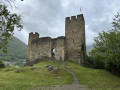
(2) Take the short path that climbs up to Château Sainte-Marie.
(3) Continue eastwards until you reach a junction with a road.
(4) Turn right, follow the road through Soula and cross the bridge over the Bastan before joining the Barèges road (D918).
(5) Turn left and follow the road until you reach the start of the marked path on the right, about 200 metres further on.
(6) Take this path, which leads to Viella, where the route ends at the cemetery. Join the D148, which runs through the village.
(7) Turn left and follow the road down to the Barèges road (D918).
(8) Turn right and follow the road for 300 metres to the bridge on the left.
(9) Cross the bridge and take the steep path that starts behind the recycling centre and leads to Viey.
(10) Follow theGR®® signposts through the village; after climbing two hairpin bends, you’ll reach a path. Follow it to Sers.
(11) Walk about twenty metres to the right, then turn left to follow the road heading north into the forest. Cross the Bastan de Sers, then climb up to the Saint-Justin campsite. The path then branches off to the left and reaches a junction.
(12) At the junction, take the right-hand branch – which is shaded and almost flat – leading straight to the centre of Barèges.
(13) Head up the main street on the left, a must-visit spot for the many cyclists tackling the Col du Tourmalet.
(14) Turn left as you leave the village. Cross the Bastan, then turn right and walk between the mountain pastures to rejoin a track. Here you rejoin theGR®® alternative route you left at the junction after the Saint-Justin campsite.
(15) Turn right, then follow the path which crosses the Bastan once more, eventually leading out onto the road (D918).
(16) Follow the road to the left for a few hundred metres until you reach the Tournaboup chairlift on the right.
(17) Leave the road and turn right to follow theGR®®, which gradually descends into the valley, passing not far from the Gaubie bridge. Continue straight on until you reach the junction with the path leading to Lac dets Coubous.
(18) Follow theGR®® as it heads east, leaving the path up to the lake on your right. Continue on to the Cabane de la Pègue. The path runs alongside the stream and you can see the landscape gradually changing, becoming more rocky and covered with conifers still bearing the marks of winter.
(19) Begin the final ascent to the Cabane d’Aygues Cluses.
Please note: work is currently underway at the site to build a mountain refuge.
(20) At the hut, head down a few dozen metres towards the west to rejoin theGR®® markings. Follow the path as it climbs to reach the Lacs de Madaméte.
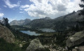
(21) Continue past the Laquet de Madaméte (dry when we were there), eventually reaching the Col de Madaméte (2,508 m).
The pass, the gateway to the Néouvielle Nature Reserve, offers a magnificent view of the Pic du Midi de Bigorre to the north and the Néouvielle to the south.
There is the option to climb the Pic de Madaméte to the west (150m elevation gain).
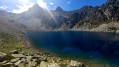
(22) Begin the descent via the Gourguet de Madaméte (or Gourg de Rabas), skirting it to the left across a scree slope. This spot also makes for a lovely photo opportunity!
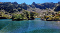
(23) Continue the descent, which is fairly straightforward, to Lac d’Aumar.
(24) Go round the lake to the right, then stop at the junction with the road.
(25) Leave theGR®®10. Turn right and continue along this road to reach the car park at the Lac d’Aubert dam (you can take a path that branches off to the right a little before this).
(26) Continue towards the dam; the campsite is located just downstream of it (E).
 Visorando Member
 Easy
 Moderate

 Difficult