From Le Mas to La Cazine

A hike full of contrasts, alternating between sections on the plain and along the hillside. Unobstructed views, an intimate atmosphere and babbling brooks that gurgle more or less loudly depending on the season.

Details

116809
Creation:
Last update:
Last review:
  • Walking
    Activity: Walking
  • ↔
    Distance: 6.12 mi
  • ◔
    Average duration: 3h 10 
  • ▲
    Difficulty: Moderate

  • ⚐
    Back to start: Yes
  • ↗
    Ascent: + 443 ft
  • ↘
    Descent: - 430 ft

  • ▲
    Highest point: 1,296 ft
  • ▼
    Lowest point: 978 ft

Photos

Description of the walk

(S/E) The walk starts at the village hall in Saint-Léger-Bridereix, which is next to the village square.

Head towards the cemetery and, to the right of it and the house next to it, take the path that leads into the woodland to the south. Cross a stream.

(1) Cut across a track, then cross a field to join another path opposite. At the end, turn right to walk alongside another field, then turn left and continue along a track until you reach the road. Follow the road to the right for about 500 metres.

(2) At the junction, turn sharply left and continue along a wide track until you reach the D951.

(3) Cross it (take care!) and take the track opposite. Before the climb, take the small path on the left. Cross the stream and head uphill to the village of Le Mas. Leave the village on the left.

(4) Continue along a track that descends to the left. Ignore the fork to the right and carry on straight ahead.

(5) On the descent, take the path on the right through the woodland and walk through the village of Le Fresse.

(6) Take the small path on the left, then the road on the left and finally the track that climbs to the right.

(7) Head down the road to the left, then take a path along the edge of the woods to reach the Combes de la Cazine. You’ll need to go downhill and then follow the path to the left, which follows the course of an old leat. When you can see the footbridge (you can cross it to follow the Combes de la Cazine route), carry on straight ahead along the old leat (staying on the same side of the valley). Gradually walk above the Cazine stream, and the path curves, allowing you to return to the road at the hamlet of Chatillon.

(8) Cross the road and head towards Saint-Léger-Bridereix via the track opposite. At the bottom of this track, a footpath leads to the boardwalk over the stream. Cross the D951 carefully near the town hall and head towards the (S/E)


Waypoints

  1. S/E : mi 0 - alt. 991 ft - The village of Saint Léger Bridereix - Eglise Saint-Léger de Saint-Léger-Bridereix
  2. 1 : mi 0.71 - alt. 1,083 ft - Track
  3. 2 : mi 1.56 - alt. 1,142 ft - Road-path junction
  4. 3 : mi 2.35 - alt. 1,188 ft - D951 road
  5. 4 : mi 3.26 - alt. 1,270 ft - Le Mas
  6. 5 : mi 3.74 - alt. 1,175 ft - Crossroads at the bottom of a descent
  7. 6 : mi 4.4 - alt. 1,132 ft - On leaving the village of Le Fresse, take the path on the left
  8. 7 : mi 5.05 - alt. 1,198 ft - Route de Chatillon - Vallée de la Cazine
  9. 8 : mi 5.81 - alt. 1,056 ft - Chatillon - Place forte de Chatillon
  10. S/E : mi 6.12 - alt. 991 ft - The village of Saint-Léger-Bridereix

Notes

Yellow signposting.
Start at the village hall – parking is available in the village square, accessible via the traffic lights.
The first part of the route is completely flat and therefore easy to walk, but may be waterlogged in places. The second part, after crossing the D951, is more challenging but well-drained and never muddy.
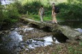
Take care when crossing the Ruisseau d’Aigueperse via the wooden footbridge: in wet weather, it can be slippery.
Take care when crossing the D951 (4): vehicles travelling along it go fast; however, the view is clear.
It is possible to head down towards the Combes de la Cazine by taking a path that branches off to the right shortly after the point (8). From there, other routes are available to walkers. A newly built footbridge allows you to cross the stream without getting your feet wet.

Worth a visit

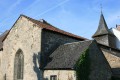
The church of Saint-Léger: its distinctive feature is a chapel dating from the 16th century.

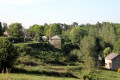
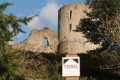
Chatillon: this small hamlet once overlooked the village of Saint-Léger-Bridereix; a veritable little stronghold perched above the Cazine and the Sédelle Valley.

The ford on the Cazine: the Cazine, which flows through the village of Saint-Léger, has a particularly good crossing point at one spot. A superb ford formed by three large granite ‘slabs’.

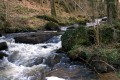
The Cazine and its valley: the confluence of the Cazine stream and the Marche geological fault has given rise to a variety of micro-landscapes that are both bucolic and particularly rich in ecological diversity.

Reviews and comments

3.5 / 5
Based on 6 reviews

Reliability of the description
3.3 / 5
Ease of following the route
3.7 / 5
Route interest
3.4 / 5
Charenton
Charenton

Overall rating : 3.3 / 5

Date of your route : May 21, 2020
Reliability of the description : ★★★☆☆ Average
Ease of following the route : ★★★★☆ Good
Route interest : ★★★☆☆ Average
Very busy route : No

Unmaintained paths. No signposting.
As a result, the walk was rather unpleasant.
This walk could be suitable for families if the paths were maintained.

Machine-translated

Azimut71
Azimut71

Overall rating : 4.7 / 5

Date of your route : May 25, 2018
Reliability of the description : ★★★★★ Very good
Ease of following the route : ★★★★★ Very good
Route interest : ★★★★☆ Good

As others have pointed out, the signposting is sporadic or non-existent; you must therefore rely solely on the route description (a GPS is of no use here), otherwise you are bound to miss the path to Le Mas after La Malcôte.
From (D) to (1), the path is not maintained, and you walk through tall grass and stinging nettles down to the stream, then through mud beyond it. As the walk is ‘officially recognised’ by the tourist office, there could be at least some basic maintenance of the paths.
Despite these minor inconveniences, the walk is enjoyable.

Machine-translated

bibi
bibi ★

Thank you for your feedback. This walk is organised by a tourist information office; I’ll try to get in touch with them so they can take note of your message.
The descriptions are proofread by three different people to ensure they are understandable to as many people as possible, but as with anything done by humans, mistakes can happen. We apologise.
Kind regards

Machine-translated

lecreusois23
lecreusois23

Overall rating : 1 / 5

Date of your route : Jul 28, 2017
Reliability of the description : ★☆☆☆☆ Very disappointing
Ease of following the route : ★☆☆☆☆ Very disappointing
Route interest : Not used / Not applicable

Once we’d got to grips with the obscure language used, we’d walked 300 along the path – or was it a track or a trail? Who knows… – when we found ourselves facing a bramble thicket: to the right, a herd of cows with a vindictive bull; to the left, a field under cultivation. So, we turned back!
Lost and unsure, we spotted the town hall; a charming lady recommended a walk through the valleys, which led us to discover several perfectly signposted hiking trails.
You may not be an expert on signposting, granted, but surely you’re at least in control of what you write, aren’t you?
I’d humbly like to remind you of the golden rule for this sort of guide: those who use it do NOT know the route, unlike the person or people who drew it up. So, please avoid anything that’s open to interpretation or confusion.

Machine-translated

gazok54
gazok54 ★

Thank you, Claire R1.
Why mention the signposting and, above all, try to follow it when, with Visorando, you’re meant to follow the route description and use the map to find your way? Besides, the signposting isn’t even mentioned in the description.
Be careful not to rate the walks based on the signposting, as neither the author nor Visorando have any control over it.

Machine-translated

Claire R1.
Claire R1.

Overall rating : 3.3 / 5

Date of your route : Dec 10, 2016
Reliability of the description : ★★★☆☆ Average
Ease of following the route : ★★★★☆ Good
Route interest : ★★★☆☆ Average

There were no signposts, and as I’d forgotten my sat-nav, I got lost at least three times. Otherwise, the route isn’t difficult and is actually quite peaceful.

Machine-translated

bibi
bibi ★

I’ve just added the detail about the house next to the cemetery; however, as for the Combe de la Cazine, that’s a variation which I’ll therefore leave in the comments.
Thank you in any case for your suggestions.

Machine-translated

bfontaine
bfontaine

Hello,

The description itself is fine. It’s more in practice that it causes problems.

Firstly, it could be pointed out that you need to walk past the house at the start of the route (the one just after the cemetery)
as the markings are virtually non-existent or have been worn away.

Regarding access to the Combe de la Cazine, as indicated in the description:

{{(8) Head down the road on the left towards Chatillon.
N.B. From the road, you can take a path on the right to reach the Combes de la Cazine.}}

It is possible to head down towards the Combes de la Cazine by taking a path that branches off to the right shortly after point (8).

It’s not easy to find – the path is very steep (I stumbled upon it quite by chance)

Once you reach the Combes, the path leading back to the starting points is completely blocked by brambles. It’s not ideal with children.

So I had to head back up a path to get back to the village of Les Colodanne and head towards Saint-Léger-de-Bridereix.

There you go

Machine-translated

bibi
bibi ★

Thank you for your feedback on the walk. Could you please help us improve the description by letting us know where and how we can make it clearer? Thank you

Machine-translated

bfontaine
bfontaine

Overall rating : 3 / 5

Date of your route : Aug 15, 2016
Reliability of the description : ★★★☆☆ Average
Ease of following the route : ★★★★☆ Good
Route interest : ★★☆☆☆ Disappointing

No maintenance of the paths and virtually no markings.

The path leading to the Combe de la Cazine after the difficult-to-find point.

The route back to Saint-Léger-de-Bridereix isn’t signposted. Luckily, I had my GPS to help me find my way.

Just so you know, this adds about 3 km to the route.

Machine-translated

mimistian
mimistian

Overall rating : 4.7 / 5

Date of your route : Sep 05, 2015
Reliability of the description : ★★★★★ Very good
Ease of following the route : ★★★★☆ Good
Route interest : ★★★★★ Very good

Hello,
It was lovely because there are very few roads:
We were lucky enough to spot three roe deer and catch a crayfish with our bare hands.

Machine-translated

Other walks in the area

For more walks, use our search engine .

The GPS track and description are the property of this route's author. Please do not copy them without permission.