Saint-Cirgues-en-Montagne route

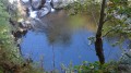
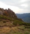
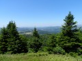
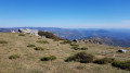
A loop route returning to the starting point, mostly along the hillside with beautiful panoramic views and close to the historic site of Mazan Abbey.

Details

3671184
Creation:
Last update:
Last review:
  • Walking
    Activity: Walking
  • ↔
    Distance: 1.85 mi
  • ◔
    Average duration: 1h 10 
  • ▲
    Difficulty: Easy

  • ⚐
    Back to start: Yes
  • ↗
    Ascent: + 341 ft
  • ↘
    Descent: - 335 ft

  • ▲
    Highest point: 3,786 ft
  • ▼
    Lowest point: 3,455 ft

Photos

Description of the walk

Park near the church and the town hall in Saint-Cirgues-en-Montagne.

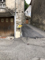
(S/E) Head to the junction with Rue Haute and turn right onto it. You’ll reach a hairpin bend marked by a wayside cross.

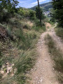
(1) Leave the road and take the path on the right, following the edge of the woodland. You’ll reach another junction. Take the path on the left. Continue along this path, crossing several streams, then reach another junction with a signpost near the Ruisseau du Pradal.

(2) Start climbing to the left; when you reach the crossroads, this is the highest point, near the Croix du Mont.

(3) Turn right, pass the Croix du Mont, and continue until you rejoin the Chemin du Mont. At the junction, take the road on the right to return to the car park by the town hall and church (S/E).

Waypoints

  1. S/E : mi 0 - alt. 3,455 ft - Car park near the church and the town hall, close to the - Vernason (cours d'eau) - Affluent de la Loire
  2. 1 : mi 0.18 - alt. 3,576 ft - After the wayside cross, turn right onto the flat section. Near the - Pradal (cours d'eau)
  3. 2 : mi 1.2 - alt. 3,638 ft - At this marker, start the climb to the left
  4. 3 : mi 1.42 - alt. 3,780 ft - Leave the tarmac and turn right
  5. S/E : mi 1.85 - alt. 3,455 ft - Parking near the church and the town hall

Notes

This short 2.9 km route is easy (provided you take it in the right direction). The climb to the highest point is actually in two parts: one at the start and the other halfway along at (2).
The final descent is very steep, which explains why the route should be walked in this direction.
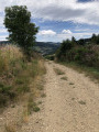
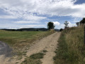
There are some lovely views along this hillside path.
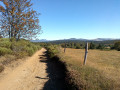
Changes in direction are illustrated with photos.

Worth a visit

This route can be done after visiting Mazan Abbey, which is a few kilometres away.

Reviews and comments

4.6 / 5
Based on 3 reviews

Reliability of the description
5 / 5
Ease of following the route
4.7 / 5
Route interest
4 / 5
charlyo.sabate%orange.fr

Overall rating : 4.3 / 5

Date of your route : Jun 11, 2026
Reliability of the description : ★★★★★ Very good
Ease of following the route : ★★★★☆ Good
Route interest : ★★★★☆ Good
Very busy route : No

Saint Cirgues-en-Montagne is a pretty little village; the Hôtel aux Parfums des Bois deserves a bit of a mention for its hiking routes – they’re fairly easy, but given the heat, we only went hiking in the morning at the latest.
We were back by 1 pm or 2 pm. The guidebooks were very well explained.

Machine-translated

fm84
fm84

Overall rating : 4.7 / 5

Date of your route : Jul 15, 2023
Reliability of the description : ★★★★★ Very good
Ease of following the route : ★★★★★ Very good
Route interest : ★★★★☆ Good
Very busy route : No

A lovely little walk that we did as a family with our four-and-a-half-year-old. It was picturesque and mostly shaded – we really enjoyed it. Thank you!

Machine-translated

chantal raymond
chantal raymond

Overall rating : 4.7 / 5

Date of your route : Oct 13, 2021
Reliability of the description : ★★★★★ Very good
Ease of following the route : ★★★★★ Very good
Route interest : ★★★★☆ Good
Very busy route : Yes

A short, easy walk which, right from the start, lets you explore the narrow streets of Saint-Cirgues

Machine-translated

Other walks in the area

For more walks, use our search engine .

The GPS track and description are the property of this route's author. Please do not copy them without permission.