Lanarce peat bogs

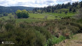
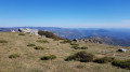
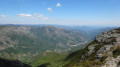
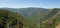
This route, starting from Le Taillet, passes through peat bogs and forests, with views of the Gerbier des Joncs.

Details

5704
Creation:
Last update:
Last review:
  • Walking
    Activity: Walking
  • ↔
    Distance: 10.05 mi
  • ◔
    Average duration: 5h 10 
  • ▲
    Difficulty: Easy

  • ⚐
    Back to start: Yes
  • ↗
    Ascent: + 666 ft
  • ↘
    Descent: - 663 ft

  • ▲
    Highest point: 4,291 ft
  • ▼
    Lowest point: 3,901 ft

Photos

Description of the walk

Park your car at the Pont du Taillet car park, on the D 288, 300 metres from the Mas du Taillet guesthouse.

(S/E) Leave the car park heading towards Lanarce and walk for about 500 metres.

(1) Take the first path on the right, which joins a small road.

(2) Carry on to the right, passing a farm and then the stopover lodge.

(3) At the 180° hairpin bend to the right, carry on straight ahead along the dirt track.

(4) At the fork in the road, turn right, ignoring the paths branching off to the right and left, pass a ruin and come out onto a tarmac road.

(5) Continue along the road to the left, towards Issanlas, until you reach the junction with the D117.

(6) Turn left and follow this road to the village. On this stretch, you’ll cross the peat bogs and the Langougniole stream.

(7) After the stream, walk round the village. Views over the plateau. Picnic spots in the village square.
Leave the village by retracing your steps a little and continue straight on towards Les Gadimelles.

(8) Pass the first road on your right, then the ‘Sentier du Tour de la Montagne Ardéchoise’ trail, also on your right.

(9). Carry on straight ahead along the tarmac road, following the stream and the peat bogs, then, further on, past an old farm.

(10) At the top of the hill, in a right-hand bend, turn onto the path on the left, which rejoins the original path.

(4) Follow the path in the opposite direction and return to the car park (S/E).

Waypoints

  1. S/E : mi 0 - alt. 4,163 ft - Car park at Pont du Taillet - Vernason (cours d'eau) - Affluent de la Loire
  2. 1 : mi 0.38 - alt. 4,193 ft - Junction at the hairpin bend.
  3. 2 : mi 0.58 - alt. 4,239 ft - Junction: turn right
  4. 3 : mi 1.39 - alt. 4,213 ft - Hairpin bend, straight ahead
  5. 4 : mi 2.04 - alt. 4,252 ft - Fork in the road, right
  6. 5 : mi 2.82 - alt. 4,262 ft - Road, on the left
  7. 6 : mi 3.66 - alt. 4,058 ft - Junction with the D 117.
  8. 7 : mi 4.69 - alt. 3,901 ft - Langougnole (cours d'eau) - Affluent de la Loire
  9. 8 : mi 5.88 - alt. 4,052 ft - Straight ahead
  10. 9 : mi 5.98 - alt. 4,058 ft - Junction with the Tour de la Montagne Ardéchoise trail
  11. 10 : mi 7.75 - alt. 4,236 ft - Turn right, then left
  12. S/E : mi 10.05 - alt. 4,163 ft - Car park at Pont du Taillet

Notes

Since the description was written, a wind farm has been built (2017)....
The environment has been severely damaged.

No refreshment points along the route.
Water at Issanlas.
High-quality accommodation at Le Mas du Taillet. Bed and breakfast, at the foot of the Faultre Forest

Worth a visit

Tour of the Ardéchoise Mountains.
Mazan Forest – numerous trails starting from the Pont du Taillet car park.
La Chavade Nordic skiing centre, 8 km away.
Shopping in Lanarce.
Accommodation: 2 hotels + bed and breakfast at the Mas du Taillet.

Reviews and comments

3.4 / 5
Based on 6 reviews

Reliability of the description
3.6 / 5
Ease of following the route
3.8 / 5
Route interest
2.8 / 5
leontia
leontia

Overall rating : 3.7 / 5

Date of your route : Jun 04, 2021
Reliability of the description : ★★★★☆ Good
Ease of following the route : ★★★★☆ Good
Route interest : ★★★☆☆ Average
Very busy route : No

A lovely route; the village of Issanlas is well worth a visit – it’s very clean and typical of the Ardèche mountains

Machine-translated

Flessbleue
Flessbleue

Overall rating : 3.5 / 5

Date of your route : May 29, 2021
Reliability of the description : Not used / Not applicable
Ease of following the route : ★★★★☆ Good
Route interest : ★★★☆☆ Average
Very busy route : No

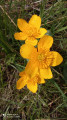
A walk to do in late May/early June – it’s absolutely covered in flowers!!!
It’s so beautiful you almost forget you’re on tarmac!!! But then again, you’ve got to like flowers!!!
A few lovely stretches through the forest, but yes… you do go through a wind farm…
Otherwise, it’s a really easy walk!

Machine-translated

vévé30
vévé30

Overall rating : 3.3 / 5

Date of your route : Sep 16, 2018
Reliability of the description : ★★★☆☆ Average
Ease of following the route : ★★★★☆ Good
Route interest : ★★★☆☆ Average

A disappointing first section. The tracks have been tarmacked following the construction of a wind farm; the route takes in some local roads, which admittedly have very little traffic, but the tarmac is a bit of a let-down...
For the second part, we tweaked the route slightly to avoid the road
A bit disappointed
Luckily, we found some mushrooms and came across some lovely scenery

Machine-translated

rioufredo
rioufredo

I’ve done the route again...
It was a disaster......
The site has been destroyed....

I understand the disappointment
I’ll make a note of that in the description

Rioufredo

Machine-translated

malaudos
malaudos

mainly between points 3 and 5 and the entire section to the west of these two points, particularly when returning via the Ardèche mountain route

Machine-translated

gazok54
gazok54 ★

Thanks, malaudos
Could you tell us exactly where this wind farm is located? That way, the author can include this information in the practical details for their walk.

Machine-translated

malaudos
malaudos

Overall rating : 2.3 / 5

Date of your route : May 16, 2016
Reliability of the description : ★★★☆☆ Average
Ease of following the route : ★★★☆☆ Average
Route interest : ★☆☆☆☆ Very disappointing

Please note: A wind farm comprising eight wind turbines is being built along the route. A large section of the route has been completely disfigured, with paths that have been widened by bulldozers to allow construction vehicles to pass. We did the walk on a public holiday, so there were no vehicles about… I’m not sure it would be very pleasant on a weekday.

Machine-translated

nesque
nesque

Overall rating : 3.7 / 5

Date of your route : Aug 14, 2014
Reliability of the description : ★★★★☆ Good
Ease of following the route : ★★★★☆ Good
Route interest : ★★★☆☆ Average

a bit too out in the sticks all the time

Machine-translated

Jean Chapuis
Jean Chapuis

Overall rating : 4 / 5

Date of your route : May 25, 2013
Reliability of the description : ★★★★☆ Good
Ease of following the route : ★★★★☆ Good
Route interest : ★★★★☆ Good

Hello,
I’m planning a week-long hiking trip in early September in the Montselgues area, so I’m having a look around to see what might suit us.
Thanks.
Jean Chapuis

Machine-translated

Other walks in the area

For more walks, use our search engine .

The GPS track and description are the property of this route's author. Please do not copy them without permission.