


Refine your search for walks in Pradal (cours d'eau)
Pradal (cours d'eau) walks


 Visorando Member
 Easy
Easy Walks near Pradal (cours d'eau)
 From the Roux tunnel to Montpezat via the ridges between Ardèche and Fontaulière
 12.96 mi
 +1,952 ft
 -3,389 ft
 7h 40
7h 40
 Difficult
 Departure from Le Roux (Ardèche)
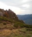
Passing through the abandoned villages of Vauclare and then Chaumiène, this walk initially follows the route of the railway line that was never completed between Aubenas and Le Puy, then climbs through a beautiful beech forest before reaching the ridge between Ardèche and Fontaulière, offering magnificent views of the Ardèche plateau and the Tanargue on the other side.
Pradelles - Cheylard-l'Évêque
 13.88 mi
+1,302 ft
-1,398 ft
7h 30
Difficult
Departure from Pradelles (Haute-Loire)
13.88 mi
+1,302 ft
-1,398 ft
7h 30
Difficult
Departure from Pradelles (Haute-Loire)
This is the 4th stage of a complete journey on the Chemin de Stevenson between Le Puy-en-Velay and Alès. This stage marks the transition from the Pays des Puys du Velay, with its open, hilly landscapes, to the Gévaudan, with its more enclosed landscapes and deep woodlands. The route follows the GR®70 (Red and White waymarkers).
The Recoumène Viaduct
6.02 mi
+781 ft
-1,007 ft
3h 25
 Moderate
Departure from Présailles (Haute-Loire)
Moderate
Departure from Présailles (Haute-Loire)
The point of interest on this route is linked to the history of the Transcévenole, an old railway line, and the Récoumène Viaduct. It also offers beautiful views of the region.
From the Chaumasse Water Tower to Mézilhac via the Knoll of Ourseyre
 7.76 mi
+761 ft
-1,617 ft
4h 15
Moderate
Departure from Sagnes-et-Goudoulet (Ardèche)
7.76 mi
+761 ft
-1,617 ft
4h 15
Moderate
Departure from Sagnes-et-Goudoulet (Ardèche)
A one-way hike along the ridges of the Ardèche mountains. Best done on a fine, sunny day after rain to enjoy superb views of the Alps almost all the way, from Mont Blanc to Mont Ventoux.
Goudet – Le Monastier-sur-Gazeille
 14.49 mi
+2,116 ft
-1,565 ft
8h 30
Difficult
Departure from Goudet (Haute-Loire)
14.49 mi
+2,116 ft
-1,565 ft
8h 30
Difficult
Departure from Goudet (Haute-Loire)
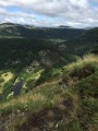
Third stage of the ‘Between Mézenc and the Loire Valley’ route.The route broadly follows theGR®®3to the fortified farm of La Valette, offering numerous panoramic views of the Loire Valley before reaching Le Monastier-sur-Gazeille via a high-altitude path which also offers some very fine views.
Les Estables - Goudet
 16.61 mi
+1,010 ft
-2,871 ft
8h 30
Difficult
Departure from Les Estables (Haute-Loire)
16.61 mi
+1,010 ft
-2,871 ft
8h 30
Difficult
Departure from Les Estables (Haute-Loire)
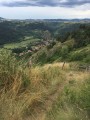
This second stage leads from the Hauts Plateaux du Mézenc to the Loire Valley. It takes you through the Mézenc National Forest and the Breysse woods, a mixture of beech and coniferous trees.The route more or less follows theGR®®40trail, avoiding wide tracks and small roads where possible.
Rocher de Cheylard - from Ray-Pic to the Col d'Aizac
 Tourism professional
 15.40 mi
+3,281 ft
-4,544 ft
9h 55
Difficult
Departure from Péreyres (Ardèche)
15.40 mi
+3,281 ft
-4,544 ft
9h 55
Difficult
Departure from Péreyres (Ardèche)
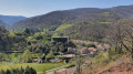
The first stage of this two-day loop around the Rocher de Cheylard takes you from the edge of the Ray-Pic waterfall to Aizac, a small village in the Cévennes Ardéchoises, perched on a pass between Volane and Besorgues.
Beech forests, broom-covered moors, chestnut trees, Roman roads, crystal-clear streams, passes with breathtaking views... you will walk from the Ardèche plateau to the lower Ardèche.
Monastier-sur-Gazeille - Le Bouchet-Saint-Nicolas
 14.64 mi
+2,533 ft
-1,585 ft
8 hrs
14.64 mi
+2,533 ft
-1,585 ft
8 hrs
 Very difficult
Departure from Le Monastier-sur-Gazeille (Haute-Loire)
Very difficult
Departure from Le Monastier-sur-Gazeille (Haute-Loire)
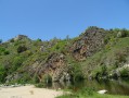
Second stage of a complete journey along the Chemin de Stevenson between Le-Puy-en-Velay and Alès. It's at Monastier-sur-Gazeille, and thus with this second stage, that Stevenson's real route begins. From this point on, the route follows the GR®70 (Red and White markings). Please note: the markings have been slightly modified from those shown in violet on the IGN map (in particular to avoid a few short stretches of road).
Sainte-Marguerite – western slope: from Neyrac-les-Bains to the Col d’Aizac
 11.49 mi
+3,533 ft
-2,677 ft
8h 20
Moderate
Departure from Meyras (Ardèche)
11.49 mi
+3,533 ft
-2,677 ft
8h 20
Moderate
Departure from Meyras (Ardèche)
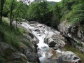
The first stage of the Sainte Marguerite circular route, which takes you from Neyrac-les-Bains, a spa town on the banks of the Ardèche, to Aizac, a small village in the Ardèche Cévennes, a stone’s throw from Antraigues-sur-Volane.
Leaving behind the lowland holm oaks, you head into the heart of the chestnut groves! From the banks of the Ardèche, you follow three of its tributaries: the Fontolière, the Bourges and finally the Besorgues, which flow along the valley floor and at the foot of picturesque villages. A very sunny walk.