Country:

 City:
City:


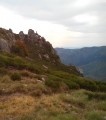
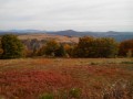
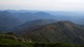
Start from the car park at the exit of the Roux tunnel on the D160 when coming from Saint-Cirgues-en-Montagne and at the entrance when coming from Montpezat-sous-Bauzon.
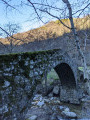
(S) From the car park, take the flat dirt track towards the bottom of the Vauclare valley, following the white-and-yellow markings. Pass by a tunnel designed for single-track use and a structure built over a stream, remnants of the work carried out for the railway line.
(1) At the signpost, continue along the upper path, still marked in white and yellow. The path is circular and loops round the abandoned hamlet of Vauclare and crosses the stream of the same name. Continue for about forty metres until you reach the start of a path on the right, which is not very visible.
(2) Ignore this path for now and carry on along the track. Turn left and head down to an old bridge. Reach the ruins of Vauclare, then return to the start of the path.
(2) On your return, climb the embankment on the left via this steep path for 10 metres; it is not always clearly visible. The white/yellow markings resume a little further on.
The construction of a forestry track has destroyed the path in several places; the use of a GPS is strongly recommended.
Cross the road; the path has been eroded by the overflowing stream, which you must cross to rejoin the well-marked trail.
You then begin the zigzagging ascent through the beech woods. Follow the marked path carefully, as numerous tracks branch off towards clearings where charcoal kilns once operated.
You’ll cross the road several times, but the white and yellow markings are always visible on the trees above.
Towards the summit, the well-marked path descends slightly to cross the stream bed (which is usually dry) before climbing up the other side. It then follows a circular route back towards the stream and climbs to the edge of the pasture after emerging from the forest. Follow the fence on the left, pass a spring, then head down to the Chemin de la Croix de Chaumiène.
(3) Continue along the dirt track to the left towards Chaumiène and La Veuve. The path is still marked in white and yellow, but you are also on a section of the Thueyts Trail (over 50 km). After 250 metres, when the path levels out again, go through the fences and take a short detour to the abandoned village of Chaumiène.
Then continue along the flat path, passing to the left of the Veuve farm (with its newly re-thatched roof). The path continues, leading towards a pass with a striking pile of boulders (Pierre Plantée), then climbs to the left, skirting a hill that forms part of the Serre de la Pierre Plantée.
(4) At the crossroads on the other side of the hill, carry on straight ahead along the path, which will become a signposted trail. After a fairly steep descent, the trail levels out again before running along the banks of the River Ardèche. After passing a sheep gate, you’ll reach the Fénadou junction.
(5) Take the signposted path on the left, which returns to the Fontaulière side of the Roche Fort and Fénadou ridges. Pass the Fontfreyde spring, then continue along the path – still marked in white and yellow – until you reach an inverted Y-junction.
(6) Carry on to the left, pass over a pass, then continue to the right beneath the ridges of the Serre de Berland.
After passing through chestnut woods, the signposted path climbs steeply to the summit of Prat Berland. It then becomes a track that descends to the Gravenne de Montpezat and continues along the Thueyts side of Le Suc. Pass a track on the left and arrive at a gate above a large tarmac-surfaced clearing.
(7) Turn right, then follow the track to the left to cross the tarmac road. Opposite, take the DFCI dirt track which descends through beautiful chestnut forests to the D536.
(8) At the departmental road, turn left towards Montpezat-sous-Bauzon. Follow the small road to the left just before the petrol station; this avoids a stretch of the D536 with no hard shoulder.
(9) You’ll reach the large bridge at the entrance to Montpezat-sous-Bauzon (53 m above the River Fontaulière).
Cross the bridge and, at the ‘pyramid’ topped by a statue of the Virgin Mary, turn right onto the Route de Prévenchères (large blue sign).
(10) Turn right to cross the bridge towards the church, which is listed as a historic monument (information about the building)
Walk between the priory and the rose garden, continue straight on, then cross the Pourseille via the submersible bridge. At the entrance to the campsite, take the path on the right between the fence and the stream.
Join the tarmac road and head straight up to the village to reach the Place de la Poste (E).

 Visorando Member
 Moderate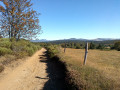
 Easy
Easy 
 Tourism professional