


 Country:

 City:
City:


Ravitaillement possible de nourriture à Valsenestre et au refuge de la Muzelle
Pour l'eau nous avons utilisé de l'eau naturelle avec filtres et pastilles d'épuration, car l'itinéraire longe les ruisseaux et des lacs la plupart du temps
Pensez à vérifier les règles du Parc (horaires bivouac) : https://www.ecrins-parcnational.fr/conse...
Balisage et itinéraire très simple à suivre, peu de croisements
Parcours en moyenne et haute montagne (neige en juillet)
A faire dans le sens décrit. Il nous parait impossible de le faire dans l'autre sens
Camping au Bourg d'Arud
Parc des Ecrins (Lauvitel - Valsenestre - Muzelle)

Randonnée de 3 jours en bivouac dans le Parc des Ecrins en juillet 2020
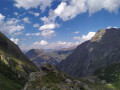
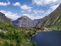
Panoramas magnifiques et extrêmement variés (passage de trois cols)
Faite par deux étudiants inexpérimentés (première randonnée de plusieurs jours)
Details
Creation:
Last update:
–
–
-
 Activity: Walking
 -
 Distance: 24.65 mi
 -
 Average duration: 3 days
 -
 Difficulty: Very difficult
 -
-
 Back to start: Yes
 -
 Ascent: + 11,680 ft
 -
 Descent: - 11,686 ft
 -
-
 Highest point: 8,556 ft
 -
 Lowest point: 2,907 ft
Photos
Stages of the route
This route needs several days, find the details below:
Notes
Other walks in the area
Le Bourg d’Arud – Lake Plan Vianney
 Visorando Member
6.61 mi
+4,731 ft
-390 ft
7h 10
Visorando Member
6.61 mi
+4,731 ft
-390 ft
7h 10
 Difficult
 Departure from Vénosc (Isère)
First day of hiking. Spectacular scenery. Nothing but uphill. Morning walk along a tourist trail to Lac du Lauvitel. Don’t miss the panoramic view of the lake!
The paths are very walkable but can be steep in places. Magnificent natural surroundings: you may spot chamois, marmots and weasels.
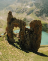
Lake Muzelle
 6.87 mi
+4,154 ft
-4,154 ft
6h 45
Difficult
Departure from Vénosc (Isère)
6.87 mi
+4,154 ft
-4,154 ft
6h 45
Difficult
Departure from Vénosc (Isère)
A breathtaking hike leading to the magnificent Lac de la Muzelle in the Écrins National Park.A challenging climb alongside streams and waterfalls.
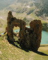
The Lake of La Muzelle
 7.38 mi
+4,101 ft
-4,101 ft
7h 00
Difficult
Departure from Vénosc (Isère)
7.38 mi
+4,101 ft
-4,101 ft
7h 00
Difficult
Departure from Vénosc (Isère)
A well-deserved but spectacular view. A magnificent lake at the foot of the Muzelle glacier that is not to be missed!
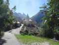
Circular around Saint-Christophe-en-Oisans
 6.05 mi
+1,955 ft
-1,946 ft
4h 30
6.05 mi
+1,955 ft
-1,946 ft
4h 30
 Moderate
Departure from Vénosc (Isère)
Moderate
Departure from Vénosc (Isère)
A beautiful route along the two banks of the Vénéon, passing through the mountain village of Saint-Christophe-en-Oisans, home of Father Gaspard, who conquered La Meije in 1877.
You will pass at the foot of two magnificent waterfalls, one of which you can cool off in by swimming underneath if you are brave enough.
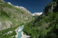
The Lanchâtra valley
 7.31 mi
+3,530 ft
-3,510 ft
6h 25
Difficult
Departure from Saint-Christophe-en-Oisans (Isère)
7.31 mi
+3,530 ft
-3,510 ft
6h 25
Difficult
Departure from Saint-Christophe-en-Oisans (Isère)
A magnificent hike in the Oisans region starting from the Plan du Lac lodge, taking in a small mountain hamlet with its tightly packed houses and offering a magnificent panorama of Pointe Swan (3,294m), all whilst following the rushing torrent of La Pisse.
Écrins - 2 days around the Refuge de la Muzelle
 12.41 mi
+5,732 ft
-5,748 ft
10h 40
Difficult
Departure from Vénosc (Isère)
12.41 mi
+5,732 ft
-5,748 ft
10h 40
Difficult
Departure from Vénosc (Isère)
Loop in the Écrins National Park. Tour of the Aiguille de Venosc via the Lauvitel and Muzelle lakes, then the Vénéon Valley.A rich and varied itinerary! It is relatively long. It can be done in two days by spending a night at the Refuge de la Muzelle or bivouacking near the refuge.
The Lac du Lauvitel from La Danchère
 3.79 mi
+1,821 ft
-1,827 ft
3h 20
Moderate
Departure from Vénosc (Isère)
3.79 mi
+1,821 ft
-1,827 ft
3h 20
Moderate
Departure from Vénosc (Isère)
The Lac du Lauvitel and its integral reserve (the first in France, created in 1995).
Lac du Lauvitel
5.04 mi
+2,369 ft
-2,365 ft
4h 25
Moderate
Departure from Vénosc (Isère)
A nice little circular loop in the Écrins National Park, to Lac du Lauvitel, from the Ougiers car park. The hike can start from La Danchère, but in August 2024 the road was closed due to a landslide in June. The ascent is via Les Selles and the descent via Les Rousses. It is a mountain trail, much of which runs through forest, so it is shaded, which is useful in hot weather. The trail is mostly paved with old stones and there are small bridges to cross.
For more walks, use our search engine .
The GPS track and description are the property of this route's author. Please do not copy them without permission.

