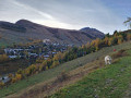
Le Bourg d’Arud – Lake Plan Vianney

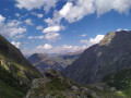
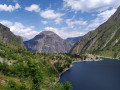
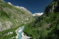
First day of hiking. Spectacular scenery. Nothing but uphill. Morning walk along a tourist trail to Lac du Lauvitel. Don’t miss the panoramic view of the lake!
The paths are very walkable but can be steep in places. Magnificent natural surroundings: you may spot chamois, marmots and weasels.

This walk is part of a multi-day hike: Parc des Ecrins (Lauvitel - Valsenestre - Muzelle)

Details

6578490
Creation:
Last update:
Last review:
  • Walking
    Activity: Walking
  • ↔
    Distance: 6.61 mi
  • ◔
    Average duration: 7h 10 
  • ▲
    Difficulty: Difficult

  • ⚐
    Back to start: No
  • ↗
    Ascent: + 4,731 ft
  • ↘
    Descent: - 390 ft

  • ▲
    Highest point: 7,438 ft
  • ▼
    Lowest point: 2,894 ft

Photos

Description of the walk

Park at the Place de la Fontaine car park in Bourg d’Arud.
Onthe GR®54orGR®54B: red and white markings

(S/E) Facing the Vénéon, turn left towards L’Alleau. Cross the bridge over the stream.

(1) Turn right onto the path that runs alongside the stream, then veers away from it by turning left. Walk alongside the leisure park and cross the bridge over the Vénéon.

(2) Follow the road to the left, which runs between the departmental road on your right and the Vénéon on your left.

(3) Turn left to cross the bridge, then take the path on the right. Just before reaching the D214C, turn left and join it.

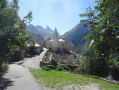
(4) Take the road on the left towards the centre of the hamlet of La Danchère. Turn right at the wash house, then left at the chapel.

(5) At the end of the tarmac road, follow theGR®54towards Lac du Lauvitel.

(6) Turn right to cross the bridge and head up the path on the right bank.

(7) At the junction, carry on straight ahead along theGR®54until you reach Lac du Lauvitel.

(8) Turn left to reach the lake’s shores and take a break if you wish. Retrace your steps.

(8) Continue left along the path leading towards Lac de Plan Vianney, then head uphill (there is only one path).

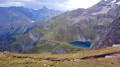
(9) Tackle a very steep section where you may need to use your hands. Reach Lac de Plan Vianney.

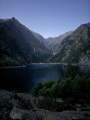
(10) Leave theGR®54Band head down to the lakeshore towards the campsite (E).

Waypoints

  1. S : mi 0 - alt. 3,068 ft - Bourg d’Arud car park
  2. 1 : mi 0.17 - alt. 3,146 ft - Path on the right
  3. 2 : mi 0.53 - alt. 3,038 ft - Turn left after the bridge
  4. 3 : mi 1.3 - alt. 2,940 ft - Bridge
  5. 4 : mi 2.36 - alt. 3,176 ft - Route
  6. 5 : mi 2.67 - alt. 3,261 ft - End of tarmac road, track
  7. 6 : mi 2.81 - alt. 3,327 ft - Bridge
  8. 7 : mi 3.31 - alt. 3,845 ft - Crossroads
  9. 8 : mi 4.72 - alt. 5,059 ft - Lake Lauvitel
  10. 9 : mi 6.26 - alt. 6,975 ft - Steep section
  11. 10 : mi 6.56 - alt. 7,421 ft - Crossroads
  12. E : mi 6.61 - alt. 7,385 ft - Lac de Plan Vianney

Notes

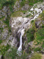
Water: there is no drinking water, but there are plenty of streams and lakes, so water purification tablets and filters are suitable.
Food: no supplies available beyond La Danchère, so plan for at least two days’ worth.
Camping: a designated camping area with low stone walls to provide shelter from the wind. Check the permitted times. There are no trees, so you’ll need to bring a tent.
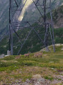
Frequent thunderstorms, so bring waterproof gear, but the area is safe (away from slopes and protected by a power line)
Check the regulations in force in the park: https://www.ecrins-parcnational.fr/conse...

You are hiking in the heart of the Écrins National Park.

The Écrins massif is an exceptional area, open to all, with a natural, cultural and scenic heritage that is truly unique. To protect these treasures, the heart of the park is marked by blue, white and red flags, and certain regulations must be observed within this area. Please familiarise yourself with these rules whilst planning your walk to help preserve this shared heritage, at https://www.ecrins-parcnational.fr.

Always be cautious and plan ahead when you're outdoors. Visorando and the author of this route cannot be held responsible for any accidents occurring on this route.

The GR® and PR® markings are the intellectual property of the Fédération Française de Randonnée Pédestre.

Reviews and comments

4.7 / 5
Based on 2 reviews

Reliability of the description
5 / 5
Ease of following the route
4.5 / 5
Route interest
4.5 / 5
User 24871181

Overall rating : 4.3 / 5

Date of your route : Aug 14, 2026
Reliability of the description : ★★★★★ Very good
Ease of following the route : ★★★★☆ Good
Route interest : ★★★★☆ Good
Very busy route : No

A popular route as far as Lauvitel, but much less so after that.
The climb between the two lakes presents no particular difficulties; there are a few steps towards the end where you’ll need to use your hands for support, but nothing too challenging. Keep an eye on the weather, as it’s often stormy.

Machine-translated

smashdc
smashdc
• Edited:

Overall rating : 5 / 5

Date of your route : Aug 25, 2023
Reliability of the description : ★★★★★ Very good
Ease of following the route : ★★★★★ Very good
Route interest : ★★★★★ Very good
Very busy route : No

2,269 m Lauvitel & Plan Vianney Lakes, Vénosc #isere #rhonealpes #lauvitel
🥰 A must-see in the region!
🌈 This hike is part of an epic 318 km trek with 19,496 m of ascent and descent over 24 days 🥾🥾 It’s really tough and quite often :-o
.
A few days later, I did the Muzelle & Lauvitel circular...
I found this hike difficult. To reach the first lake, the climb is quite steep: 15 per cent – 20 per cent.
To get to Plan Vianney, it’s even tougher! Short climbs, large steps, and very steep ascents through the woodland.
There’s hardly any shade and it’s generally quite windy.
When you reach the valley, you can see how far you’ve come, and there are still some steep climbs ahead of you.
I did a round trip. The descent isn’t too steep by comparison.
So you’ll see fewer people.
Right at the top, keep your eyes on the electricity pylon – you can’t really miss it.
The wires run across the lake, but you’ll still get some lovely photos.
It would be worth doing this as a two-day trip and climbing up above the second lake :-)
👉 The water level of Lake Lauvitel can vary by more than 20 metres over the course of a year!
👉 The descent from Lake Lauvitel to the hamlet of Vénosc was paved by the locals in the areas most prone to erosion ;-)
I found the descent quite long in the end, and you need to be a bit wary of the rather changeable terrain.
The best views are from higher up, as usual.
.
13.6 km & 1,345 m ascent/descent
⚡️ Highlights of the walk:
Alt. 1,530 m – Lake Lauvitel
Alt. 2,269 m – Lake Plan Vianney

Machine-translated

Other walks in the area

For more walks, use our search engine .

The GPS track and description are the property of this route's author. Please do not copy them without permission.