Country:
 City:
City:


To reach Sucé-sur-Erdre railway station on the Nantes/Nort-sur-Erdre/Châteaubriant tram-train line, there are several options:
- take the tram-train from Nantes (25 mins from Nantes SNCF station) or La Chapelle-sur-Erdre (10 mins) - or by car; in that case, make use of the ample parking facilities on both sides of the track, around Sucé-sur-Erdre station.
(S/E) Take the path running perpendicular to the railway line towards the north-west. The path is clearly visible, with a ‘Grande Voïette’ sign at the side of the road. The path runs through a cutting and, as you gradually climb, you’ll discover the gardens of the houses in the Sucé housing estates. Join the Route de Procé.
(1) Turn left onto it and follow it for about 300 metres, ignoring the signposting and the path branching off to your right. At the first junction, turn left towards “La Haie”. As you pass through this hamlet, admire the old houses which have been skilfully restored. Continue along this small road, which, after the hamlet, becomes a stony track . On your left, a wide cultivated field opens up a sweeping view across a variety of valleys.
(2) Turn right at a right angle, following the yellow signposts. You’ll reach a small tarmac road in the hamlet of La Hocmardière.
(3) Turn right and continue along the road through this area where many horses are grazing peacefully. You’ll soon come to a T-junction.
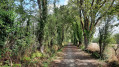
(4) Turn right, following the yellow markings, then after 300 metres, turn left down the tree-lined avenue. Cut left again and then, fairly soon after, turn right onto the wide gravel track, which you’ll follow for a good kilometre. You’ll then reach a junction with several roads leading off at almost right angles.
(5) Take the right-hand path until you reach the D37 (the Casson road). Cross it with great care as traffic can be heavy and fast-moving. Continue to the junction at the hamlet of La Chotinière.
(6) Here you have a choice of routes to continue the walk:
- continue to the right along the tarmac road, passing through the hamlet of La Chotinière. This route is recommended in wet weather,
- leave the road and turn left onto the dirt track (as shown on the map); continue straight ahead, ignoring the path that branches off to the right. The path winds its way but is clearly visible, right up to the next tarmac road. When you reach this road, turn right and then left onto the footpath that skirts the gardens of the houses. The path continues through the countryside and then turns into a cattle track. This makes for a tricky passage in wet weather.
(7) You’ll reach the farm by taking the small road on the right. Watch the goats in the enclosure as you walk past them on your left. At the next crossroads, carry on straight ahead along the stony track.
In both cases, you’ll reach the crossroads before the hamlet of La Brichetière.
(8) Carry on along this stony farm track and pass the entrance to the La Cornerais farm on your left before turning onto the path opposite, beneath the hedges that line the path on both sides. Take the road on your left until you reach the junction with the stony path.
(9) Turn right and carry on straight ahead until you reach the Route de La Goulitière, which you cross.
(10) Keep going straight on along the path behind the gardens, as you are now entering the built-up area of Sucé-sur-Erdre. At the next T-junction, turn left onto the CD69 (Sucé-sur-Erdre to Nort-sur-Erdre).
(11) Walk along the pavement and cross to the other side to be on the safe side. Head towards the roundabout and the tram-train level crossing.
(12) By crossing again at the pedestrian crossing, you’ll easily reach the car park behind the Sucé-sur-Erdre tram-train station (S/E), where you can catch the train or get back into your car.




 Visorando Member
 Easy
Easy