Country:
 City:




Starts from Place Notre-Dame (hiking sign). Parking along the road between the roundabout by the war memorial and the statue of Notre-Dame de Bon Secours.
Yellow signposting
The markings are one-sided, in the direction of this description, and are mainly positioned at junctions. At the most important of these, the markings are supplemented by directional signs (follow thePR® No. 27 “Les coteaux de Lésigny”). N.B. In December 2022, some posts had been dislodged: if in doubt about the direction indicated, refer to the map and the description.
(S/E) Walk up the road towards the statue. At the Fork in the road at the foot of the statue, turn right and head uphill. At the junction at the top of the hill, head down to the left into Rue de la Raillerie (ignore a red arrow indicating a right turn).
(1) At the ‘give way’ sign, turn right and then immediately left towards La Boutelaye. Cross a river and walk alongside the former outbuildings of La Boutelaye Castle.
(2) When you reach the castle gate (with a metal cross opposite), turn right onto a grassy path. Continue straight on (south) between the fields.
(3) At a fork in the road (not shown on the map, with a body of water on the right), take the path on the right and follow a hedge on your left. At the next junction (marker 64), go straight on (ignore thePR® No. 26 which branches off to the right). Continue southwards to the hamlet of La Chapelière.
Yellow + Blue signposting
(4) At the crossroads (cross), head up a small road on the left. About a hundred metres further on, level with an isolated house on the right-hand side, turn left onto a field track.
(5) At the three-way junction that appears shortly afterwards (elevation 87), turn right. Walk uphill between the fields and then along a hedge on the right-hand side. Note a sign on the left-hand side marking the presence of a maquis in this area in 1944. Cross a small wooded area, ignoring a path branching off to the right. Ignore another path on the right and continue along the edge of the woods on your left until you reach a junction.
(6) Then turn right onto a wide path towards Trainebot. Walk alongside a pine forest on your left (some sections may be damp). Continue through the pine forest until you reach a Fork in the road.
(7) Take the path on the right, still heading towards Trainebot. Join a path coming from the left and continue along its extension (south-south-west). Walk alternately alongside meadows and wooded areas.
(8) Cross the Trainebot farm and rejoin the tarmac road. Then cross a small road and continue straight ahead along a farm track towards Clos Tiret. Ignore a path branching off to the left.
Yellow markings
(9) At the next junction, carry straight on (ignore the blue markings heading off to the right). At the junction shortly afterwards, carry straight on again, between meadows bordered by a hedge.
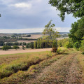
(10) At the next junction, turn left. Walk alongside a hedge on your left and turn left, then right, following the path. At the T-junction (not shown on the map), turn left and enter a woodland. At a junction, go straight on and head downhill. Leave the woodland and continue downhill through open countryside (beautiful view).
(11) Return to the tarmac road and walk downhill through the hamlet of Alogny (a lovely old house on the right-hand side). At the end of the small road, turn right and, at the ‘give way’ sign immediately ahead, follow the D5 to the left. Take care along this road, particularly at a narrow section after entering the hamlet of Les Froux.
(12) At the junction in the centre of the hamlet, turn left and head up a narrow lane. The tarmac soon gives way to a stony track which climbs and enters a woodland.
(13) At a fork in the road, turn right onto a roughly level path. Stay on the main path as it winds through the woods and ignore the faint tracks on either side. Pass through a pine forest and return to a junction you passed earlier.
(7) Go straight on, following thePR® trail back, and retrace your steps in the opposite direction through the pine forest and then along the edge of the pine forest.
(6) At the next junction, carry on straight ahead along the wide path through the pine forest. Further on, walk along the right-hand side of a large, recently felled area of woodland and head downhill. Leave the pine forest, continue along the edge of the woodland and reach the Château de La Boutelaye.
(2) Follow the small road straight on. At the ‘give way’ sign, turn right and pass the sign marking the entrance to Lésigny.
(1) Continue straight on, taking care, along the D16. Take thefirst left, into Rue de la Richerie (the street shown earlier on the IGN map does not exist). Pass a cul-de-sac on the left, walk past the statue of Notre-Dame de Bon Secours once more and you will immediately reach Place Notre-Dame (S/E).

 Tourist office
 Easy

 Visorando Member