


 Country:
 City:
City:



The route starts from the car park of the old Condé-en-Brie station.
(S/E) Leave the station, head south-east and soon turn left towards the town centre. Walk past the entrance to the château, then past the foot of the church, and continue to the market halls.
(1) Then turn left onto Rue Saint-Rémy. At the end of the street, continue along a path through the pastures. Cross the Surmelin (picnic table) and carry on in the same direction.
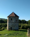
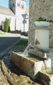
(2) At the crossroads (dovecote), turn right. Pass a wash house on your left and walk towards the church.
(3) Cross the D20 and continue along Rue de Nogent. The tarmac soon gives way to a footpath. Walk past some orchards on your left, then cross a small bridge. Continue along the path, walking past an orchard on your right. Then walk through the hamlet of Nogent.
(4) At the junction, carry on straight ahead, veering slightly to the left (do not take the bridge on the right). Walk to the hamlet of Montchevret.
(5) At the crossroads, take the second turning on the right, Rue de Malaquais. When the street bends to the left, carry on straight ahead along a path. Walk between orchards and fields, pass under a high-voltage power line and arrive at a junction.
(6) Carry on straight ahead along a grassy path. Keep going straight on, first south-east then east-south-east. You’ll come out onto a small road; follow it as it continues until you immediately reach the cemetery at Baulne-en-Brie.
(7) Then turn right, leaving the cemetery on your left. Walk through the village until you reach a crossroads at the foot of the church.
(8) Continue straight on along the Grande Rue and pass in front of the ‘Wall of Living Memory’. Then turn left and then right, cross the Surmelin stream and pass a sports ground (with a picnic table).
(9) Cross the D4 and take the gravelled path directly opposite, heading towards Condé-en-Brie. Walk uphill alongside a woodland and then enter the woodland.
(10) At the top, at a junction, turn right at the edge of the woodland.
(11) At the junction, turn sharply right and, at the Fork in the road immediately ahead, veer left. Stay along the edge of the woodland and follow the path as it winds several times. Then head west-north-west, still staying along the edge of the woodland. Pass under a high-voltage power line and head downhill to the Condé-en-Brie cemetery.
(12) Enter the cemetery and walk through it. On the other side, walk past the wash house and continue straight on into Condé along Rue de l’Ormet. Cross the DF20 on the right-hand side and arrive at the market halls.
(1) Carry on straight ahead. Just before a roundabout, turn right and head back towards the old railway station (S/E).

 Visorando Member
 Difficult

 Local authority
 Easy
Easy 
