Country:

 City:


Car park at the junction of Chemin du Chéra and Rue Poyoux-Sarts.
(S/E) From the car park, turn left straight onto the path at the edge of the woodland, which runs parallel to Rue Poyoux-Sarts. This path winds gently downhill along the edge of the woodland and behind the gardens, then through meadows. Ignore the path on the left and continue slightly to the right, heading slightly uphill.
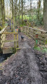
(1) When you reach the Ruisseau de Maurissart at the end of the path, cross it and take the forest track that climbs up the valley alongside the stream. When you reach a small rise, keep slightly to the left, cross the wooden bridge and continue straight on. The path emerges near a few houses.
(2) As you leave the path, take the tarmac road to the right and continue to the roundabout. Go round the roundabout on the left and climb up the ditch opposite to rejoin the forest track. Go through the gate and keep to the left (ignore the path opposite, which is closed by a gate). The forest track is roughly tarmacked and a sign marking the state-owned forest is visible shortly afterwards.
(3) After one kilometre, turn right onto a wide, grassy path that runs in a straight line. Follow it for 200 metres and turn right again to walk alongside a wire fence protecting young plantations (a somewhat mixed stand of trees). Follow this path for a good kilometre until you reach a tarmac road.
(4) Take this road to the right for about fifty metres and, before the bend, turn left onto the small path leading off diagonally (ignore the dirt track running alongside the garden). This path soon opens out onto a wider forest track, which you take to the left. This track runs through the undergrowth but follows the boundary with a neighbouring field.
(5) As the track begins a right-angle bend to the right, carry on straight ahead (keeping slightly to the left) along the very narrow path running between two pastures, then continue straight ahead along the small tarmac road.
(6) When you reach the first houses (the hamlet of Les Gottes), turn right onto Rue de la Charmille, which continues as a dirt track until it meets a concrete road. Cross this road and continue along the dirt track towards the woods.
(7) At the edge of the woodland, carry on along the dirt track that runs alongside the woodland (under the high-voltage power line). Walk past a large square farmhouse, continue along the tarmac road (Chemin Saint-Loup) and cross the road (Chemin du Chéra; be careful, as there is heavy traffic at certain times!) to join a rather potholed tarmac track which leads into the woods, becoming a forest track that is barely passable by vehicle.
(8) After crossing a small stream and having climbed all the way up the valley, take the path on the right which runs diagonally (at this point, the forest track you have just left is about to exit the woods to cross some fields). This path begins a long descent.
(9) Before the stream (bridge), take the path on the right. A fence separates the path from the stream, which you follow, soon passing by the Tibetan temple (various ancient and religious buildings).
(10) Shortly after the temple, take the path on the right before the stream (bridge). This path winds its way uphill through the woods, past meadows, before descending again to join the road and the car park at the junction of Chemin du Chéra and Rue Poyoux-Sarts (S/E).

 Visorando Member

 Easy

 Difficult