Refine your search for walks in Orbieu (rivière) - Affluent de l'Aude
Orbieu (rivière) - Affluent de l'Aude walks


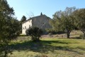
 Notre Dame du Carla
 Association / Club / Walk leader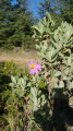
 6.60 mi
 +922 ft
 -958 ft
 3h 50
3h 50
 Moderate
 Departure from Lagrasse (Aude)
This hike, a little longer than Charlemagne's buttocks, takes you to a chapel and a viewpoint overlooking the surrounding area, all surrounded by wild vegetation.
Mont Major
 Visorando Member
 8.68 mi
+1,398 ft
-1,394 ft
5h 10
Moderate
Departure from Saint-Pierre-des-Champs (Aude)
8.68 mi
+1,398 ft
-1,394 ft
5h 10
Moderate
Departure from Saint-Pierre-des-Champs (Aude)
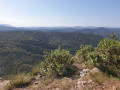
Despite its modest altitude, Mont Major (542 m), the highest point of the Serre de Blanes, offers a magnificent, almost 360° panorama encompassing the Montagne d’Alaric, the Carcassonne plain and, on a clear day, the peaks of the Ariège Pyrenees and the Canigou. The ascent, starting from the village of Saint-Pierre-des-Champs, takes place amidst a landscape typical of the Corbières, with small, isolated vineyards, pine trees and heath where holm oaks reign supreme. A breath of fresh air in a setting where peace and quiet are guaranteed.
Lagrasse – Mayronnes
 10.62 mi
+1,880 ft
-1,430 ft
6h 30
10.62 mi
+1,880 ft
-1,430 ft
6h 30
 Difficult
Departure from Lagrasse (Aude)
Difficult
Departure from Lagrasse (Aude)
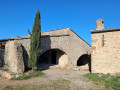
The third and final stage runs between the medieval village of Lagrasse and the village of Mayronnes, passing by the Notre-Dame du Carla Chapel and the Roman bridge at Rieux-en-Val.
Villerouge-Termenès – Lagrasse
 11.57 mi
+1,496 ft
-2,146 ft
6h 35
Moderate
Departure from Villerouge-Termenès (Aude)
11.57 mi
+1,496 ft
-2,146 ft
6h 35
Moderate
Departure from Villerouge-Termenès (Aude)
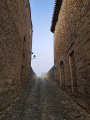
The second stage between Villerouge-Termenès and Lagrasse begins on the heights of the Corbières and then descends gradually towards the superb medieval village of Lagrasse and its abbey.
Walks near Orbieu (rivière) - Affluent de l'Aude
Cubières-sur-Cinoble – Caudiès-de-Fenouillède
 13.53 mi
+3,714 ft
-3,963 ft
9h 25
Difficult
Departure from Cubières-sur-Cinoble (Aude)
13.53 mi
+3,714 ft
-3,963 ft
9h 25
Difficult
Departure from Cubières-sur-Cinoble (Aude)
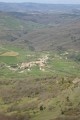
Day two: return to Caudiès-de-Fenouillède via the Pic or Pech de Bugarach.
Descent from the Lacamp Plateau
 16.05 mi
+1,781 ft
-2,303 ft
8h 55
Difficult
Departure from Clermont-sur-Lauquet (Aude)
16.05 mi
+1,781 ft
-2,303 ft
8h 55
Difficult
Departure from Clermont-sur-Lauquet (Aude)
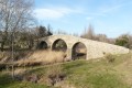
Part Two: from Clermont-sur-Lauquet, climb up to the Lacamp plateau, then descend to Labastide-en-Val, Villetritouls, Taurize, Rieux-en-Val and return to Mayronnes.
Caudiès-de-Fenouillèdes - Cubières-sur-Cinoble
 15.07 mi
+3,287 ft
-3,009 ft
9h 45
Difficult
Departure from Caudiès-de-Fenouillèdes (Pyrénées-Orientales)
15.07 mi
+3,287 ft
-3,009 ft
9h 45
Difficult
Departure from Caudiès-de-Fenouillèdes (Pyrénées-Orientales)
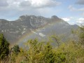
First stage of a 2-day circular route starting from Caudiès-de-Fenouillèdes, taking you to Cubières-sur-Cinoble on thefirst day.
This is a fairly long stage with a significant elevation gain. It is possible to adapt the route as you wish, as there are numerousPR®,GR® 36, Cathar TrailGR®367- 367A andGRP® Tour des Fenouillèdes paths.
The Agly and the Bugarach
28.61 mi
+6,995 ft
-6,972 ft
2 days
Difficult
Departure from Caudiès-de-Fenouillèdes (Pyrénées-Orientales)
Here is a 45 km circular route that will allow you to explore the former natural border between France and Spain, between the Aude and the Pyrénées-Orientales, as well as the upper Agly valley and its magnificent Galamus Gorges, before climbing up to the Pic de Bugarach.The route starts from Caudiès-de-Fenouillèdes towards Duilhac-sous-Peyrepertuse, then descends towards Cubières-sur-Cinoble.On the second day, approach and climb up to the Pech de Bugarach, then descend and return to Caudiès.