


Treck : 4 jours/ 3nuits en Suisse dans l'Oberland Bernois

Randonnée de 4 jours et 3 nuits ( 1 nuit en bivouac, et 2 nuits en camping ), du samedi au mardi.
Randonnée cool sauf le dimanche, plus sportif du fait du dénivelé.
Réservation en camping a prévoir, argent liquide, bouteille d'eau et nourriture pour le bivouac.
Details
Creation:
Last update:
–
–
-
 Activity: Walking
 -
 Distance: 19.59 mi
 -
 Average duration: 4 days
 -
 Difficulty: Difficult
 -
-
 Back to start: No
 -
 Ascent: + 6,312 ft
 -
 Descent: - 8,376 ft
 -
-
 Highest point: 8,560 ft
 -
 Lowest point: 2,602 ft
-
 Country:
Switzerland
Country:
Switzerland
-
 Area: Alps
 -
 City:
Kandersteg
City:
Kandersteg -
 Start: N 46.497241° / E 7.685169°
 -
 End: N 46.596841° / E 7.908291°
 -


 Hour-by-hour weather


Stages of the route
This route needs several days, find the details below:
Other walks in the area
From Kandersteg Campsite to Lake Oeshinensee
 Visorando Member4.64 mi
+1,476 ft
-1,503 ft
3h 25
Visorando Member4.64 mi
+1,476 ft
-1,503 ft
3h 25
 Moderate
Departure from Kandersteg (Canton of Bern)
Moderate
Departure from Kandersteg (Canton of Bern)
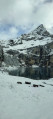
This hike makes for a relaxing day out. You can stroll around the lake and enjoy a bite to eat. The starting point, at Camping Kanderseg, is at an altitude of 1,228 metres, whilst Lake Oeshinensee is at 1,590 metres. You then return to the starting point
Lake Oeschinensee from Kandersteg
 4.13 mi
+1,371 ft
-1,358 ft
3h 05
Moderate
Departure from Kandersteg (Canton of Bern)
4.13 mi
+1,371 ft
-1,358 ft
3h 05
Moderate
Departure from Kandersteg (Canton of Bern)
A lovely little hike offering access to Lake Oeschinen, at the mere cost of a bit of a sweat, rather than paying for the cable car. There are no difficulties on this route, apart from the fact that it’s uphill all the way on the way there, but nothing technically challenging in itself.
Kandersteg - Selde
 6.89 mi
+4,895 ft
-3,658 ft
7h 25
Moderate
Departure from Kandersteg (Canton of Bern)
6.89 mi
+4,895 ft
-3,658 ft
7h 25
Moderate
Departure from Kandersteg (Canton of Bern)
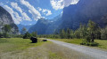
This third stage will take you from Kandersteg to the hamlet of Selde. The Kander river will accompany you throughout this beautiful route. Calm from Kandersteg to Eggeschwand, the Kander can be heard as you climb up through the gorges, where you can enjoy the various waterfalls and cascades. You will then follow it more peacefully through the wide Gastertal valley to Selde.
Selde - Lauchernalp
 7.15 mi
+3,937 ft
-2,313 ft
6h 45
Difficult
Departure from Kandersteg (Canton of Bern)
7.15 mi
+3,937 ft
-2,313 ft
6h 45
Difficult
Departure from Kandersteg (Canton of Bern)
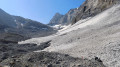
This fourth stage will take you from Selde to Lauchernalp. You will start by crossing the Kander via a suspension bridge. After Gfelalp, you will have a superb view of the Kanderfin glacier, the source of the Kander. The climb to the Lötschenpass crosses a glacier without any difficulty. An equipped passage takes you to the pass, where you can enjoy a break at the hut. You will admire the wide panorama of the 4,000-metre peaks of the Valais Dom, Weisshorn and Matterhorn. At the Lötschen Pass, as at Lauchernalp, you can see the Restipass, which is the planned route for the next day's stage.
Griesalp – Hundshubel
5.09 mi
+4,052 ft
-1,250 ft
5h 50
Difficult
Departure from Reichenbach im Kandertal (Canton of Bern)
Hike with 1,300 metres of elevation gain: be warned, it’s going to be tough. It’s a challenging day, all uphill from the hotel to the campsite. We’ll arrive in the heart of the countryside. We’ll need to set up camp before having a nap and getting out the card games (not forgetting the food).
Schwarenbach - Engstligenalp
 4.39 mi
+2,526 ft
-2,844 ft
4h 15
Difficult
Departure from Leukerbad (Valais)
4.39 mi
+2,526 ft
-2,844 ft
4h 15
Difficult
Departure from Leukerbad (Valais)
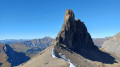
After a night spent in absolute silence, this second stage begins with a pleasant climb to Schwartzgrätli. A fairly exposed section along the Felsenhorn wall will require a little caution, despite the cables and ropes. You will then continue along the Engstlige ridge with the Tschingellochtighorn, with its remarkable relief, in your sights. To conclude the day, you will descend via the Ärtele ridge to Engstligenalp, a superb mountain pasture at the foot of the Wildstrubel.
Adelboden - Lenk
 8.63 mi
+2,195 ft
-3,120 ft
5h 55
Difficult
Departure from Adelboden (Canton of Bern)
8.63 mi
+2,195 ft
-3,120 ft
5h 55
Difficult
Departure from Adelboden (Canton of Bern)
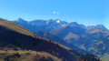
For this fourth stage, you will follow the Via Alpina to Lenk. At the Hahnenmoospass, you can enjoy views of the Wildstrubel and Wildhorn mountains and the Plaine Morte glacier. A long descent will take you to the peaceful village of Lenk in the Simme Valley.
Engstligenalp Waterfall
 3.66 mi
+2,539 ft
-2,552 ft
3h 55
Moderate
Departure from Adelboden (Canton of Bern)
3.66 mi
+2,539 ft
-2,552 ft
3h 55
Moderate
Departure from Adelboden (Canton of Bern)
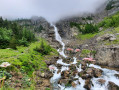
The Engstligen Falls, near Adelboden in the Bernese Highlands, consist of two waterfalls, Engstligen Fall I and II, with heights of 97 and 165 m respectively. They are listed in the Swiss inventory of landscapes of national importance.
For more walks, use our search engine .
The GPS track and description are the property of this route's author. Please do not copy them without permission.

