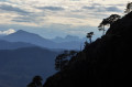
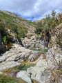
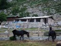
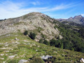
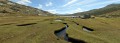
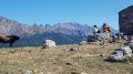
Lake Creno from Orto

Walk from Orto to Lake Creno. 360° views of the region.

Details

33943871
Creation:
Last update:
Last review:
  • Walking
    Activity: Walking
  • ↔
    Distance: 4.60 mi
  • ◔
    Average duration: 3h 35 
  • ▲
    Difficulty: Difficult

  • ⚐
    Back to start: Yes
  • ↗
    Ascent: + 1,683 ft
  • ↘
    Descent: - 1,683 ft

  • ▲
    Highest point: 4,357 ft
  • ▼
    Lowest point: 2,713 ft
  • ⚐ Country: France
  • ⚐ City: Orto (20125)
  • ⚑
    Start/End: N 42.187754° / E 8.930635°
  • ❏
    IGN map(s): Ref. 4251OT, 4251OTR
  • Hour-by-hour weather

Photos

Description of the walk

Park at the top of the village of Orto.

(S/E) Head north and follow the path towards Lake Creno. The path leads up to the ridge, passing beneath a chestnut grove. In spring, there were lots of little flowers and small streams. You’ll pass two fenced-off springs.

(1) You will then tackle the steepest section, which winds its way through the chestnut grove and then through a stand of holm oaks.

(2) You’ll pass above a cross; this spot offers a view of the valley through the trees.

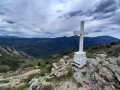
(3) You’ll then pass another spring. Reach the ridge at a White Cross.

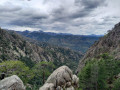
(4) This spot offers a stunning 360° view of the surrounding area. After a well-deserved break at the cross, look out for the sign and turn right towards Lac de Creno for about 100 m, then keep left at the three-way junction. Carry on until you reach another three-way junction.

(5) This time, take the path on the right: Lac de Creno. Pass above the Bergerie de l’Arate and enter the pine forest.

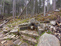
(6) Then pass the Funtana di a Veduvello and carry on to Lac de Creno.

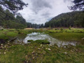
(6) Carry on to Lake Creno. The spot is magnificent and offers several picnic spots.

(7) Walk round the lake in a clockwise direction and, on the opposite side to where you arrived, you’ll reach another lovely viewpoint.

(8) All that remains is to retrace your steps to return to Orto (S/E).

Waypoints

  1. S/E : mi 0 - alt. 2,713 ft - Orto
  2. 1 : mi 0.56 - alt. 3,219 ft - Second spring
  3. 2 : mi 0.69 - alt. 3,379 ft - Cross
  4. 3 : mi 0.92 - alt. 3,812 ft - Source
  5. 4 : mi 1.06 - alt. 4,039 ft - Summit cross
  6. 5 : mi 1.25 - alt. 4,101 ft - Common junction (out and back)
  7. 6 : mi 1.87 - alt. 4,341 ft - Funtana di a Veduvello
  8. 7 : mi 2.02 - alt. 4,331 ft - Lac de Creno
  9. 8 : mi 2.28 - alt. 4,295 ft - Viewpoint
  10. S/E : mi 4.6 - alt. 2,713 ft - Orto

Reviews and comments

4.3 / 5
Based on 2 reviews

Reliability of the description
4 / 5
Ease of following the route
4.5 / 5
Route interest
4.5 / 5
BIBIjuju
BIBIjuju

Overall rating : 4.3 / 5

Date of your route : Jul 01, 2024
Reliability of the description : ★★★★☆ Good
Ease of following the route : ★★★★★ Very good
Route interest : ★★★★☆ Good
Very busy route : Yes

a lovely, easy walk

Machine-translated

to8994
to8994

Overall rating : 4.3 / 5

Date of your route : Jun 17, 2024
Reliability of the description : ★★★★☆ Good
Ease of following the route : ★★★★☆ Good
Route interest : ★★★★★ Very good
Very busy route : No

A lovely walk. The lake is small but very pretty.
The view across to the other side is stunning.
The descent is steep and stony – that’s Corsica for you!

Machine-translated

Other walks in the area

For more walks, use our search engine .

The GPS track and description are the property of this route's author. Please do not copy them without permission.