


Refine your search for walks in Mont Rond (1783 m)
Mont Rond (1783 m) walks


 Lac du Gui and Mont Rond
 Visorando Member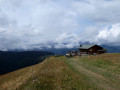
 3.21 mi
 +961 ft
 -961 ft
 2h 20
2h 20
 Easy
Easy
 Departure from Notre-Dame-de-Bellecombe (Savoie)
From Lac de Plan Désert, easily access the small Lac du Gui and then Mont Rond via a track. This small summit offers views of the Arly valley and the surrounding mountains.
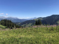
Mont Rond via Les Frasses
 4.03 mi
+1,066 ft
-1,056 ft
2h 45
Easy
Departure from Notre-Dame-de-Bellecombe (Savoie)
4.03 mi
+1,066 ft
-1,056 ft
2h 45
Easy
Departure from Notre-Dame-de-Bellecombe (Savoie)
A family-friendly hike that takes you through the typical mountain pastures of the Beaufortin region, with Mont Rond as its highest point. The view from the summit offers a detailed panorama of the various peaks of the Aravis massif. The path to Lac de Gui overlooks the steep-sided valleys of Roche Blanche and the Ruisseau de Douce.
Walks near Mont Rond (1783 m)
Les Saisies - Roselette Chalet
10.55 mi
+2,303 ft
-1,647 ft
6h 50
 Moderate
Departure from Hauteluce (Savoie)
Moderate
Departure from Hauteluce (Savoie)
Stage 1 of the Tour du Beaufortain, connecting Les Saisies resort to the Roselette chalet.
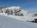
 From Chaucisse to the Col des Aravis via the Chalet du Curé
 9.45 mi
+2,146 ft
-1,463 ft
5 hrs
9.45 mi
+2,146 ft
-1,463 ft
5 hrs
 Difficult
Departure from Saint-Nicolas-la-Chapelle (Savoie) (Savoie)
Difficult
Departure from Saint-Nicolas-la-Chapelle (Savoie) (Savoie)
Starting from the hamlet of Chaucisse, this walk, with Mont Blanc as a backdrop, takes you into a magnificent landscape at the foot of the Étalle, then past the well-known Chalet du Curé, before descending gently towards the Col des Aravis.
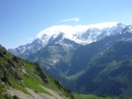
Chalet de Roselette - Refuge de la Croix du Bonhomme
 6.16 mi
+3,261 ft
-1,358 ft
5h 40
Moderate
Departure from Les Contamines-Montjoie (Haute-Savoie)
6.16 mi
+3,261 ft
-1,358 ft
5h 40
Moderate
Departure from Les Contamines-Montjoie (Haute-Savoie)
From Roselette to the Croix du Bonhomme via a short section of the Tour du Mont Blanc variant.
Col de la Fenetre
7.73 mi
+1,296 ft
-3,596 ft
4h 40
Moderate
Departure from Les Contamines-Montjoie (Haute-Savoie)
This walk starts from the top of the gondola at Le Signal. It is an interesting walk, up to and through the Col de la Fenetre. The descent takes you back down through alpine pastures and into the valley leading back to Les Contamines-Montjoie.
⚠️ Please note that you need to park at (A) and not (D) for this walk ⚠️
Mont Joly from the Signal gondola lift
9.37 mi
+2,562 ft
-3,875 ft
6h 30
Difficult
Departure from Les Contamines-Montjoie (Haute-Savoie)
This hiking route provides access to Mont Joly via the south face, bypassing the ridge between Les Croches and Le Joly. From the summit of Mont Joly, you can enjoy a magnificent panorama. Please note that the return journey involves a steep descent.
Traverse of Mont Joly and Aiguille Croche
 8.73 mi
+3,058 ft
-2,910 ft
6h 40
Moderate
Departure from Saint-Gervais-les-Bains (Haute-Savoie)
8.73 mi
+3,058 ft
-2,910 ft
6h 40
Moderate
Departure from Saint-Gervais-les-Bains (Haute-Savoie)
A good ridge walk starting from the Bettex telecabin station at Mont d'Arbois and finishing at Le Signal telecabin station above Les-Contamines-Montjoie.
The Curé passage
10.65 mi
+2,900 ft
-4,199 ft
7h 25
Difficult
Departure from Beaufort (Savoie) (Savoie)
Lake Gittaz and the Curé passage.
Molliessoulaz Lodge - Les Saisies
9.49 mi
+4,888 ft
-2,579 ft
8h 35
Difficult
Departure from Queige (Savoie)
The final stage of the Tour du Beaufortain, between Molliessoulaz and Les Saisies.
Refuge Nant Borrant - Refuge des Mottets
 9.72 mi
+4,452 ft
-3,018 ft
8h 20
Difficult
Departure from Les Contamines-Montjoie (Haute-Savoie)
9.72 mi
+4,452 ft
-3,018 ft
8h 20
Difficult
Departure from Les Contamines-Montjoie (Haute-Savoie)
Stage2 of the Tour du Mont Blanc: from the Nant Borrant mountain hut (Contamines-Montjoie) to the Mottets mountain hut (Bourg-Saint-Maurice) via the Col des Fours route.
Refuge de La Balme - Bourg Saint Maurice
7.05 mi
+2,615 ft
-3,117 ft
5h 30
Moderate
Departure from Les Contamines-Montjoie (Haute-Savoie)
Itinéraire de la traversée des Alpes. Départ du Refuge de la Balme jusqu’aux Chapieux. Cette étape nous fait entrer dans un monde minéral (Col de la Croix du Bonhomme) et nous permet d'avoir un magnifique panorama sur la belle région du Beaufortain.