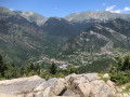
Mont Pépoiri from the Millefonts car park

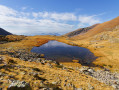
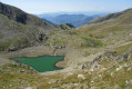
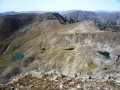
Discover a must-do hike in the Mercantour National Park: the ascent of Mont Pépoiri, a peak offering breathtaking panoramic views of the Millefonts Lakes and the surrounding peaks. From the Millefonts car park, the trail winds its way through typical high-mountain landscapes. Alpine pastures lie alongside rocky areas, with a few larch trees adding a touch of greenery to the rocky landscape. As you climb, you’ll pass close to several alpine lakes, including the splendid Lac Gros, an ideal spot to stop and admire the reflection of the mountains in its crystal-clear waters. At the summit of Mont Pépoiri, at an altitude of 2,674 metres, the panoramic view is well worth the effort. The Millefonts Lakes stretch out below, forming a spectacular landscape that will delight photography and nature enthusiasts alike. The descent completes this circular route, taking you back to the starting point whilst offering further views of the massif.

Details

n°69854039
Creation:
Last update:
Last review:
  • Walking
    Activity: Walking
  • ↔
    Distance: 4.30 mi
  • ◔
    Average duration: 3h 50 
  • ▲
    Difficulty: Moderate

  • ⚐
    Back to start: Yes
  • ↗
    Ascent: + 2,090 ft
  • ↘
    Descent: - 2,090 ft

  • ▲
    Highest point: 8,760 ft
  • ▼
    Lowest point: 6,670 ft

Photos

Description of the walk

Park at the Millefonts car park.

(S/E) Follow the road you arrived on for about 50 metres, then turn left onto the path which serves as a shortcut and joins the GR®.

(1) Turn left.

(2) Continue along the GR®°°, leaving the path on your left (which you’ll take on the descent), and climb up to the Col de Veillos. 

(3) At this point, the two paths split. Take the one on the right, staying on the GR®. 

(4) Note the alternative path on your right – this will be the route back – and carry on straight ahead on the GR® to reach Lac Rond. 

(5) Carry on along the GR®, pass Lac Long, then walk high around Lac Gros to reach the ridge and the Col du Barn (6) 

(7) Leave the path leading to the Col du Clot Barrat on your left and continue along the ridge to reach Mont Pepoiri. 

(8) Take the path at the foot of the mast which descends the south-western shoulder of the peak and rejoin the ascent path above the Col de Vielhos. 

(4) Turn left and follow the ascent route in the opposite direction.

(2) Turn right onto a narrow path which serves as an alternative route and leads directly back to the Millefonts car park (S/E). 

Waypoints

  1. S/E : mi 0 - alt. 6,670 ft - Car park - Parking des Millefonts
  2. 1 : mi 0.2 - alt. 6,864 ft - GR junction
  3. 2 : mi 0.31 - alt. 6,926 ft - Common junction (out and back)
  4. 3 : mi 0.53 - alt. 7,182 ft - Col de Veilhos
  5. 4 : mi 0.82 - alt. 7,448 ft - Crossroads of the circular loop
  6. 5 : mi 1.46 - alt. 7,592 ft - Lac Rond (Lacs des Millefonts)
  7. 6 : mi 2.13 - alt. 8,038 ft - Col du Barn
  8. 7 : mi 2.36 - alt. 8,343 ft - Junction
  9. 8 : mi 2.77 - alt. 8,753 ft - Mont Pépoiri
  10. S/E : mi 4.3 - alt. 6,670 ft - Car park - Parking des Millefonts

Notes

Recommendations:

Make sure you wear good walking boots suitable for mountain trails.
Although this hike is of moderate difficulty, it requires some experience of walking at altitude. Remember to bring plenty of water and suitable clothing, as conditions can change rapidly in the mountains.

This route passes through a protected area, which may be subject to special regulations:

Worth a visit

(3) The Col de Veilhos offers a panoramic view of the surrounding mountains and the Valberg plateau. It is a good landmark for finding your bearings and appreciating the beauty of the surrounding countryside.
(5) Lac Rond, with its crystal-clear waters, is particularly prized for its beauty. Lac Long and Lac Gros are equally impressive, offering magnificent mountain scenery, ideal for a break or a photo. Lac Gros is one of the most picturesque spots on the hike. It offers a peaceful atmosphere and unspoilt natural surroundings. It is the perfect place to relax for a while before continuing towards the summit.
(6) The Col de Barn is an excellent vantage point before reaching the summit of Mont Pépoiri. It offers impressive panoramic views of the Alpes-Maritimes and the valley below.
(8) The summit of Mont Pépoiri offers a spectacular 360° view of the surrounding mountains, notably the Mercantour range and the neighbouring valleys. It is a highlight of the hike, with magnificent scenery that makes the climb well worth the effort.

Flora and fauna 
Depending on the season, the hike takes you through different types of landscape, such as alpine meadows, pine and larch forests, and rocky areas. You may spot animals typical of the Alps, such as chamois, marmots or eagles. The alpine flora is also rich, with rare plants and colourful flowers in summer.

Viewpoints
Throughout the route, there are numerous vantage points offering incredible panoramic views of the surrounding mountains, valleys and lakes. These views are ideal for taking photos or simply enjoying the tranquillity of nature.

Always be cautious and plan ahead when you're outdoors. Visorando and the author of this route cannot be held responsible for any accidents occurring on this route.

The GR® and PR® markings are the intellectual property of the Fédération Française de Randonnée Pédestre.

Reviews and comments

4.7 / 5
Based on 1 review

Reliability of the description
5 / 5
Ease of following the route
4 / 5
Route interest
5 / 5
claireMe
claireMe

Overall rating : 4.7 / 5

Date of your route : Sep 19, 2025
Reliability of the description : ★★★★★ Very good
Ease of following the route : ★★★★☆ Good
Route interest : ★★★★★ Very good
Very busy route : Yes

Very beautiful hike with magnificent 360° views

Machine-translated

Other walks in the area

For more walks, use our search engine .

The GPS track and description are the property of this route's author. Please do not copy them without permission.