


Refine your search for walks in Monistrol-d'Allier
Monistrol-d'Allier walks


 Route des orgues de Monistrol-d’Allier
 Visorando Member
 3.82 mi
 +1,053 ft
 -1,056 ft
 2h 40
2h 40
 Moderate
 Departure from Monistrol-d'Allier (Haute-Loire)
A short walk offering the chance to explore the basalt flows in the Monistrol-d’Allier area. The route follows the River Allier and offers lovely views throughout the walk. Towards the end of the route, you’ll find the Troglodyte Chapel of La Madeleine and the magnificent Rocher du Lion.
A stretch of the pilgrims' route in Monistrol
12.11 mi
+2,211 ft
-2,215 ft
7h 30
Moderate
Departure from Monistrol-d'Allier (Haute-Loire)
This long circular loop offers two very different atmospheres. The first part is spent in the company of pilgrims on the Way of St James, often in groups, some more talkative than others, passing through hamlets marked by this pilgrimage (crosses, statues). In the second part, you will be alone in the world in the vast expanses of the plateau overlooking the Allier valley.The Visorando app is useful on certain sections.
Chapelle Saint-Étienne from Monistrol-d'Allier
6.33 mi
+1,079 ft
-1,089 ft
3h 50
Moderate
Departure from Monistrol-d'Allier (Haute-Loire)
Circular route on the heights of the Allier, around Monistrol, to discover a chapel overlooking the valley. See the variation in the Practical Information section for a round trip to Château de la Beaume.
According to one review, it seems thatthe Visorando app is necessary to follow the route properly.
The Treuil cave
 3.74 mi
+892 ft
-873 ft
2h 30
3.74 mi
+892 ft
-873 ft
2h 30
 Easy
Departure from Saint-Privat-d'Allier (Haute-Loire)
Easy
Departure from Saint-Privat-d'Allier (Haute-Loire)
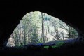
Starting from Saint-Privat-d'Allier, a large mountain village at an altitude of 870 metres, follow this route to discover the imposing Treuil cave, with the added bonus of beautiful views of the Allier Gorges.
Lac de l'Oeuf
 6.46 mi
+1,142 ft
-1,129 ft
4h 00
Easy
Departure from Saint-Privat-d'Allier (Haute-Loire)
6.46 mi
+1,142 ft
-1,129 ft
4h 00
Easy
Departure from Saint-Privat-d'Allier (Haute-Loire)
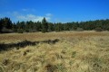
From the village of Saint-Privat d'Allier, walk along the Saint-Jacques path to Lac de l'Oeuf, an ancient crater filled with a bog. On the way back, the descent to Dallas and Le Villard will give you distant views of the surrounding area.
Saint-Didier
 6.65 mi
+1,220 ft
-1,204 ft
4h 05
Moderate
Departure from Saint-Privat-d'Allier (Haute-Loire)
6.65 mi
+1,220 ft
-1,204 ft
4h 05
Moderate
Departure from Saint-Privat-d'Allier (Haute-Loire)
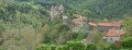
A walk to discover the village of Saint-Didier-d'Allier from above. A beautiful descent from Chier to Saint-Didier overlooking the Allier valley, the Rouchoux Gorges and the castle of Saint-Didier.The return to Saint-Privat d'Allier is partly along the road, but it is narrow and very beautiful.
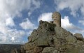
The chapel and tower of Rochegude
 4.79 mi
+938 ft
-961 ft
3h 00
Moderate
Departure from Saint-Privat-d'Allier (Haute-Loire)
4.79 mi
+938 ft
-961 ft
3h 00
Moderate
Departure from Saint-Privat-d'Allier (Haute-Loire)
This easy hike takes you along theGR® 65 (the famous Saint-Jacques-de-Compostelle trail) to discover the chapel and keep of Rochegude, which dominate the Allier valley. Then a beautiful descent through a forest will take you to Pratclaux for a return to the village of Saint-Privat.
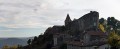
Around Saint-Privat-d'Allier
 7.02 mi
+1,227 ft
-1,234 ft
4h 20
Moderate
Departure from Saint-Privat-d'Allier (Haute-Loire)
7.02 mi
+1,227 ft
-1,234 ft
4h 20
Moderate
Departure from Saint-Privat-d'Allier (Haute-Loire)
This is a very pleasant walk to enjoy with family or friends. It passes through numerous small hamlets while winding its way along the national road.
Saint-Privat-d'Allier - Saugues
 12.76 mi
+2,313 ft
-2,175 ft
7h 55
12.76 mi
+2,313 ft
-2,175 ft
7h 55
 Difficult
Departure from Saint-Privat-d'Allier (Haute-Loire)
Difficult
Departure from Saint-Privat-d'Allier (Haute-Loire)
This seventeenth "mountain" stage with significant elevation gain takes you to the village of Monistrol-d'Allier and the troglodyte chapel of La Madeleine, which are must-see sights before arriving in Saugues.
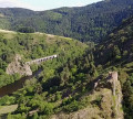
Circular walk of the castles and fortified towns of Alleyras
 12.92 mi
+2,569 ft
-2,543 ft
8h 10
Difficult
Departure from Alleyras (Haute-Loire)
12.92 mi
+2,569 ft
-2,543 ft
8h 10
Difficult
Departure from Alleyras (Haute-Loire)
Starting from Pont d’Alleyras station, a crossing point over the Allier for over 2,000 years, the Vabres plain has always been dotted with numerous castles and watchtowers to control the passage of travellers. This route follows one of the two Roman roads designed to link Bordeaux, the capital of Aquitaine, with Lyon, the capital of Gaul, passing through the southern part of the Massif Central towards Rodez and Cahors. In the Middle Ages, the River Allier formed the boundary between the Velay and the Gévaudan regions.
Stroll around Saint-Jean-Lachalm
0.98 mi
+112 ft
-108 ft
0h 35
Easy
Departure from Saint-Jean-Lachalm (Haute-Loire)
A short hike to discover this village in the Devès region, a Cluniac site.
Le Suc de Combret and La Durande
 Tourism professional
 3.05 mi
+486 ft
-469 ft
1h 50
Easy
Departure from Saint-Bérain (Haute-Loire)
3.05 mi
+486 ft
-469 ft
1h 50
Easy
Departure from Saint-Bérain (Haute-Loire)
Set off to explore the Suc de Combret pozzolan quarry and the artwork “Racines en dentelles” by Francine Garnier & Alain Engelaere, installed as part of the “Echo, Street & Land Art en Velay” project. Whilst you’re there, take in the spectacular view from La Durande.
La Durande
 8.51 mi
+1,027 ft
-1,024 ft
4h 50
Moderate
Departure from Le Vernet (Haute-Loire) (Haute-Loire)
8.51 mi
+1,027 ft
-1,024 ft
4h 50
Moderate
Departure from Le Vernet (Haute-Loire) (Haute-Loire)
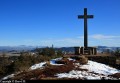
Starting from Le Vernet, this walk offers beautiful panoramic views of the Devès at the summit of La Durande.
From the Allier Gorges to the Margeride: the circular ‘Loop of the Crosses with Balls’
 8.25 mi
+2,159 ft
-2,146 ft
5h 40
Moderate
Departure from Prades (Haute-Loire) (Haute-Loire)
8.25 mi
+2,159 ft
-2,146 ft
5h 40
Moderate
Departure from Prades (Haute-Loire) (Haute-Loire)
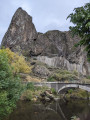
A circular walk starting from Prades that leads to Charraix, a village known for its ‘crosses with balls’.
From the Allier Gorges to the foothills of the Margeride, a magnificent walk through the characteristic landscapes of the Haute-Loire, with its basalt columns and granite boulders scattered across the meadows.
The crosses with balls in Charraix
9.40 mi
+2,129 ft
-2,126 ft
6h 10
Moderate
Departure from Prades (Haute-Loire) (Haute-Loire)
A beautiful themed hike in the hills above the Allier valley. Charraix is a pretty village with a rich architectural heritage in addition to its famous crosses with balls. There are some beautiful views along several sections of this route.Visorando app recommended between (9) and (10)
Saugues - Saint-Alban-sur-Limagnole
 21.43 mi
+1,946 ft
-1,962 ft
10 hrs
21.43 mi
+1,946 ft
-1,962 ft
10 hrs
 Very difficult
Departure from Saugues (Haute-Loire)
Very difficult
Departure from Saugues (Haute-Loire)
During this 18th stage of the Way of St James, you’ll traverse a wild, poetic and challenging landscape as you cross the Margeride and Gévaudan plateaus. You’ll spot rocky outcrops scattered here and there at the whim of chance and time, promising a surprising journey where it’s lovely to reconnect.
 Association / Club / Walk leader
More walks in Monistrol-d'Allier
Select a point of interest below: