


 Country:

 City:
City:


Parking is available in front of the Monistrol-d’Allier cemetery or in front of Saint-Pierre Church.
(S/E) Walk down from the cemetery towards Saint-Pierre Church, turn left and continue downhill to the bottom of the village. When you reach Rue des Jacquets, turn left until you reach the first junction.
(1) Turn right onto Montée de la Madeleine, cross the Ance and head uphill to the first bend.
(2) Carry on straight ahead along the stony path overlooking the River Allier. Follow this path downhill to a junction.
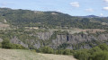
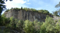
(3) Turn right, follow the wide track, cross an old quarry, and admire the rock formations. Then continue along a narrow path overlooking the railway line and the River Allier. The path widens, moves away from the river and climbs towards the hamlet of La Valette, where the tarmac begins.
(4) Turn right onto the road leading uphill, then turn left onto a wide, stony track suitable for vehicles. Follow this track uphill to a crossroads.
(6) Turn left onto the track that leads back down to a road.
(6) Turn left onto this road and, at the next junction, continue down the road to the right until you reach the hamlet of Les Escluzels.
(7) As you leave the hamlet, turn left onto a steeply sloping path, walk past the Chapelle de la Madeleine, and you’ll come to a road.
(8) Turn right and head straight down. Pass beneath the Rocher du Lion. Continue downhill to the fork in the road at the bend, where you turned off on the way there.
(2) Turn right and follow the outbound route in the opposite direction back to the car park (S/E).
 Visorando Member
 Easy
Easy 


 Difficult
