Country:

 City:
City:


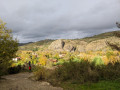
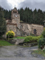
In Prades, park at the entrance to the village near the bridge, where there are a few spaces, or further down at the beach car park.
Yellow markings
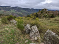
(S/E) Leave the car park by crossing the bridge over the Allier. Opposite, at the foot of the Roche Servière (basalt columns), take the stony path that climbs to the left and follow it until you reach a small tarmac road. Turn left onto this road and follow it for 600 m until you reach a hairpin bend.
(1) Just before the bend, take the path on the right which descends towards the Domaine du Pradel (stopover lodge), then continue along the road that runs alongside the Allier.
(2) Pass the Sainte-Marie-des-Chazes Chapel and continue until you reach the red metal bridge.
(3) Cross the Allier to reach the village of Saint-Julien-des-Chazes and continue along the main road to the church. To the left of the church, take the path which crosses the railway line and then climbs into the woods. As you emerge from the forest, the path opens out onto meadows and offers a magnificent view of the Gorges de l’Allier. It continues to climb and crosses another path.
(4) Turn left onto this track, which then becomes a tarmac road. Follow it for about 500 m until you reach a junction by a crucifix.
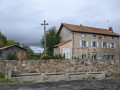
(5) Turn left onto the road, which will become a track; then, at the junction with a path running at right angles, follow it to the right to climb back up to the village. In the centre of the village, in front of the town hall, you’ll find one of the ball-topped crosses and a fountain with five basins.
(6) Retrace your steps and walk alongside the church wall, noting a second ball-topped cross. The street continues as a footpath that descends for 1 km before joining a tarmac road. Below the path, you can see the Rocher du Bounou, which once supported a tower.
(7) Turn left onto the road at Moulin de Martin.
(8) After a small bridge, at the Fork in the road, take the path on the right uphill and, very soon after, at the next junction, turn left for 700 metres until you reach a four-way crossroads.
(9) Turn left and you’ll reach a fork about fifty metres after the sharp right-hand bend. Please note: there are signs of forestry work and the signpost is lying on the ground, hidden in the grass (as of 2023).
(10) Turn left and begin the descent along a path that is sometimes overgrown with vegetation, whilst staying on the main route at all times. At the next junction, turn right; the path becomes a road leading to Prades.
(11) Cross the bridge under the railway line and, a little further on, turn right and walk past the town hall. Cross the river (the Seuge) and follow it to the left until you reach the car park (S/E).

 Visorando Member
 Association / Club / Walk leader
 Easy
Easy  Tourism professional
 Difficult