


Refine your search for walks in Modave
Modave walks


 The Hoyoux Valley between Pont de Bonne and Val Tibiémont
 Visorando Member
 7.77 mi
 +607 ft
 -623 ft
 4h 05
 Moderate
 Departure from Modave (Province de Liège)
A very beautiful walk in the Hoyoux valley, alternating between wooded sections, open landscapes with beautiful views and charming sites.
Mimi ACOS walk from Pont de Bonne
10.86 mi
+1,158 ft
-1,152 ft
6h 00
 Difficult
Departure from Modave (Province de Liège)
A fairly challenging route for beginners but a real test for experienced walkers. The terrain is very varied. There are roads and paths of all kinds. It’s a walk along the Houyou, then along the Ravel L126, through woods, fields, villages and magnificent scenery. At the end of the route, in the surrounding area, you’ll find the Vivaqua site and Modave Castle, before heading back towards Pont-de-Bonne (Modave). On arrival, you can enjoy a drink, have a bite to eat depending on the time of day, and treat yourself to an ice cream from CAPOUE.
Between the woods of Modave Castle and Vyle-et-Tharoul
3.40 mi
+341 ft
-325 ft
1h 50
 Easy
Departure from Modave (Province de Liège)
Departure from the car park opposite the water catchment (Chaussée de Pailhe, 4577 Modave GPS coordinates: 50.448143, 5. 284329), passing by the water catchment and Modave Castle. Pass through the Ravel (an old disused railway line converted for pedestrians and cyclists) between Modave and Vyle-et-Tharoul. Return to the starting point through the woods of Vyle-et-Tharoul.
Between Vierset, Barse and Pont de Bonne
10.64 mi
+1,004 ft
-1,027 ft
5h 45
Moderate
Departure from Modave (Province de Liège)
While the situation is probably clear to locals, day visitors will be completely lost.Vierset-Barse is a former municipality formed by the village of Vierset, located on the heights, and the hamlet of Barse, located below on the right bank of the Hoyoux. Today, it is part of Modave.The starting point, the old Barse railway station, on the other hand, is on the left bank and located in the current hamlet of Ereffe (municipality of Marchin).
Circular starting from Modave
6.44 mi
+361 ft
-387 ft
3h 15
Moderate
Departure from Modave (Province de Liège)
From the village centre, the route first heads towards the church and its distinctive bell tower, then on to the castle via a beautiful tree-lined avenue.After a short tour of the castle grounds, head for the nature reserve overlooking the Hoyoux valley and the Vivaqua facilities upstream of the pumping station. This valley was once home to the village of Petit-Modave.The route follows the course of the Hoyoux (from quite a distance) through the woods to the beautifully restored old farmhouse of Tibiémont.A little further on, you will discover the hamlet of Val Tibiémont, located on either side of the Hoyoux. The ford, which can be quite impressive in flood conditions, is fortunately equipped with a small permanent footbridge. Please note that there is no railing, just a rather narrow slab laid on a few stone or concrete bases.At Clavier Station, the route follows the RAVeL, sometimes in open countryside, sometimes in the woods, to the old Modave-Village stop.
Around Modave, via Val Tibiémont and Linchet
 8.72 mi
+518 ft
-518 ft
4h 30
Moderate
Departure from Modave (Province de Liège)
It is always a pleasure to walk along the long lane leading to Modave Castle, to catch a glimpse of it as you pass, then to discover the small, steep-sided valley of the old village of Petit Modave, before continuing towards the hamlet of Val Tibiémont and its ford.
The walk continues along the wooded banks of the Hoyoux until you reach the village of Les Avins, before returning to Modave via a section of the RAVeL cycle path, then crossing the Thier de la Croix nature reserve and finally the countryside around Linchet.
Between the castle and the old railway line from Modave
 8.23 mi
+574 ft
-587 ft
4h 15
Moderate
Departure from Modave (Province de Liège)
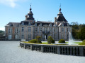
This walk, probably a classic in the region, starts at Modave Castle (visits in season) and follows the Hoyoux valley, sometimes very close to the river, sometimes much further away, to the outskirts of the village of Avins.
Modave Castle and the Hoyoux Valley
 11.61 mi
+1,191 ft
-1,191 ft
6h 25
Moderate
Departure from Modave (Province de Liège)
This walk will take you to discover the magnificent Modave Castle and its gardens, as well as the Vivaqua Estate, which collects and manages part of the water supply for the city of Brussels, the Hoyoux valley, the Condroz villages of Vyle-et-Tharoul, Jamagne and Grand-Marchin, and vast expanses of farmland and woodland.
Walk in Petit Modave
 Tourist office
 4.92 mi
+354 ft
-331 ft
2h 35
Moderate
Departure from Modave (Province de Liège)
Starting from Modave Castle, this walk takes you through the southern part of the Modave nature reserve and the Hoyoux valley. You will also discover the hamlet of Tibiémont, the Val ford, the site of the former Survillers castle and its beautiful viewpoint. A beautiful forest path (the wooded lane) will take you gently back to the castle. This walk is recognised by the Wallonia Tourist Board (Belgium).
A walk through the countryside and woodland north of Strée-lez-Huy
 11.31 mi
+814 ft
-804 ft
5h 55
Moderate
Departure from Modave (Province de Liège)
Rural in character at the start, in the middle and at the end, this walk on the heights above the Meuse passes through beautiful woodland areas with a variety of tree species for much of the route. Three easy shortcuts allow you to shorten the distance if necessary.
The Bagatelle Maquis circular route starting from Pailhe
3.81 mi
+249 ft
-256 ft
2h 00
Easy
Departure from Clavier (Province de Liège)
Walk around the village of Pailhe, passing by the monument in honour of the resistance fighters of the Maquis de Bagatelle.
Tihange Woods
 3.42 mi
+525 ft
-509 ft
2h 00
Easy
Departure from Province de Liège
This hike follows part of an old Vita trail in the Bois de Tihange, which is fairly quiet. You will walk alongside two streams: the Rau de Chéra and the Rau de Bonne Espérance.
The road to the car park is very quiet.
In the woods around Huy
 7.08 mi
+712 ft
-705 ft
3h 50
Moderate
Departure from Province de Liège
90% of the walk is on forest paths, partly following the Bois de Tihange walk.
Nandrin Fond d'Oxhe
5.41 mi
+528 ft
-528 ft
2h 55
Easy
Departure from Amay (Province de Liège)
A very pleasant walk entirely through the forest. The numerous circular loops on this route make it easy to shorten the walk.
The descent to the car park follows a lovely little stream that flows into the Ruisseau d'Oxhe
Villers-le-Temple, streams and forests
10.93 mi
+1,030 ft
-1,037 ft
5h 55
Moderate
Departure from Nandrin (Province de Liège)
Villers-le-Temple, an ancient village marked by the Middle Ages, is set in a landscape of streams, bridges and paths connecting woods and farmland. Houripont and the Chessaine bridge bear witness to these historical passages. The Wetai and Fond d'Oxhe rivers have carved out cool, shady valleys that accompany the walk.
Around the village, the Bois de Bourgogne recalls its seigneurial history, the Bois des Dames feeds local legends, and the Bellegrange and Chaumont woods alternate between dense forests and bright clearings. Schist and limestone, discreet fauna and forest flora make this hike a peaceful and immersive experience, perfect for observing nature and enjoying the peace and quiet.
Circular around Goesnes starting from Jallet
 10.98 mi
+781 ft
-778 ft
5h 45
Moderate
Departure from Ohey (Province de Namur)
This circular starting from Jallet first passes by the work of art entitled 'Renversement' (Overturning), which has been overturned and lying on the side of the path for quite some time, a simple reminder that all human action has certain limits.Then, turning towards Goesnes and taking the Tige du Sart aux Roches, the route crosses the countryside towards Jamagne in the direction of the Triffoy Nature Reserve before climbing and then descending towards Vyle, its church and its castle, which has been converted into a residence.After Vyle Castle, the walk takes a long detour along the memory trail, that of the Secret Army and the Bagatelle parachute drop zone, between Pailhe and Goesnes, during the Second World War.On the way back, the route passes in front of the Château-Ferme de Tahier before returning to the Chêne à l'Image, the forest and its Trivouac and finally the magnificent Château d'Hodoumont.
From Ombret to Neuville-sous-Huy via the Ampsin lock footbridge
 7.66 mi
+551 ft
-548 ft
4h 00
Moderate
Departure from Amay (Province de Liège)
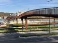
A varied walk from the heights of the commune of Ombret, leading to the banks of the Meuse, which you can cross via the new cycle and footbridge at the Ampsin-Neuville lock and its facilities, including the original fish ladder. The return journey takes you through the Neuville-sous-Huy and Saint-Lambert national forest.
From Solières to La Sarte in Ben
 9.47 mi
+807 ft
-817 ft
5h 05
Moderate
Departure from Province de Liège
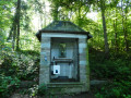
Whilst the local authorities offer a few signposted walks, there are clearly not many walkers in the area… and yet the region is well worth the effort!Lovely rolling countryside alternates with woodland sections (mainly deciduous) of all kinds: stony paths, wide tracks and winding trails, sometimes as muddy as you could wish for.
Streams, forests and fields in the Solières area
8.15 mi
+1,040 ft
-1,050 ft
4h 40
Moderate
Departure from Province de Liège
This varied and undulating route allows you to explore the beautiful region of Solières and Ben-Ahin with its vast woodlands and picturesque streams (the Solières and Ben streams).
Templar route starting from Amay
 11.85 mi
+1,188 ft
-1,171 ft
6h 30
Difficult
Departure from Amay (Province de Liège)
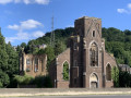
This beautiful hike takes you to the superb village of Villers-le-Temple, which was the seat of an important commandery of the Order of the Temple from the 13th century onwards (hence its name). It is a varied route, with no difficulty other than its length, combining small roads and little-used forest paths, passing through small villages and very quiet hamlets, offering some magnificent landscapes.
The Amay gravel pit and the Ombret puddingstone
 9.80 mi
+581 ft
-574 ft
5h 00
Moderate
Departure from Amay (Province de Liège)
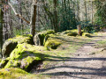
Between the gravel pit and the puddingstone, you’ll find the Meuse, the fishway, the lock and the new Ampsin footbridge, the Tihange power station, Neuville Castle, and the state-owned forests of Neuville-sous-Huy and Saint-Lambert.Take the time to walk around the gravel pit and enjoy its aquatic wildlife!It’s a lovely walk, even if the N90 on the other bank of the Meuse is a bit noisy.The extension of the N684 between Tihange and Strée has been under construction for over ten years. Make the most of the remaining months (before the end of 2026) for a quieter experience!
From Amay (station) to Scry and back
12.43 mi
+1,394 ft
-1,394 ft
6h 55
Difficult
Departure from Amay (Province de Liège)
This route, slightly modified to allow for a start and finish at a station, was part of an organised walk that attracted several dozen walkers, all of whom left delighted. The route offers the chance to admire the beauty of the Condroz forests and landscapes, as well as that of the Fond d’Oxhe stream valley.
The Fond d'Oxhe valley from Ombret-Rawsa
 7.93 mi
+1,024 ft
-1,010 ft
4h 30
Moderate
Departure from Amay (Province de Liège)
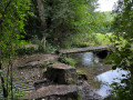
This is a somewhat challenging hike through the woods on either side of the Fond d'Ohxe valley in the Saint-Lambert National Forest.Starting from the ruins of the Church of Notre-Dame in Ombret, the circuit skirts the hamlet of Les Communes before climbing into the woods, then descending shortly afterwards into the Fond d'Ohxe and climbing back up the other side through the Bois des Dames and Bourgogne woods. The return journey is again through the woods, on the opposite side, offering some beautiful views of the Meuse valley at the end of the walk.
Vallon de la Solières
 4.42 mi
+597 ft
-581 ft
2h 35
Moderate
Departure from Wanze (Province de Liège)
Not far from Huy, discover a steep-sided valley with lush vegetation, caves and rock shelters, as well as the Lovegnée-Bosquet nature reserve.
In the vicinity of Comognes-le-Libois, Saint-Fontaine and Ossogne
6.07 mi
+479 ft
-479 ft
3h 10
Easy
Departure from Ohey (Province de Namur)
A lovely, easy 10 km walk, with the first part through the woods to the pretty village of Saint-Fontaine with its ford, then back towards Libois via Ossogne.
The Wanhériffe Woods from Bas-Oha
 7.74 mi
+548 ft
-518 ft
4h 00
Moderate
Departure from Wanze (Province de Liège)
Explore the Meuse hillside, starting from the village of Bas-Oha. The route climbs gradually up the hillside towards the plateau, heads towards the top of the Bois de Fond du Ri and then descends gradually back towards the Meuse at Java. There are some lovely views of the opposite side of the valley.
Condruz walk on the Évelette side
 7.52 mi
+367 ft
-364 ft
3h 45
Moderate
Departure from Ohey (Province de Namur)
A walk, presenting no particular difficulty, leading from one Condroz ridge to another in the commune of Évelette, and offering some fine views, both of the countryside and of the large surrounding farms. It passes through the villages of Tahier and Libois before reaching Évelette.
Au Vî Bon d'Ju d'Giblou
 10.37 mi
+702 ft
-699 ft
5h 25
Moderate
Departure from Wanze (Province de Liège)
Land of the Meuse, land of farms, land of stone, land of (rail)ways, land of castles. The hike takes you through countryside and forests, starting from the Château à l'Horloge in Bas-Oha (SNCB station nearby).
The Gerée circular starting from Hermalle-sous-Huy
 4.75 mi
+584 ft
-587 ft
2h 40
Easy
Departure from Engis (Province de Liège)
Circular provided by the SI. Walk alternating between ascents and descents, without any major difficulties. The last section of the Chemin des Crêtes is a steep descent.
On the heights above the Meuse between Moha, Bas-Oha and Couthuin
 11.94 mi
+741 ft
-745 ft
6h 10
Moderate
Departure from Wanze (Province de Liège)
Farmland and manorial estates – that’s what’s on offer. Numerous castles and manor houses await you – sometimes clearly visible, sometimes nearby, sometimes well hidden, sometimes slightly off the route – each with its own story!In order: Lamalle, Laminne, Blanc, Envoz, Temple and Moha, whilst Potesta and Fosseroule lie just off the route.
 From Moha Castle to Fallais Castle