


Refine your search for walks in Mines de Pimorent (Porté-Puymorens)
Mines de Pimorent (Porté-Puymorens) walks


 Visorando Member
Walks near Mines de Pimorent (Porté-Puymorens)
 From Pas de la Case to the Joaquim Folch i Girona Refuge
 8.68 mi
 +4,058 ft
 -3,114 ft
 7h 30
7h 30
 Difficult
 Departure from Porta (Pyrénées-Orientales)
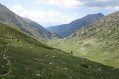
The fourth stage of the route linking Ax-les-Thermes to Latour-de-Carol. A beautiful high-mountain stage with no significant difficulties but featuring some elevation gain.
This stage sets off from Pas de la Case, followed by two small passes and then, a little further down, the Portella Blanca – the ‘white gate’ – which opens onto the descent into the Engaït valley before a final pass. It ends with the descent to the Jhaquim Floch i Girona refuge, which is in poor condition but offers a safe shelter.
L'Hospitalet near Andorra - Refuge des Bésines
 4.50 mi
+2,359 ft
-180 ft
4h 10
4.50 mi
+2,359 ft
-180 ft
4h 10
 Moderate
Departure from L'Hospitalet-près-l'Andorre (Ariège)
Moderate
Departure from L'Hospitalet-près-l'Andorre (Ariège)
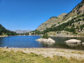
Part of the long route (9 stages) around Carlit, hiking from refuge to refuge, based on the Tour des Pérics and using various marked trails,GRP® andGR® in the area.
Initial stage designed to ease you gently into the hike.
From L’Hospitalet-près-l’Andore to Mérens-les-Vals via Porteille des Bésines
 10.31 mi
+3,353 ft
-4,577 ft
7h 40
Difficult
Departure from L'Hospitalet-près-l'Andorre (Ariège)
10.31 mi
+3,353 ft
-4,577 ft
7h 40
Difficult
Departure from L'Hospitalet-près-l'Andorre (Ariège)
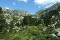
A hike from station to station with 900 m of ascent and nearly 1,300 m of descent, passing through the Refuge des Bésines and the eponymous Porteille, and following theGR®107CandGR®10trails.
Porté Puymorens - Refuge des Bésines
 10.33 mi
+3,419 ft
-1,919 ft
7h 45
Difficult
Departure from Porté-Puymorens (Pyrénées-Orientales)
10.33 mi
+3,419 ft
-1,919 ft
7h 45
Difficult
Departure from Porté-Puymorens (Pyrénées-Orientales)
It is part of the long (9-day) itinerary around the Carlit, travelling from refuge to refuge, based on the Peyrics tour and using various marked trails.
From the Juclar Refuge to Pas de la Case
 9.19 mi
+1,762 ft
-2,421 ft
5h 45
Moderate
Departure from Canillo (Andorra)
9.19 mi
+1,762 ft
-2,421 ft
5h 45
Moderate
Departure from Canillo (Andorra)
This third stage of the route linking Ax-les-Thermes to Latour de Carol takes you to Pas de la Case… and its hotels and refreshment stops; it is an easy, somewhat long stage that takes place at altitude, mainly along the gentle, grassy ridges of Andorra, but without any difficulty. It is best to tackle this stage in good weather, as landmarks can be misleading, especially if fog sets in.
From the Joaquim Folch i Girona mountain refuge to Latour-de-Carol
 12.57 mi
+951 ft
-4,688 ft
6h 35
Difficult
Departure from Meranges (Girona)
12.57 mi
+951 ft
-4,688 ft
6h 35
Difficult
Departure from Meranges (Girona)
The final stage of the route linking Ax-les-Thermes to Latour-de-Carol. A downhill stage through the valley, the return leg – pleasant but a little long – with a risk of getting lost as you approach the villages. You should also bear train timetables in mind.
Refuge des Bésines - Barrage des Bouillouses
 10.15 mi
+2,152 ft
-2,434 ft
6h 35
Moderate
Departure from Mérens-les-Vals (Ariège)
10.15 mi
+2,152 ft
-2,434 ft
6h 35
Moderate
Departure from Mérens-les-Vals (Ariège)
Modification on 12 September 2022: validated on Sunday 11 September 2022.
Fourth and final stage of the Tour Des Pérics. The scenery is consistently stunning.
This is a fairly long stage, with cars being collected by shuttle buses.
See practical information on the Tour des Pérics.
Refuge des Bésines - Refuge d'En Beys
 4.85 mi
+1,532 ft
-1,978 ft
3h 35
Difficult
Departure from Mérens-les-Vals (Ariège)
4.85 mi
+1,532 ft
-1,978 ft
3h 35
Difficult
Departure from Mérens-les-Vals (Ariège)
Part of the long (9-day) itinerary around Carlit, hiking from refuge to refuge, based on the Peyrics tour and using various marked trails.
Refuge des Bésines - L'Hospitalet near Andorra
 4.42 mi
+121 ft
-2,297 ft
2h 10
4.42 mi
+121 ft
-2,297 ft
2h 10
 Easy
Departure from Mérens-les-Vals (Ariège)
Easy
Departure from Mérens-les-Vals (Ariège)
Part of the long (9-day) itinerary around Carlit, hiking from refuge to refuge, based on the Peyrics tour and using various marked trails.
Refuge des Bésines - Refuge d'en Beys
 8.43 mi
+3,015 ft
-3,435 ft
6h 30
Difficult
Departure from Mérens-les-Vals (Ariège)
8.43 mi
+3,015 ft
-3,435 ft
6h 30
Difficult
Departure from Mérens-les-Vals (Ariège)
The third stage takes you through Cerdagne, in the Eastern Pyrenees.The return trip along the ridge (3) to (4) should be done in the absence of fog, rain or frost.I have classified this hike as difficult due to the ridge crossing from (4) to (5) and the descent through the rocks from the Faury pond (10) to the En Beys refuge (E).There are numerous places to stop for a break at the lakes along the way.Be careful of the multiple marked trails:GR®®10-GR®®107-GR®®107-GR®®107(variant) andGRP®® Tour des Pérics -GRP®® Tour des Montagnes d'Ax. Follow the description, the GPX track and the signs on the ground carefully.
⚠️ From (8) to (E)you are in the Orlu National Hunting and Wildlife Reserve, where regulations must be observed. See practical information.