


Refine your search for walks in Manteyer
Manteyer walks


 La Roche-des-Arnauds: the Bishops' circuit
 Visorando Member
 5.85 mi
 +764 ft
 -761 ft
 3h 20
3h 20
 Moderate
 Departure from La Roche-des-Arnauds (Hautes-Alpes)
The Circuit des Évêques (named after a place you will pass near) is a very popular route in La Roche-des-Arnauds. It will allow you to discover the cable bridge and the Corréo plateau with interesting views of the Tête de Clappe, the Pic de Bure and the Pic de Ceüze.
This circuit is also selected as a mountain bike circuit.
La Gerle and Rabou Waterfalls
 8.83 mi
+1,801 ft
-1,795 ft
5h 40
Moderate
Departure from La Roche-des-Arnauds (Hautes-Alpes)
8.83 mi
+1,801 ft
-1,795 ft
5h 40
Moderate
Departure from La Roche-des-Arnauds (Hautes-Alpes)
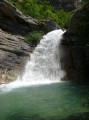
A circular route allowing you to discover the beautiful waterfalls of La Gerle and Rabou, starting from La Roche des Arnauds. In the heart of the refreshing Petit Buëch valley, the route is partially signposted and features footbridges to cross the torrent.
La Roche-des-Arnauds: Distillery Route (from the tower to Petit Buëch)
 5.55 mi
+860 ft
-853 ft
3h 20
Moderate
Departure from La Roche-des-Arnauds (Hautes-Alpes)
5.55 mi
+860 ft
-853 ft
3h 20
Moderate
Departure from La Roche-des-Arnauds (Hautes-Alpes)
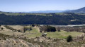
An easy route to climb above La Roche-des-Arnauds, passing under the cliffs of La Barre and along the bucolic banks of the Petit Buëch. With a panoramic view from the ruins of the tower.
The Tour de la Gerle
 2.40 mi
+584 ft
-568 ft
1h 35
2.40 mi
+584 ft
-568 ft
1h 35
 Easy
Departure from La Roche-des-Arnauds (Hautes-Alpes)
Easy
Departure from La Roche-des-Arnauds (Hautes-Alpes)
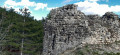
A short family circular on the heights of La Roche-des-Arnauds, with waterfalls, a scenic path and, finally, the remains of a castle offering a view of the village!
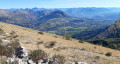
The ridges of Céüse West: La Manche – Crête de Lumineuse – Crête de Raux
 5.54 mi
+1,348 ft
-1,319 ft
3h 45
Moderate
Departure from Manteyer (Hautes-Alpes)
5.54 mi
+1,348 ft
-1,319 ft
3h 45
Moderate
Departure from Manteyer (Hautes-Alpes)
A route starting from the old ski resort, taking in the ridges of the Céüse mountain via its western slope. From the Sapie valley, this route leads to the La Manche ridge, which you follow to the Crête de Lumineuse. The hike continues via the two summits of the Crête de Raux, offering a remarkable panorama of the surrounding peaks, before descending back to the starting point.
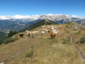
The Tour de la Montagne de Ceüse
 7.95 mi
+2,034 ft
-2,037 ft
5h 25
Moderate
Departure from Manteyer (Hautes-Alpes)
7.95 mi
+2,034 ft
-2,037 ft
5h 25
Moderate
Departure from Manteyer (Hautes-Alpes)
A remarkable circuit on the Ceüse mountain.
Tour of the Corréo lake
2.24 mi
+200 ft
-226 ft
1h 10
Easy
Departure from La Roche-des-Arnauds (Hautes-Alpes)
A short walk above Gap, around the lake in the hamlet of Corréo (a water reserve for the Gap Canal, which is used for irrigation). This route offers pleasant scenery at the foot of the Charance and Céüse mountains.
Tête de Vente-Cul and the summit of Les Teyssonnières
 5.35 mi
+2,474 ft
-2,461 ft
4h 35
Moderate
Departure from La Roche-des-Arnauds (Hautes-Alpes)
5.35 mi
+2,474 ft
-2,461 ft
4h 35
Moderate
Departure from La Roche-des-Arnauds (Hautes-Alpes)
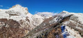
This hike is an unforgettable experience, particularly after a snowfall which has transformed the natural landscape. Located near La Roche-des-Arnauds, it offers an accessible and well-maintained route, although it is not signposted. The cairns dotted along the path make it easy to find your way, even for less experienced walkers. Right from the start, the landscape opens up to spectacular views: Céüse, the Tête de la Clappe, the Rabou Valley and Charance. Every stage invites you to pause and reflect, and to lose yourself in the moment. The gradual ascent eventually leads to the summit of Les Teyssonnières, a breathtaking panoramic viewpoint, particularly over the Pic de Bure and the massifs of Les Trois Évêchés, Le Parpaillon and Les Écrins. This walk combines natural beauty, tranquillity and a sense of wonder. It offers a unique experience for walkers seeking adventure and serenity, and occasionally provides the chance for an exceptional encounter with mouflons or ibex.
On the heights above Lake Pelleautier
 3.93 mi
+528 ft
-525 ft
2h 15
Easy
Departure from La Freissinouse (Hautes-Alpes)
3.93 mi
+528 ft
-525 ft
2h 15
Easy
Departure from La Freissinouse (Hautes-Alpes)
An easy walk starting from Lake Pelleautier, with stunning views over the Gap region and the surrounding mountains.
Below the Corniche de Céüse and Lake Pelleautier
 9.76 mi
+1,335 ft
-1,329 ft
5h 40
Moderate
Departure from La Freissinouse (Hautes-Alpes)
9.76 mi
+1,335 ft
-1,329 ft
5h 40
Moderate
Departure from La Freissinouse (Hautes-Alpes)
Starting from Lake Pelleautier, enjoy a pleasant hike at the foot of Montagne de Céüse along the long forest road dominated by cliffs and offering superb panoramic views.
Matacharre Ridge and Pic Chauve circular loop
6.94 mi
+2,910 ft
-2,897 ft
5 hrs
 Very difficult
Departure from La Roche-des-Arnauds (Hautes-Alpes)
Very difficult
Departure from La Roche-des-Arnauds (Hautes-Alpes)
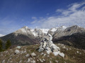
A little-visited ridge and peak offering a 360° panorama of the surrounding mountains and a magnificent view of the Combe de Mai and the snow-capped Montagne de Bure.
Please note: take note of the comments in the practical information section before setting out on this hike.
Crête des Rortres, Pic Chauve, Grotte du Pertuis, Ravin de la Mèque circular loop
 6.88 mi
+2,838 ft
-2,825 ft
5h 40
Moderate
Departure from La Roche-des-Arnauds (Hautes-Alpes)
6.88 mi
+2,838 ft
-2,825 ft
5h 40
Moderate
Departure from La Roche-des-Arnauds (Hautes-Alpes)
From La Roche des Arnauds, this route takes you up Pic Chauve via the Crête des Rortres, then down via the Col des Sérigons, with a stop at the Grotte du Pertuis (bring a torch) before returning via the Ravin de la Mèque.Apart from the section along the ridge, the route runs mainly through woodland, with a few clearings offering views of the landscape. Pic Chauve overlooks the upper valley of the Petit Buëch and offers beautiful panoramic views.
Pertuis Cave at Pic Chauve
 3.83 mi
+1,732 ft
-1,726 ft
3h 15
Moderate
Departure from La Roche-des-Arnauds (Hautes-Alpes)
3.83 mi
+1,732 ft
-1,726 ft
3h 15
Moderate
Departure from La Roche-des-Arnauds (Hautes-Alpes)
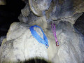
This is a half-day hike, either on foot or with snowshoes. Almost the entire route is through forest with clearings to enjoy the scenery and finish the climb to the Pertuis, which can be visited with a good torch. The return is via another pleasant path.
A circular walk along the ridges of the Montagne de Charance starting from Clos la Chau
 6.48 mi
+2,264 ft
-2,264 ft
4h 55
Moderate
Departure from La Roche-des-Arnauds (Hautes-Alpes)
6.48 mi
+2,264 ft
-2,264 ft
4h 55
Moderate
Departure from La Roche-des-Arnauds (Hautes-Alpes)
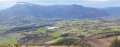
A beautiful ridge walk across the Montagne de Charance, from Clot la Chau to the Brèche de Charance, passing through its highest point, the Cuchon (1,903 m), and the iconic Pic de Charance (1,825 m). The return route follows the north-facing slope through the Bois du Devès, via the Avalanche forest tracks and the small pass of Devès.This climb is a great classic, very popular with hikers from Gap, most often starting from the Charance estate.
The flat section of the Drac Canal
 2.60 mi
+276 ft
-295 ft
1h 25
Easy
Departure from La Roche-des-Arnauds (Hautes-Alpes)
2.60 mi
+276 ft
-295 ft
1h 25
Easy
Departure from La Roche-des-Arnauds (Hautes-Alpes)
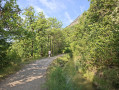
A pleasant little walk above Gap, between the pine and oak forest, then along the Drac Canal. Without any difficulty, it offers a beautiful view of Céüse and the mountains south of Gap, including the Lure mountain.
Below the Cuchon de Charance via the Chapelle de Sauveterre (return via Rougier)
 2.98 mi
+1,283 ft
-1,283 ft
2h 30
Moderate
Departure from La Roche-des-Arnauds (Hautes-Alpes)
2.98 mi
+1,283 ft
-1,283 ft
2h 30
Moderate
Departure from La Roche-des-Arnauds (Hautes-Alpes)
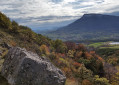
A short circular family walk (suitable for a 6-year-old who walks well) to enjoy the south-westerly views from Charance sur Cëuze, Pic de Bure, Lure, Gap, La Roche-des-Arnaud and Montmaur, all the way to Le Morgon.
The summit of the Barre de la Roche-des-Arnauds via a circular route from Les Baux
6.60 mi
+3,012 ft
-2,999 ft
5h 40
Moderate
Departure from La Roche-des-Arnauds (Hautes-Alpes)
A climb to the summit of La Barre overlooking La Roche-des-Arnauds, passing through the Col des Roux and a circular route before the descent back to the mountain pasture. The ridge offers a panoramic view of the Upper Buëch valley, and the circular route allows you to discover the cabrettes, a remarkable piece of forestry heritage.
La Barre, Col des Roux and Col de Garcinel as seen from Les Baux
10.42 mi
+3,284 ft
-3,310 ft
7h 40
 Difficult
Departure from La Roche-des-Arnauds (Hautes-Alpes)
Difficult
Departure from La Roche-des-Arnauds (Hautes-Alpes)
A circular route along the Barre ridge overlooking La Roche-des-Arnauds and descending through the Matacharre Forest, with beautiful panoramic views over the Haut Buëch valley.
Les Cabrettes des Roux
 7.07 mi
+2,467 ft
-2,448 ft
5h 25
Moderate
Departure from La Roche-des-Arnauds (Hautes-Alpes)
7.07 mi
+2,467 ft
-2,448 ft
5h 25
Moderate
Departure from La Roche-des-Arnauds (Hautes-Alpes)
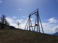
This hike is first and foremost an opportunity to discover a little-known heritage and practice of forestry, namely cable transport. This ancient practice dates back to the 1930s and has been partially restored by Mr Pierre Para. The "cabrette" is the common name given to the pylon that supports the cable. Of course, throughout the hike, the view of the south face of the Pic de Bure and its east pillar (opened by René Desmaison in three days in September 1961) will be remarkable.
Circular Matacharre to Col de Conode
9.07 mi
+1,923 ft
-1,903 ft
5h 50
Moderate
Departure from La Roche-des-Arnauds (Hautes-Alpes)
A classic PR® marked trail, located mainly in the Sauvas National Forest, above La Roche des Arnauds.
The route descends from the Maison Forestière de Matacharre to the Ravin du Rif de l'Arc, climbs back up to the Col de Matacharre via the forest road through Le Pinet, then follows a GRP® trail with a few tricky sections to the Col de Conode (GR®94B). The circular route finally ends with the descent on the D7 track from Conode.
Mèfi1: the crossing between the Col de Matacharre and the Col de Conode includes three tricky crossings of schistose ravines and scree slopes, some of which are quite exposed. This part of the route requires you to be accustomed to this type of terrain andto remain cautious.
A round trip to La Tête de la Clappe from Matacharre
6.26 mi
+2,346 ft
-2,323 ft
4h 55
Moderate
Departure from La Roche-des-Arnauds (Hautes-Alpes)
A virtually round-trip ascent to the summit of the Tête de la Clappe: climb up the forest track to the Col de Garcinel, then follow a ridge path with a short circular loop to descend along the hillside, just below the summit. A classic summit situated above La Roche des Arnauds, offering beautiful panoramic views over the Haut Buëch valley.
The Ceüse Forest Heritage Trail and the Sigot nursery
 5.38 mi
+1,171 ft
-1,142 ft
3h 30
Moderate
Departure from Sigoyer (Hautes-Alpes) (Hautes-Alpes)
5.38 mi
+1,171 ft
-1,142 ft
3h 30
Moderate
Departure from Sigoyer (Hautes-Alpes) (Hautes-Alpes)
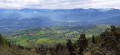
This path leading to the Sigot Nursery allows you to discover the site’s forestry, human and historical heritage, starting with the Grotte des Maquisards.
This lovely, easy walk is dotted with wooden sculptures and information boards. Picnic tables are provided so you can enjoy a comfortable lunch break.
After a gentle warm-up as you climb up a wide track, you’ll reach the Blocs de Céüse area and the Grotte des Maquisards. The forest track continues along the hillside, then you’ll take a path restored by the ONF which leads you to the former Sigot Nursery before heading back down to the starting point.