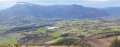
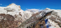
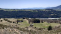
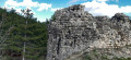
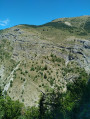
La Barre, Col des Roux and Col de Garcinel as seen from Les Baux

A circular route along the Barre ridge overlooking La Roche-des-Arnauds and descending through the Matacharre Forest, with beautiful panoramic views over the Haut Buëch valley.

Details

46547005
Creation:
Last update:
Last review:
  • Walking
    Activity: Walking
  • ↔
    Distance: 10.42 mi
  • ◔
    Average duration: 7h 40 
  • ▲
    Difficulty: Difficult

  • ⚐
    Back to start: Yes
  • ↗
    Ascent: + 3,284 ft
  • ↘
    Descent: - 3,310 ft

  • ▲
    Highest point: 6,503 ft
  • ▼
    Lowest point: 3,422 ft

Description of the walk

Reach La Roche-des-Arnauds via the D994, taking the road towards Les Roux and then the hamlet of Les Baux. Park on the Les Baux plateau, near the Fontaine Bomboute or in the hamlet.

(S/E) Take the path heading due north and walk to the hamlet of Serre Lambert.

(1) Continue along the path to the left, following the right bank of the Béal de Pré le Bayle. You will reach a bend on the edge of the canal.

(2) Turn right and continue uphill to reach the cliffs of La Barre.

(3) Turn left to follow the ridge and reach the summit of La Barre. The summit ridge is flat, but take care of the cliff in places as you follow it.

(4) After the Col des Roux, continue along the path on the left (Crête de Clappe to Col de Cabrettes) which passes beneath the Tête de la Clappe. Carry on to the Col de Garcinel.

(5) Take the track branching off to the right and heading due north. Follow it to the Col de Conode forest road (elevation 1624).

(6) Follow this forest track as it descends to the left towards Les Jacquerons (Clot de Piarrou) and Matacharre.

(7) At the junction, continue straight down the Matacharre Forest Road, heading south.
Pass the ONF barrier and continue downhill to the RD418.

(8) Turn left onto this road and head uphill towards Les Roux and Les Baux. Pass under the erratic boulder at La Condamine.

(9) Leave the road and follow the path down to the right, heading south-east. At the hairpin bend, take the path on the left and follow it to the Source de la Combe.

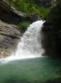
(10) Follow the path to the left (yellow markings on a tree): take care, as there are some steep and overhanging sections. The route offers views of the waterfalls, with several sections passing close to pools. The path then runs along the edge of a field until it reaches a track.

(11) Turn right before passing the Béal de Pré le Bayle. Stay alert as the signposting on this section of the “Tour de La Gerle” trail is sparse.

(12) At the junction, head up the path on the left, which leads out onto the mountain pasture and joins Serre la Pigne via a country track.

(13) Continue straight ahead and pass below Lac Peyssier (l’Épervier). Carry on to a junction.

(14) Take the path on the left, heading north, to reach the car park (S/E).

Waypoints

  1. S/E : mi 0 - alt. 3,832 ft - Fontaine Bomboute (La-Roche-des-Arnauds)
  2. 1 : mi 0.38 - alt. 4,127 ft - Serre Lambert
  3. 2 : mi 0.83 - alt. 4,701 ft - Bend along the edge of the irrigation channel
  4. 3 : mi 1.56 - alt. 5,335 ft - La Barre. Towards the - Col des Roux (1857m)
  5. 4 : mi 3.11 - alt. 6,102 ft - Col des Roux - La Cabrette des Roux
  6. 5 : mi 4.17 - alt. 5,515 ft - Col de Garcinel (1684m)
  7. 6 : mi 4.61 - alt. 5,325 ft - Col de Conode forest road
  8. 7 : mi 6.11 - alt. 4,314 ft - Matacharre forest track
  9. 8 : mi 8.21 - alt. 3,422 ft - D418 road
  10. 9 : mi 8.76 - alt. 3,638 ft - Junction with the D418, after - La Condamine (La roche-des-Arnauds)
  11. 10 : mi 8.94 - alt. 3,533 ft - Source de la Combe (La roche-des-Arnauds)
  12. 11 : mi 9.16 - alt. 3,593 ft - Junction with the Grand Béal track
  13. 12 : mi 9.5 - alt. 3,583 ft - Fourche Bastine
  14. 13 : mi 9.73 - alt. 3,783 ft - Serre la Pigne
  15. 14 : mi 10.3 - alt. 3,799 ft - Passing Lake Peyssier
  16. S/E : mi 10.42 - alt. 3,832 ft - Fontaine Bomboute

Notes

Fountain at La Roche-des-Arnauds (village) and at the starting point (Fontaine Bomboute).

(4) Shelter available at the Col des Roux hut (it is always open).

Worth a visit

(4) At the Col des Roux, you can see a ‘cabrette’ and a small restored hut. Further period ‘cabrettes’ can be seen further along the path as it descends due north.
These structures bear witness to a common practice in forestry in the 1930s: cable transport. A ‘cabrette’ is the common name given to the post that supports the cable, and this one has been partially restored by Pierre Para.

(9) The Condamine erratic boulder: this rock was transported by the glacier from the Briançonnais region tens of thousands of years ago. Despite its height of 5 metres, it is only partially visible from the road as it is obscured by vegetation forming a sort of copse.

(10) The waterfalls and pools are perfect for cooling off!

Shorter alternatives:
* Turn back once you reach the ridge: elevation gain 450 m, total time 2 hours 45 minutes.
* Turn back at the summit of La Barre: elevation gain 800 m, total time 4 hours 45 minutes.
* At the Col des Roux, descend via the northern slope of the ridge. Then join the Sentier des Avalanches, where you should turn right and then right again to return to the ridge and rejoin the original route: elevation gain 900 m, total time 5 hours 30 minutes.

Reviews and comments

4.7 / 5
Based on 2 reviews

Reliability of the description
5 / 5
Ease of following the route
5 / 5
Route interest
4 / 5
vincentlc
vincentlc

Overall rating : 4.7 / 5

Date of your route : May 25, 2025
Reliability of the description : ★★★★★ Very good
Ease of following the route : ★★★★★ Very good
Route interest : ★★★★☆ Good
Very busy route : No

A pleasant, easy-to-follow walk, with a ridge offering numerous views. The ridge isn’t at all daunting, even for those who aren’t particularly experienced in the mountains or who suffer from vertigo.
The forest track is indeed quite long, and there’s also a stretch of road at the end.
As a leisurely and cautious walker, it took me 7 hours, including breaks.

Machine-translated

millim
millim

Overall rating : 4.7 / 5

Date of your route : Aug 03, 2024
Reliability of the description : ★★★★★ Very good
Ease of following the route : ★★★★★ Very good
Route interest : ★★★★☆ Good
Very busy route : No

A walk enjoyed in glorious sunshine.
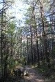
The descent along the forest track is quite long, although there’s shade all the way to the Matacharre forest.
Towards the end, the waterfall and the pools are lovely and… refreshing.

Machine-translated

Other walks in the area

For more walks, use our search engine .

The GPS track and description are the property of this route's author. Please do not copy them without permission.