Country:

 City:
City:


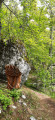
The starting point is in the hamlet of Piémont de Céüse (Les Roses district). Walk through the village of Sigoyer towards the Col des Guérins. Before reaching the Guérins campsite, leave the D219 by taking the road on the right towards Les Bonnets (Chemin des Bonnets, Chemin des Roses, Piste C55, yellow sign for the ‘Céüse Forest Heritage Trail’), then take the Chemin des Graviers on the left and park shortly afterwards at the side of the road.
It is also possible to continue along the road (which then becomes a forest track) to reach the Blocs de Céüse car park (car park facing west towards Céüse).
You can reach the village of Sigoyer via the Gap urban area bus service (free and open to all).
(S/E) Take the Route Forestière de la Rocade Inférieure and continue to the crossroads.
(1) Continue straight on until you reach the Blocs de Céüse car park (the car park facing west towards Céüse).
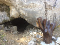
(2) An information board describes the heritage trail. Continue along the forest track, following the yellow sign for the Céüse Forest Heritage Trail. You’ll soon reach the Grotte des Maquisards (on the left-hand side of the track).
(3) Leave the boulders used for climbing on your right and continue along the forest track on the hillside for just under two kilometres, until you reach a path on the left.
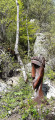
(4) Take the heritage trail branching off to the left (yellow sign) which leads up to the higher level. This trail features a few wooden sculptures and information panels and joins the Route Forestière de la Rocade Supérieure
(5) Cross this to reach the old Sigot Nursery path. Restored by the ONF, this path leads to the former Sigot Nursery (1,550 m) and the terraces created by foresters during the reforestation of the massif in the early 20th century.
A large information board explains how the site was developed at the time. The workers’ hut has been replaced by picnic tables near the fountain.
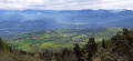
(6) Continue a short way along the path that climbs towards the Céüse cliff-top walk (GR® de Pays between Céüse and Durance, alternative route) to enjoy a beautiful view.
(7) From there, turn back towards the Route Forestière de la Rocade Supérieure.
(5) Continue along the road to the right (south-west) until you reach a track junction.
(8) Turn left onto the forest road, which descends towards the car park (heading east) for 200 m, and look for the start of a very narrow path on the right that leads downhill (be careful! It’s not very visible from the road).
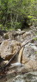
(9) Follow this path as it descends through the forest, passing close to a water source, before joining the Route Forestière de la Rocade Inférieure (tarmac road) which you took at the start.
(1) Walk down the road to the right until you return to the starting point (S/E) (or walk back up it if you’ve parked at the bouldering car park).


 Visorando Member
 Difficult
 Association / Club / Walk leader
 Very difficult
 Easy
Easy