A circular walk along the ridges of the Montagne de Charance starting from Clos la Chau

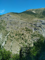
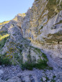
A beautiful ridge walk across the Montagne de Charance, from Clot la Chau to the Brèche de Charance, passing its highest point, the Cuchon (1,903 m), and the iconic Pic de Charance (1,825 m). The return route follows the north-facing slope through the Bois du Devès, via the Avalanche forest tracks and the small pass of Devès. This ascent is a great classic, very popular with mountaineers from Gap, most often started from the Charance estate.

Details

56617798
Creation:
Last update:
Last review:
  • Walking
    Activity: Walking
  • ↔
    Distance: 6.48 mi
  • ◔
    Average duration: 4h 55 
  • ▲
    Difficulty: Moderate

  • ⚐
    Back to start: Yes
  • ↗
    Ascent: + 2,264 ft
  • ↘
    Descent: - 2,264 ft

  • ▲
    Highest point: 6,227 ft
  • ▼
    Lowest point: 4,042 ft

Photos

Description of the walk

On the D994 road between Gap and Veynes, head towards Rabou via the D503. Pass the junctions for Basse Corréo and then Haute Corréo. About 4 km before reaching the village of Rabou, park in the dirt car park on the right just after a bend (at a place called Clot la Chau – elevation 1234).

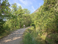
(S/E) Take the wide track leading uphill, heading north-east. Ignore the path coming from the right; after about 300 m, you’ll reach a junction of tracks in a bend.

(1) Continue along the track on the right, heading south, ignoring the one coming from the left. The route is now signposted as the GR®93 until the next junction.

(2) Continue along the track on the left, heading south-east, and leave the GR®93, which branches off to the right.

(3) Take the track opposite, heading south-east then east, towards the Rougier barn. Pass by the ruins and follow the path towards the ravine. Cross the Rousine (a tributary of the Selle), then head back up the slope to join the path coming from the Chapelle de Sauveterre.

(4) Follow the path on the left, heading north-east. Marked in yellow (route 11), it climbs the southern ridge via broad rocky steps. Then leave the path on the left (towards the small pass of Devès) and take the one on the right, heading east. The climb becomes steeper along a rocky path with tight hairpin bends, then levels off as it crosses a mountain pasture (note the temporary electric fence) until it reaches a grassy ridge at around 1,550 m. Continue along the well-marked path to reach a rocky spur, which you should round via its left flank. After a hairpin bend, you’ll reach the ridge near a large cairn. Continue along the ridge and climb directly up the grassy dome to cross over onto the western slope. Continue along a flat section to reach a rocky outcrop, then follow the summit ridge to a large cairn marking the highest point of Charance.

(5) Follow the ridge down to a small pass, then climb back up to the cross on the Pic de Charance. Enjoy the panoramic view over Gap and the surrounding peaks.

(6) Descend along the ridge path, heading north-east, to reach the Brèche de Charance.

(7) Turn left, heading west, and descend along a path to join the Route Forestière de la Brèche (track D53). You’ll reach a hairpin junction.

(8) Continue left, heading south-west, along the Route Forestière de l’Avalanche until you reach a clearing at the end of the forest track.

(9) Take the grassy track to the right, heading south, and enter the Devès woods. Follow the fairly well-marked path (markings visible at the start), then reach a grassy, open area.

(10) Turn right to follow a path along the edge of the woodland, heading south-west then north-west. Then descend via a series of switchbacks between the trees before turning left, heading south, and reaching a junction with the GR®93.

(11) Follow it straight ahead for about a hundred metres, still heading south, then turn right at the junction with the track. Follow the GR®93 down to the original track junction.

(1) Continue straight ahead, heading west, to reach the car park (S/E).

Waypoints

  1. S/E : mi 0 - alt. 4,045 ft - Clot la Chau car park
  2. 1 : mi 0.25 - alt. 4,199 ft - Junction of the circular loop
  3. 2 : mi 0.5 - alt. 4,275 ft - Y-junction (GR®93)
  4. 3 : mi 0.59 - alt. 4,298 ft - Crossroads – Grange Rougier
  5. 4 : mi 1.03 - alt. 4,505 ft - Rougier post - Rousine (rivière)
  6. 5 : mi 2.38 - alt. 6,181 ft - Le Cuchon (1903 m)
  7. 6 : mi 2.72 - alt. 5,994 ft - Pic de Charance
  8. 7 : mi 3.1 - alt. 5,413 ft - La Brêche de Charance (1648m)
  9. 8 : mi 4.01 - alt. 4,908 ft - Route Forestière de l’Avalanche
  10. 9 : mi 4.34 - alt. 4,954 ft - End point (large cairn)
  11. 10 : mi 4.99 - alt. 5,000 ft - Collet de Devès
  12. 11 : mi 6.02 - alt. 4,252 ft - Junction – GR93
  13. S/E : mi 6.48 - alt. 4,045 ft - Clot la Chau car park

Notes

There are no water sources along the route: ensure you carry sufficient supplies, especially in summer.

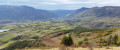
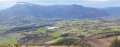
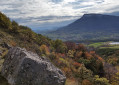
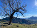
Between (5) and (8): the Charance ridges offer a beautiful panoramic view over Gap towards Céüse, the Dévoluy, the Pic de Gleize, the Vieux Chaillol, the Ubaye, the Montagne de la Blanche, and the peaks of the Écrins. Take care on windy days as the route is exposed along the ridges (little shade). These exposed sections, whilst not technically difficult, do require sure-footedness and should therefore be avoided by children and those prone to vertigo.

Don’t forget your binoculars to admire the panoramic views.

Alternatives

  • You can also start from the Chapelle de Sauveterre.
  • It is possible to avoid the ridge walk between points (7) and (8) by backtracking slightly to descend via the small path on the mountainside which also leads to the Brèche.
  • From (8) La Brèche de Charance, you can descend towards the Charance estate (picnic tables and a fountain), then return by following the Gap Canal to the Chapel of Sauveterre, and heading back up the GR®93 to point (3).
  • From (11) the Collet de Devès, you can return directly to (5) the Rougier signpost via a shorter route: head south-east then south, and return via the same route as on the ascent.

Worth a visit

The Charance ridges offer sweeping views over Gap towards Céüse, the Dévoluy, the Pic de Gleize, the Vieux Chaillol and the Écrins massif, the Ubaye and the Montagne de la Blanche...

Chapelle de Sauveterre: Notre-Dame de Sauveterre was built in the 17th century. In days gone by, a procession would set out from La Roche-des-Arnaud on Whit Monday to seek a blessing on the fruits of the earth.

The Domaine de Charance long belonged to the powerful bishops of Gap, who had a château built there and laid out the park and its canals. In 1973, the town of Gap became the owner and opened it to the public. The name ‘Charance’ comes from Vivaro-Alpine Occitan and means ‘waterfall’. It derives from the Celtic word ‘rin’, meaning ‘running water’, and the prefix ‘cha’, conveying the idea of a fall.

The Gap Canal (or Drac Canal) draws water from the River Drac in the Haut-Champsaur and channels it to the Gap basin, where it is used primarily to supply the town of Gap with drinking water. Each year, around 2,200,000 of water is supplied for human consumption.
Water transfers from the Drac catchment to that of the Durance have a long history and address the water shortage in the Gap catchment. As early as the 15th century, the royal authorities authorised the diversion of certain mountain streams; yet the water needs of the Gap catchment remained critical. It was not until 1863 that Mr Garnier, the department’s Member of Parliament, stepped in as concessionaire and launched the works—into which he poured his entire fortune. As contractors went bankrupt one after the other, the State (Ministry of Public Works) took over the project in 1873. According to the authorities, the total cost is said to have reached 10,000,000 francs, equivalent to around 2 billion euros. Today, this canal supplies drinking water to more than 40,000 inhabitants and also enables the generation of around 8,000,000 kW of electricity per year.

Always be cautious and plan ahead when you're outdoors. Visorando and the author of this route cannot be held responsible for any accidents occurring on this route.

The GR® and PR® markings are the intellectual property of the Fédération Française de Randonnée Pédestre.

Other walks in the area

For more walks, use our search engine .

The GPS track and description are the property of this route's author. Please do not copy them without permission.