Sars-la-Bruyère Walk

A family-friendly, rural walk along the village’s quiet paths and streets.
Sars-la-Bruyère was first mentioned on 25 October 1185. Its name derives from the Latin *sartum*, meaning ‘cleared’ or ‘weeded’ land, and the village was built along the Roman road between Bavay and Utrecht. It witnessed the Battle of Malplaquet in 1709 and fighting between American and German forces in September 1944.

Details

5498750
Creation:
Last update:
Last review:
  • Walking
    Activity: Walking
  • ↔
    Distance: 3.16 mi
  • ◔
    Average duration: 1h 30 
  • ▲
    Difficulty: Easy

  • ⚐
    Back to start: Yes
  • ↗
    Ascent: + 85 ft
  • ↘
    Descent: - 72 ft

  • ▲
    Highest point: 512 ft
  • ▼
    Lowest point: 423 ft

Photos

Description of the walk

.
School car park near the glass recycling bins.

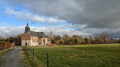
(S/E) Leave the car park and turn right, towards the village war memorial and the memorial to an American soldier. Head towards Saint-Jean-Baptiste Church and walk round it on the left to see the fountain.

(1) Walk round the church to see the spring. Walk alongside the cemetery and follow the path.

(2) At the junction, take the path on the left, lined with cherry laurel. When you reach the small bridge, go under it and, keeping to the right, join Rue de Taisnières. Turn right onto it.

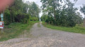
(3) When you reach number 47, squeeze through to the left onto the narrow path between the properties. At the property with the red gates, carry straight on along the dirt track. You’ll come to a T-junction.

(4) Turn right, towards the solitary tree.

(5) Turn left into the woods and follow the path as it bends to the right; then, at the first junction, turn right. When you reach the picnic table, carry straight on. Walk along the Coron de l’Amour via Rue de Blaugies, then, at the junction, turn right until you reach the junction you passed on the way there.

(3) Follow the path with the ‘private’ sign on the left – the sign is slightly hidden by the hedge. You’ll reach another junction you passed on the way out.
(2) Turn slightly left and walk through the campsite, taking care not to disturb the peace and quiet of the place. At Rue des Écoles, turn right and return to the car park (S/E).

Waypoints

  1. S/E : mi 0 - alt. 459 ft - School car park
  2. 1 : mi 0.11 - alt. 446 ft - Fountain
  3. 2 : mi 0.32 - alt. 453 ft - Crossroads, 1st circular loop
  4. 3 : mi 0.85 - alt. 456 ft - Crossroads, 2nd circular loop
  5. 4 : mi 1.32 - alt. 463 ft - Towards the solitary tree
  6. 5 : mi 1.64 - alt. 482 ft - Entrance to the Bois de Sars
  7. S/E : mi 3.16 - alt. 463 ft - School car park

Reviews and comments

5 / 5
Based on 2 reviews

Reliability of the description
5 / 5
Ease of following the route
5 / 5
Route interest
5 / 5
User 25920194

A brilliant walk through the village, fields and woods… one to do again

Machine-translated

Willy BOUVRY
Willy BOUVRY

Overall rating : 5 / 5

Date of your route : Apr 23, 2025
Reliability of the description : ★★★★★ Very good
Ease of following the route : ★★★★★ Very good
Route interest : ★★★★★ Very good
Very busy route : No

A pleasant walk.
The path through the woods is a bit worn.

Machine-translated

mich simon
mich simon

Thank you for your feedback, Isa – it encourages me to plan more walks.

Machine-translated

isa isaa
isa isaa

Overall rating : 5 / 5

Date of your route : Aug 26, 2023
Reliability of the description : ★★★★★ Very good
Ease of following the route : ★★★★★ Very good
Route interest : ★★★★★ Very good
Very busy route : Yes

A short walk through fields, meadows and woods, along a narrow lane – very pleasant and peaceful; I’d recommend it

Machine-translated

Other walks in the area

For more walks, use our search engine .

The GPS track and description are the property of this route's author. Please do not copy them without permission.