


Refine your search for walks in Lutzelbourg
Lutzelbourg walks


 Circular around Lutzelbourg and the Plan Incliné
 Visorando Member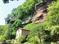
 12.57 mi
 +1,572 ft
 -1,545 ft
 7h 10
7h 10
 Difficult
 Departure from Lutzelbourg (Moselle)
It's a fairly long route of just over 20 km, which can be done on foot or by trail running.These 20 km offer a wealth of diversity, including trails, an abandoned canal, landscapes, rocks, tunnels and a castle.A route that is well worth exploring. If it is too long, it is quite easy to split it into two parts.Although the route is long, it is fairly easy to follow. Most of the paths used are marked by the Club Vosgien.
The Lutzelbourg tour
 7.51 mi
+860 ft
-860 ft
4h 10
7.51 mi
+860 ft
-860 ft
4h 10
 Moderate
Departure from Lutzelbourg (Moselle)
Moderate
Departure from Lutzelbourg (Moselle)
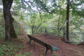
A hilly route around the pretty village of Lutzelbourg, following the circular castle walk, the Marne-Rhine Canal and the Gustave Hentz Circular, featuring beautiful forest paths lined with rocks including Pulsfels Bellevue and the Krappenfels (Corbeau Rock).
Le tour de Lutzelbourg par Roche Plate
 7.48 mi
+1,106 ft
-1,093 ft
4h 25
Moderate
Departure from Lutzelbourg (Moselle)
7.48 mi
+1,106 ft
-1,093 ft
4h 25
Moderate
Departure from Lutzelbourg (Moselle)
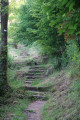
Randonnée circulaire vallonnée autour du joli village de Lutzelbourg. Plusieurs points d'intérêts : château, points de vue et jolis sentiers ombragés bordés de gros rochers.
The Rocher du Petit Moulin and Lutzelbourg Castle
 2.12 mi
+407 ft
-407 ft
1h 20
2.12 mi
+407 ft
-407 ft
1h 20
 Easy
Departure from Lutzelbourg (Moselle)
Easy
Departure from Lutzelbourg (Moselle)
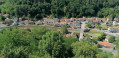
Walk on the heights of Lutzelbourg with beautiful views and visit the castle ruins. Walk with elevation gain.
Lutzelbourg to Saverne
9.94 mi
+3,294 ft
-3,428 ft
7h 25
Moderate
Departure from Lutzelbourg (Moselle)
A lovely walk between Lutzelbourg station and Saverne station, taking in the castles of Lutzelbourg, Petit and Grand-Geroldseck, and Haut-Barr, an archaeological site with Gallo-Roman ruins, and passing by the Tour du Brotsch.
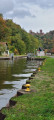
The Valley of the Lock Keepers - the Rock Trail - the ruins of Lutzelbourg Castle
 9.20 mi
+1,345 ft
-1,342 ft
5h 25
Moderate
Departure from Garrebourg (Moselle)
9.20 mi
+1,345 ft
-1,342 ft
5h 25
Moderate
Departure from Garrebourg (Moselle)
Discover the Lutzelbourg region as you walk along the valley of the lock keepers and then up to the heights on the rocky path to reach the ruins of Lutzelbourg Castle
Around the Plan Incliné, starting from Henridorff
 7.92 mi
+1,014 ft
-1,024 ft
4h 35
Moderate
Departure from Henridorff (Moselle)
7.92 mi
+1,014 ft
-1,024 ft
4h 35
Moderate
Departure from Henridorff (Moselle)
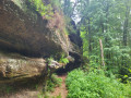
Setting off from Henridorff, we’ll view the Marne–Rhine Canal from the top of the rocky outcrops, then head down the towpaths to reach a pedestrian tunnel passing under the canal.Halfway along the route, let’s stop for lunch at the Brasserie des Éclusiers, on the banks of the canal.You’ll pass through:- through a service tunnel beneath the canal. (Bring a head torch).- along the Forellenbaechel stream, beneath the railway lines.
Hultehouse - Grafenstein Castle - Saint Vit - Wasserwald
 10.91 mi
+1,969 ft
-1,975 ft
6h 45
Moderate
Departure from Hultehouse (Moselle)
10.91 mi
+1,969 ft
-1,975 ft
6h 45
Moderate
Departure from Hultehouse (Moselle)
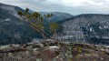
A beautiful walk on the slopes of the Zorn Valley, where you will discover breathtaking landscapes, the ruins of Greifenstein Castle, the Saint-Vit cave and the Gallo-Roman site of Wasserwald.
Actual elevation gain: 534 m.
Lutzelbourg Castle from Phalsbourg
 7.94 mi
+955 ft
-955 ft
4h 30
Moderate
Departure from Phalsbourg (Moselle)
7.94 mi
+955 ft
-955 ft
4h 30
Moderate
Departure from Phalsbourg (Moselle)
This hike takes you to Lutzelbourg Castle with its view of the village of Lutzelbourg and its "Canal de la Marne au Rhin".
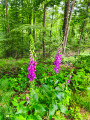
A mixture of forest paths, trails through the woods and across fields. There is a little tarmac, however, for crossing the villages.
In the forest between Phalsbourg, Lutzelbourg and Saverne
 10.99 mi
+1,926 ft
-1,949 ft
6h 45
Moderate
Departure from Danne-et-Quatre-Vents (Moselle)
10.99 mi
+1,926 ft
-1,949 ft
6h 45
Moderate
Departure from Danne-et-Quatre-Vents (Moselle)
This beautiful, undulating circular route through the woodland complements a previous, shorter route. It covers all the previous points of interest, with the addition of a few alternative routes and other interesting stops along the way. From the Grotte de Danne, you’ll need to make your way from the Rocher du Breitkopf to the Grotte Saint-Vit, then head to the Rocher de Blumenthal to reach Lock 24 towards Lutzelbourg, and finish at Roche Plate and the washhouse route near the Finstingerkopf Forest House… these are the main directions for this walk.
The Phalsbourg Forest and Lutzelbourg Castle
 10.32 mi
+1,250 ft
-1,273 ft
5h 50
Moderate
Departure from Phalsbourg (Moselle)
10.32 mi
+1,250 ft
-1,273 ft
5h 50
Moderate
Departure from Phalsbourg (Moselle)
A walk starting from Phalsbourg, a town fortified by Vauban, which will take us to the village of Hultehouse and Lutzelbourg Castle.
Around the Saint-Louis-Arzwiller Inclined Plane
 7.12 mi
+974 ft
-958 ft
4h 05
Moderate
Departure from Saint-Louis (Moselle)
7.12 mi
+974 ft
-958 ft
4h 05
Moderate
Departure from Saint-Louis (Moselle)
A beautiful circular route offering the chance to discover the Saint-Louis-Artzwiller Inclined Plane, the Rocher du Calice and the Vallée des Éclusiers. Part of the walk takes place in the forest along forest tracks and beautiful paths, where you’ll discover fantastic and unique rock formations, a magnificent rocky outcrop, a typical Moselle village, and a picturesque stretch of the old canal better known as the ‘Vallée des Éclusiers’ with its old locks, now out of service. The Saint-Louis-Arzviller inclined plane, a boat lift unique in Europe built in 1969, replaced the seventeen locks of the old Marne-Rhine Canal. It forms part of the Marne-Rhine Canal, enabling passage through the Vosges, and is one of the most visited river sites in France.
Around the Saint-Louis Inclined Plane
 6.47 mi
+774 ft
-784 ft
3h 40
Moderate
Departure from Saint-Louis (Moselle)
6.47 mi
+774 ft
-784 ft
3h 40
Moderate
Departure from Saint-Louis (Moselle)
A lovely walk around the Plan Incliné, featuring the Rocher du Calice, a passage under the Marne-Rhine Canal (bring a torch), the Passerelle Patou, the abandoned canal, the Maison Forestière Bodenmarck, the Rocher du Corbeau with views over the canal, the Sentier des Roches, and finally a walk past the Plan Incliné.
Haselbourg circular, via Saint-Fridolin and Falkenfels
 9.60 mi
+1,362 ft
-1,371 ft
5h 35
Moderate
Departure from Saint-Louis (Moselle)
9.60 mi
+1,362 ft
-1,371 ft
5h 35
Moderate
Departure from Saint-Louis (Moselle)
A beautiful hike to Haselbourg/Heller, in the Dabo region, starting from the Plan Incliné car park in Saint-Louis, passing by the Saint-Fridolin Chapel, named after an Irish monk, and its baptistery. Continue on to the cave dwellings of Falkenberg and the Rocher des Faucons, with a beautiful view of Dabo. In Haselbourg, a picturesque village, the main street circles the Roman camp. Return along the Zorn, on the left bank, on the unmarked "CV" path. The path is not difficult, but a map or GPS is recommended. Upon arrival, you can also visit the Lerher crystal factory.
More walks in Lutzelbourg
Select a point of interest below: