Around the Plan Incliné, starting from Henridorff

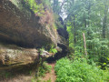
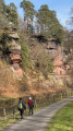
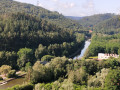
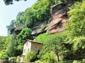
Setting off from Henridorff, we’ll view the Marne–Rhine Canal from the top of the rocky outcrops, then head down the towpaths to reach a pedestrian tunnel passing under the canal.
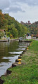
Halfway along the route, let’s stop for lunch at the Brasserie des Éclusiers, on the banks of the canal.
You’ll pass through:
- through a service tunnel beneath the canal. (Bring a head torch).
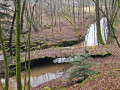
- along the Forellenbaechel stream, beneath the railway lines.

Details

60736028
Creation:
Last update:
Last review:
  • Walking
    Activity: Walking
  • ↔
    Distance: 7.92 mi
  • ◔
    Average duration: 4h 35 
  • ▲
    Difficulty: Moderate

  • ⚐
    Back to start: Yes
  • ↗
    Ascent: + 1,014 ft
  • ↘
    Descent: - 1,024 ft

  • ▲
    Highest point: 1,168 ft
  • ▼
    Lowest point: 715 ft

Photos

Description of the walk

Park in the car park at Henridorff Cemetery, Rue de la Paix.

(S/E) Walk up Rue de la Paix until you reach Route de Lutzelbourg. Turn left onto it, following the GR®532 markings and the Green Ring markings.

(1) Leave the road and take a path on the left, following the same signposts. You’ll come to a road; follow it to the left, then leave it 200 metres further on to take a path on the right. You’ll arrive at a track.

(2) Leave the GR®532 and continue along this track until you cross a stream.

(3) About 10 m after crossing the stream, turn left onto an unmarked track for about 250 m. Then turn right onto the GR®532, marked with a Yellow Rectangle.
Follow these markings to the towpath of the Marne–Rhine Canal.

(4) At the canal, turn right and continue to Lutzelbourg Lock No. 19. Go through the lock to the other side of the canal, then continue to the right, keeping the canal on your right.

(5) At the Brasserie des Éclusiers, leave the towpath. Cross the brewery’s car park, then the D98 road, and follow the path marked with a Yellow Disc sign, which runs alongside the D98 and then the D98C.

(6) Follow the hairpin bend to the right and continue along this track, marked with a Yellow Disc. Cross the D98C road with care. Keep to the right and continue along the road for about 250 m until you reach a crystal factory.
Turn left onto the D97B road and follow it for about 150 m, then turn left off the D98B road and follow the track for about 300 m.

(7) Turn right at the hairpin bend and follow the Yellow Disc markings to the D97B road, ignoring any side paths.

(8) Overlooking the Plan Incliné.

(9) Cross the D97B, turn right and walk for a few tens of metres, then turn left onto a track marked with a Blue Ring, which descends towards the Marne–Rhine Canal.
Go under the canal and continue to the D98 road.

(10) Cross it and continue along the track, following the Blue Ring and Yellow Rectangle (Yellow Rectangle and White Rectangle) markings.
Go under the railway lines to reach the towpath of the old canal. Follow it, keeping to the left, as far as lock no. 13.

(11) Cross the old canal via the lock. Follow the yellow-white-yellow Yellow Rectangle markings until you reach the junction with a track marked with a Yellow Ring. Keep to the right on this track and head up to Henridorff. Take the road to Lutzelbourg on the left, until you reach the junction you passed on the way there.

(1) Follow the route back in the opposite direction to the car park (S/E).

Waypoints

  1. S/E : mi 0 - alt. 1,165 ft - Car park, Rue de la Paix
  2. 1 : mi 0.23 - alt. 1,115 ft - Junction of the circular loop
  3. 2 : mi 1.48 - alt. 928 ft - Change in signposting
  4. 3 : mi 2.01 - alt. 755 ft - Change of direction with no signposting
  5. 4 : mi 2.98 - alt. 715 ft - Canal de la Marne au Rhin
  6. 5 : mi 3.81 - alt. 728 ft - Brasserie des Éclusiers
  7. 6 : mi 4.95 - alt. 820 ft - Hairpin bend
  8. 7 : mi 5.56 - alt. 755 ft - Yellow Disc markings in a hairpin bend
  9. 8 : mi 6.2 - alt. 1,024 ft - Plan Incliné (Saint-Louis-Arzviller)
  10. 9 : mi 6.43 - alt. 991 ft - Crossing the D97B
  11. 10 : mi 6.73 - alt. 768 ft - Crossing the road
  12. 11 : mi 7.07 - alt. 768 ft - Lock No. 13
  13. S/E : mi 7.92 - alt. 1,168 ft - Car park, Rue de la Paix

Notes

(7) Head torch or torch.

After carrying out a recce, I found that the paths between points (7) and (9) had very few signposts. Use the app to check that you are heading in the right direction.

Worth a visit

Lehrer Crystal Works with production workshop.

Always be cautious and plan ahead when you're outdoors. Visorando and the author of this route cannot be held responsible for any accidents occurring on this route.

The GR® and PR® markings are the intellectual property of the Fédération Française de Randonnée Pédestre.

Reviews and comments

4.3 / 5
Based on 3 reviews

Reliability of the description
4.3 / 5
Ease of following the route
4.3 / 5
Route interest
4.3 / 5
Lionel.D
Lionel.D
• Edited:

Overall rating : 4.3 / 5

Date of your route : Mar 06, 2026
Reliability of the description : ★★★★☆ Good
Ease of following the route : ★★★★★ Very good
Route interest : ★★★★☆ Good
Very busy route : No

The hike is best done in good weather. The route is very pleasant and quite varied (canals, viewpoints, forest, streams). The passages under the canal and railway line are easy, and a torch is useful but not essential. We then visited the crystal factory. In addition to the shop and workshop, you can also enjoy a coffee or refreshment there, which is nice after a good walk.

Machine-translated

Lukowiak Michel
Lukowiak Michel

Overall rating : 4.7 / 5

Date of your route : May 17, 2025
Reliability of the description : ★★★★★ Very good
Ease of following the route : ★★★★☆ Good
Route interest : ★★★★★ Very good
Very busy route : No

A lovely walk that’s easy to enjoy.

Machine-translated

thom67500
thom67500

Overall rating : 4 / 5

Date of your route : Sep 21, 2024
Reliability of the description : ★★★★☆ Good
Ease of following the route : ★★★★☆ Good
Route interest : ★★★★☆ Good
Very busy route : No

A lovely walk in the woods with no particular difficulties.

Machine-translated

Other walks in the area

For more walks, use our search engine .

The GPS track and description are the property of this route's author. Please do not copy them without permission.