Country:

 City:
City:


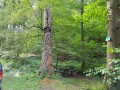
On leaving Phalsbourg towards Saverne on the D604, turn right at the first roundabout after the cemetery, opposite the Lycée Saint-Antoine, and head towards “Bois de Chênes Haut”. Continue until you reach the edge of the forest on Rue de Finstingerkopf; follow this road to the left until you reach the junction with Rue de la Roche; the Bois de Chênes Haut picnic area is just on the right-hand side (wooden sculpture depicting the legend of Saint Hubert).
(S/E) Head straight on to the far end of the picnic area to find the path leading towards the Grotte de Danne.
Yellow Ring
Follow the path towards “Grotte de Danne”; it joins the forest track leading to the Finstingerkopf Forest House. After 150 m, take the path on the right. Follow the signposted “Route du château de Danne” straight on for 100 m.
(1) Take the path on the left to reach the junction signposted “Larchenbrunnel”.
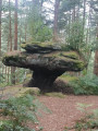
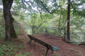
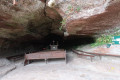
(2) Carry on straight ahead, following the “Route du château de Danne” signposting, to reach Rocher Albert, the Grotte de Danne, and – why not? – climb up to the Danne terrace (bench).
Retrace your steps back to the “Larchenbrunnel” junction.
Red Saltire
(2) Carry on to the left. Head down the forest path signposted “le Stutzbach Herrgott Schweitzerkopf” and join the forest track below. Cross the Stutzbach stream via the wooden bridge to climb back up to the Stutzbach Forest Track.
(3) Cross this track, take the forest path opposite, and continue up the winding path to reach the Herrgott Forest Road, ignoring the side paths.
(4) Continue to the right along the Herrgott Forest Road until you reach the Herrgott Cross.
Red Triangle
(5) Cross the road to join the path opposite, which, further on, crosses two paths below.
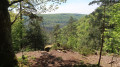
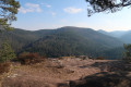
(6) Just before a bend to the left, take the sloping path on the right. Continue towards the Rocher du Breitkopf and reach the viewpoint (bench and panoramic view). Descend into the valley via the stone steps leading to the foot of the rock and continue along the winding path; cross the stream via wooden footbridges to reach the forest track.
(7) Follow the forest track to the left, then, after about 200 m, take the path on the left to reach the Fontaine Mélanie.
(8) Retrace your steps.
(7) Continue straight on for about 20 m, then turn left.
Blue Ring
Climb up the forest track, reach the first path, then continue on to join the Ramsthal Forest Road. Cross the road towards the Fontaine des Bavarois opposite.
(9) Continue right along the forest road for 20 metres, then turn left onto the path to reach the upper forest track.
(10) At the junction, take the path on the left towards “Bonne Source”, then carry on and follow the signpost for “Marienfels 1 min” on the left.
(11) Head to the Marienfels Rock viewpoint (bench). Retrace your steps and continue left along the path.
Red Ring
At the junction of the two paths, take the one on the left towards “Greifenstein”. The path winds downwards and is circular, circling the Greifenstein to reach the steps leading up to the castle (municipal by-law prohibiting access for safety reasons).
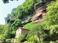
(12) Continue following the signposts towards the Saint-Vit Grotto; there you’ll find a large picnic area, a chapel set in the grotto, a magnificent botanical garden and a viewpoint overlooking the ruined castles of Haut Barr and Grand Geroldseck.
(13) Continue towards “Rappenfels Stambach”.
Blue Rectangle with a white cross
(14) After about 300 m, turn left onto the forest path towards “Rappenfels”. Head down towards the Rappenfels viewpoint.
(15) Retrace your steps to rejoin the Saint-Vit Forest Track.
(14) Continue to the left, towards the Schweizerkopf Forest House; walk 100 m past it to reach a junction.
Blue Cross
(16) Take the path on the left. After a 700-metre descent, you’ll reach the Rocher de Blumenthal (viewpoint).
(17) Follow the path, which crosses several forest tracks before reaching the area known as the Stutzbach Valley on the stony forest road below.
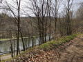
(18) Turn right for a few metres, then turn left onto the Route Forestière du Stutzbach and follow it for 100 m. At the ‘Route Forestière du Stutzbach’ forest sign, take the narrow path on the right leading uphill, following the ‘Lutzelbourg’ signpost. The path overlooks the Marne–Rhine Canal and reaches the large, open junction opposite Lock 24.
Yellow Triangle
(19) Head up the path signposted “Roche Plate” to reach, at the top of the rocks and on the final flat section, a small picnic area marked “Roche Plate”. Continue straight on for 50 metres along the path until you reach the Fork in the road where two forest tracks meet.
Blue Ring
(20) Continue straight on. Avoid the paths on the left and follow the sign for “Route des lavoirs” (fixed to a large tree on the right 100 m after the Fork in the road). Go past the bend at the end of the path, then take the forest path on the right, following the sign for “Vallée du Stutzbach, lavoir, la Roche 50 m”.
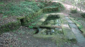
(21) Pass in front of the Bois de Chêne washhouse, known as “la Roche”, then continue along the forest track for 20 m and take the path on the right.
Yellow Ring and Red Saltire
(1) Head up the path towards the Finstingerkopf Forest House, following the signposting “Route du château de Danne” (Yellow Ring) then “Bois de Chênes Haut MF Finstingerkopf” (Red Saltire) to reach the stony forest track leading to the Forest House, which you should follow to the left.
Continue along this track, passing behind the Forest House, and after about 150 m, take the Yellow Ring path on the right to reach the picnic area (S/E).



 Visorando Member

 Easy
Easy 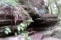
 Difficult