The railway lines of our ancestors and the Petite Gineste from Serres

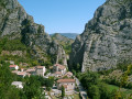
The first section follows the roads through the village of Serres.
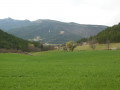
The second section follows a narrow path through the forest. The slopes are quite steep and slippery due to the pine needles covering the ground.
The third section follows a wide track forming the embankment alongside the Buëch.

Point of interest: at the summit, a heritage information board detailing the historical site where the village of Serres was founded.

Details

1931247
Creation:
Last update:
Last review:
  • Walking
    Activity: Walking
  • ↔
    Distance: 4.66 mi
  • ◔
    Average duration: 2h 35 
  • ▲
    Difficulty: Easy

  • ⚐
    Back to start: Yes
  • ↗
    Ascent: + 538 ft
  • ↘
    Descent: - 558 ft

  • ▲
    Highest point: 2,533 ft
  • ▼
    Lowest point: 2,096 ft

Photos

Description of the walk

Park in the Tourist Office car park. ¹

Red and whiteGR® signposts

(S/E) From the Tourist Office car park or the one opposite, stay on the left-hand pavement (red and white markings). At the roundabout, cross the bridge over the Buëch, continue along the main street, Rue Marius Meyere, and Route de Laragne. Take care.

(1) Turn left onto Avenue de la Flamenche, keep going straight on, ignoring the dead-end street.
Take the second street on the left, the Chemin du Sacre.

(2) At the Camping des Deux Soleils, carry on straight along the track leading to a farm. Continue along the dirt track, then at the bottom of the track, turn right and follow the edge of the field.

Yellow markings

(3) Leave theGR® and turn right onto the path through the woods (yellow markings). At the end of the path, which goes up and down, you’ll reach some steps and a wooden footbridge; turn left.

(4) At the end of the path, turn right onto the dirt track. Continue until you reach the railway line and the road.

(5) Cross the railway tracks and the D1075 departmental road (formerly the RN75). Take care. Turn left, walking parallel to the road.

(6) Take the path on the right which runs alongside the leisure centre and leads to the Buëch. Turn right and continue all the way along until you reach the Buëch bridge on your left, following the signposts. Join the main street, Rue Marius Meyere, and turn left towards the Tourist Office car park (S/E).

Waypoints

  1. S/E : mi 0 - alt. 2,182 ft - Tourist Office car park
  2. 1 : mi 0.4 - alt. 2,228 ft - On the left is Avenue de la Flamenche
  3. 2 : mi 1.12 - alt. 2,497 ft - Go straight on to the Camping des Deux Soleils
  4. 3 : mi 1.55 - alt. 2,369 ft - On the right, a yellow-marked path.
  5. 4 : mi 2.26 - alt. 2,215 ft - Turn right. Yellow signposting.
  6. 5 : mi 2.54 - alt. 2,182 ft - Railway line and the D1075 road
  7. 6 : mi 2.64 - alt. 2,165 ft - Path on the right.
  8. S/E : mi 4.66 - alt. 2,182 ft - Tourist Office car park

Notes

Always be cautious and plan ahead when you're outdoors. Visorando and the author of this route cannot be held responsible for any accidents occurring on this route.

The GR® and PR® markings are the intellectual property of the Fédération Française de Randonnée Pédestre.

Reviews and comments

4.1 / 5
Based on 3 reviews

Reliability of the description
4.7 / 5
Ease of following the route
4.3 / 5
Route interest
3.3 / 5
jeanyvessimon
jeanyvessimon

Overall rating : 4 / 5

Date of your route : Sep 16, 2024
Reliability of the description : ★★★★★ Very good
Ease of following the route : ★★★★☆ Good
Route interest : ★★★☆☆ Average
Very busy route : No

I particularly appreciated the fact that a news flash on the app warned of fallen trees or branches on the route, forcing me to leave it. The app was useful for easily finding the rest of the route once I’d got round the obstacles.
The final section of the route, along a straight track beside the EDF canal, is indeed rather monotonous.

Machine-translated

marche dans le 05
marche dans le 05

Overall rating : 4.7 / 5

Date of your route : Mar 30, 2021
Reliability of the description : ★★★★★ Very good
Ease of following the route : ★★★★★ Very good
Route interest : ★★★★☆ Good
Very busy route : No

This walk is suitable for everyone, is well signposted, can be completed in half a day, and is pleasant and varied

Machine-translated

bertin.huguette
bertin.huguette

Overall rating : 3.7 / 5

Date of your route : Apr 26, 2019
Reliability of the description : ★★★★☆ Good
Ease of following the route : ★★★★☆ Good
Route interest : ★★★☆☆ Average

a long drive

Machine-translated

Other walks in the area

For more walks, use our search engine .

The GPS track and description are the property of this route's author. Please do not copy them without permission.