The vineyards of Château-Porcien

Explore the village nestled between the arms of the River Aisne, and take a walk through the hills above the village in the former vineyard.

Details

1660481
Creation:
Last update:
Last review:
  • Walking
    Activity: Walking
  • ↔
    Distance: 4.26 mi
  • ◔
    Average duration: 2h 10 
  • ▲
    Difficulty: Easy

  • ⚐
    Back to start: Yes
  • ↗
    Ascent: + 236 ft
  • ↘
    Descent: - 220 ft

  • ▲
    Highest point: 427 ft
  • ▼
    Lowest point: 213 ft

Photos

Description of the walk

Park in the car park at Place de l’Église Saint-Thibault.

S/E:: Walk round the old village via Rue de la Couture, Rue de la Morteau and Rue des Remparts, and cross the bridge over the River Aisne. Continue to Place de la Mairie. Turn right onto Rue de Sommevue, then head towards the junction with Rue des Promenades.

(1) Turn right here, then turn right again towards the village hall. Turn left, following the promenade to the sports hall, then left again in front of the fire station. Turn right onto Chemin des Grands Jardins.

(2) At the junction, head left up Rue du Jard le Comté until you reach the main road, Rue de Sommevue. Follow it to the right, passing the secondary school, until you reach the junction with Chemin des Bois.

(3) Turn left, then immediately left again onto a path between two housing estates and head uphill to Rue des Cliquots. Continue uphill to reach Rue des Hauts Libausarts. Turn left onto this road and follow it to the junction with Rue des Limons.

(4) Head up the path on the right at a place called Les Briqueteries. At the top, turn left onto Rue des Truquettes and walk past the farm. At the junction, make a zigzag turn left-right at the wayside cross. Further on, follow the path on the left which runs alongside an embankment. You’ll come out at the junction with Rue de Saint-Fergeux.

(5) Take the path on the left, bordered by a hedge on the right, and follow it down towards the village along the narrow lane. You’ll come to a junction with Rue des Mudelennes. Follow this road to reach a multi-way junction.

(6) Then head up Rue de la Barre to the left, passing a few houses and the water tower. At the junction in the woods, turn right onto Chemin des Vignes. Walk alongside the vineyards on your left before heading back down towards the village. Pass the old castle (private property) on Ruelle du Château.
You’ll soon rejoin the main road by turning right onto Rue Croix Bayonne.

(7) Follow Rue de Sommevue to the right until you reach the junction with Rue des Promenades, which you passed on the way out.

(1) Follow the same route as on the way there to return to the church car park (S/E).

Waypoints

  1. S/E : mi 0 - alt. 223 ft - Church car park - Aisne (l')
  2. 1 : mi 0.64 - alt. 233 ft - Crossroads at the circular loop
  3. 2 : mi 1.12 - alt. 223 ft - Carrefour, Rue du Jard
  4. 3 : mi 1.55 - alt. 240 ft - Carrefour Chemin des Bois
  5. 4 : mi 1.97 - alt. 384 ft - Carrefour, Rue des Limons
  6. 5 : mi 2.75 - alt. 374 ft - Chemin de Saint-Fergeux
  7. 6 : mi 3.15 - alt. 292 ft - Junction of Rue des Mudelennes and Rue de la Barre
  8. 7 : mi 3.84 - alt. 236 ft - Junction of Rue Croix Bayonne and Rue Sommevue
  9. S/E : mi 4.26 - alt. 223 ft - Church car park

Notes

Shops in the village, bakeries, Carrefour Contact mini-market.
Post office, Crédit Agricole.
Stopover lodge for walkers on the Way of St James (digital lock at the town hall)
Water at the cemetery.

Worth a visit

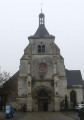
Church.
Vineyards.
Old wash house.
Kayaking route.

Reviews and comments

4.8 / 5
Based on 2 reviews

Reliability of the description
5 / 5
Ease of following the route
5 / 5
Route interest
4.5 / 5
Le Neuvillois
Le Neuvillois

Thanks!
I’ll give it a go...

Machine-translated

Carterando2
Carterando2

At point 5, take the path lined with a hedge on the right, heading east, rather than the one heading south which runs through the fields and then descends along the edge of a woodland to reach the village.
As for the path leading to the old castle, this is private property. Nevertheless, there is a lovely view as you begin the descent towards Château-Porcien.
If you wish, you can take a steep path with wide steps to reach the Wignacourt fortified house more quickly.

Machine-translated

Le Neuvillois
Le Neuvillois

Overall rating : 5 / 5

Date of your route : Aug 21, 2022
Reliability of the description : Not used / Not applicable
Ease of following the route : ★★★★★ Very good
Route interest : ★★★★★ Very good
Very busy route : Yes

This route really showcases the best features of the site and the village. Further out, it offers lovely views over the Vallage. The Préardennaises Ridges, the Montagne de Reims and even the Argonne form a barrier on the horizon.
Interesting, then...
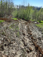
There was just one detail that puzzled us regarding the map’s interpretation. Immediately south of Point 5, the path has been ploughed up, even though it is clearly shown on the cadastral map (source: Géoportail). The farmer, who was working on plots 1, 2, 5 and 7 together, did not bother to lift his plough, meaning that the path is now obscured. A slight dip in the ground and a subtle change in soil colour are clues that will soon disappear. Furthermore, the continuity of the path downstream is not obvious, even to the attentive observer, as it initially runs along the edge of the woodland…
I would add that, apart from the delicious blackberries on the descent towards the village, the path offers lovely views over the built-up area and the ‘Château cliff’… It would be a shame to miss out on these views on the way back…
Thank you for whatever you can do...

PS: photos and screenshots on Géoportail are available

Machine-translated

Rethel
Rethel

Overall rating : 4.7 / 5

Date of your route : Jul 03, 2022
Reliability of the description : ★★★★★ Very good
Ease of following the route : ★★★★★ Very good
Route interest : ★★★★☆ Good
Very busy route : Yes

An easy walk that takes us to some interesting places.

Machine-translated

Other walks in the area

For more walks, use our search engine .

The GPS track and description are the property of this route's author. Please do not copy them without permission.