From Guinicourt to Menneville

A pleasant walk with no major difficulties. Best undertaken in dry weather, starting on paths through the fields and returning partly along the River Aisne through leafy stretches.

Details

231445
Creation:
Last update:
Last review:
  • Walking
    Activity: Walking
  • ↔
    Distance: 6.45 mi
  • ◔
    Average duration: 3h 00 
  • ▲
    Difficulty: Easy

  • ⚐
    Back to start: Yes
  • ↗
    Ascent: + 85 ft
  • ↘
    Descent: - 85 ft

  • ▲
    Highest point: 269 ft
  • ▼
    Lowest point: 177 ft

Description of the walk

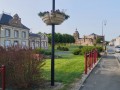
Start on Rue de la Libération, between the town hall and the church in Guignicourt.

(S/E) With the town hall behind you and the church on your right, walk a few metres along Rue de la Libération and turn left into Rue Pierre Curtil, towards Prouvais. Walk past the supermarket and take the first right, Rue Ehrard de Nazelle. Continue to the end of this street. You’ll arrive at a small square (with the cemetery opposite on the left).

(1) Carry on straight ahead (east-southeast) along a path. Ignore any turn-offs to the right or left. You’ll reach a small road.

(2) Cross the road and carry on straight ahead, passing between the greenhouses and a shed. Take the first path on the right, which heads due south towards a road.

(3) Cross the D925 road (take care). Take the path straight ahead, slightly to the left (do not take the one running alongside the road on your left). After 50 metres, in a slight bend, take the path on the right. Walk past a pond on your right. Continue due west, then turn right to enter Menneville via Rue des Prés.

(4) Take the first small street on the left, then turn sharply right until you reach the main street (Rue du Centre). Then turn left and follow the street for 300 metres.

(5) Leave the road on the left and follow a path that leads towards the River Aisne. Continue west-north-west for about 800 metres until you reach a poplar plantation. Then head right towards the D925.

(6) Cross the road and turn left onto Chemin d’Illerrieden. Follow this track, which runs parallel to the D925, until you reach the entrance to Guignicourt.

(7) Leave Chemin d’Illerrieden, turn left to cross the D925 and take a sloping path leading down to the river.

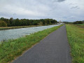
(8) Turn right and walk alongside the river (on your left). Walk past the campsite.

(9) After a large concrete slab (former tennis court), take the first street on the right to head back up towards the church and finish your walk (S/E).

Waypoints

  1. S/E : mi 0 - alt. 200 ft - Guignicourt Town Hall
  2. 1 : mi 0.41 - alt. 217 ft - Guignicourt Cemetery
  3. 2 : mi 2.06 - alt. 223 ft - Crossroads
  4. 3 : mi 2.92 - alt. 197 ft - D925 road
  5. 4 : mi 3.64 - alt. 194 ft - Entrance to Menneville
  6. 5 : mi 3.93 - alt. 194 ft - On the left, path towards the Aisne
  7. 6 : mi 4.69 - alt. 194 ft - Chemin d’Illerrieden
  8. 7 : mi 5.56 - alt. 207 ft - Turn left to cross the D925
  9. 8 : mi 5.91 - alt. 180 ft - Near the - Canal latéral à l'Aisne
  10. 9 : mi 6.38 - alt. 184 ft - Turn right towards the car park - Aisne (l')
  11. S/E : mi 6.45 - alt. 200 ft - Guignicourt Town Hall

Reviews and comments

4.4 / 5
Based on 3 reviews

Reliability of the description
5 / 5
Ease of following the route
5 / 5
Route interest
3.3 / 5
Xavier E.
Xavier E.

Overall rating : 4.7 / 5

Date of your route : Nov 08, 2021
Reliability of the description : ★★★★★ Very good
Ease of following the route : ★★★★★ Very good
Route interest : ★★★★☆ Good
Very busy route : No

All clear

Machine-translated

randocaille
randocaille

Overall rating : 4.7 / 5

Date of your route : Jul 23, 2018
Reliability of the description : ★★★★★ Very good
Ease of following the route : ★★★★★ Very good
Route interest : ★★★★☆ Good

A lovely walk, a very pleasant village, a nice route.

Machine-translated

yannmorbreizh
yannmorbreizh

Overall rating : 4 / 5

Date of your route : Dec 19, 2016
Reliability of the description : ★★★★★ Very good
Ease of following the route : ★★★★★ Very good
Route interest : ★★☆☆☆ Disappointing

As for me, having done it in the autumn, I found it rather monotonous

Machine-translated

Other walks in the area

For more walks, use our search engine .

The GPS track and description are the property of this route's author. Please do not copy them without permission.