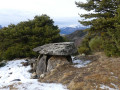
Le Châtelard via the three fountains

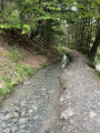
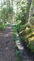
A moderately difficult hike with a few narrow sections, scree slopes and rocky terrain. A largely shaded route featuring three fountains, the old Châtelard battery, the Pisse Canal with superb views of the Pisse Waterfall, the lake and the Ubaye Valley.

Details

40567023
Creation:
Last update:
Last review:
  • Walking
    Activity: Walking
  • ↔
    Distance: 7.26 mi
  • ◔
    Average duration: 5h 05 
  • ▲
    Difficulty: Moderate

  • ⚐
    Back to start: Yes
  • ↗
    Ascent: + 1,959 ft
  • ↘
    Descent: - 1,942 ft

  • ▲
    Highest point: 5,623 ft
  • ▼
    Lowest point: 4,180 ft

Description of the walk

Park at the paragliding car park at the entrance to the village of Saint-Vincent-les-Forts.

(S/E) Head away from the village along the road you arrived on. At the junction, carry on straight ahead until you reach a Fork in the road.

(1) Leave theGRP® and turn left onto the track that climbs up to a fork.

(2) Look out for the Pisse Irrigation Canal path on your left – you’ll take this on the way back – and carry on straight ahead.

(3) Take a short detour to the left to see the Barbotane Fountain, then rejoin the route by following the track which continues to climb to the left.

(4) Leave the track to visit the Fontaine de l’Âne, situated on the right. There is also a hut which serves as a shelter. Return to the track and continue to the right.

(5) At the bend near the Fontaine du Loup, leave the track and take a path on the left which becomes narrow in places and crosses two stable scree slopes until you reach a fork.

(6) Ignore the path on the right leading to La Montagnette and carry on straight ahead. You’ll reach a fork in the path from where you can enjoy the view of the Waterfall de la Pisse.

(7) Turn left downhill and reach the Canal d’Irrigation de la Pisse.

(8) Carry on straight ahead to reach the Clot du Dou hut.

(9) Take the path that climbs to the right just after the hut. You’ll emerge further up onto a wider track.

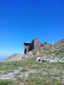
(10) Turn right and head for the Ancienne Batterie du Châtelard.

(11) Viewpoint and history: turn back.

(10) Carry on straight ahead and return to the Clot du Dou hut.

(9) Turn right onto the path you took on the way up and rejoin the Pisse Irrigation Canal.

(8) Turn right onto the path running alongside it, until you reach a junction you passed on the way up.

(2) Turn right and follow the ascent route in the opposite direction to return to the car park where you started (S/E).


Waypoints

  1. S/E : mi 0 - alt. 4,180 ft - Paragliding car park
  2. 1 : mi 0.3 - alt. 4,272 ft - Common junction (out and back)
  3. 2 : mi 0.65 - alt. 4,521 ft - Junction of the circular canal loop
  4. 3 : mi 0.94 - alt. 4,701 ft - Barbotane Fountain
  5. 4 : mi 1.42 - alt. 4,948 ft - Fontaine de l’Âne junction
  6. 5 : mi 1.74 - alt. 5,092 ft - Fontaine du Loup, end of track
  7. 6 : mi 2.22 - alt. 5,591 ft - Junction: go straight on
  8. 7 : mi 2.91 - alt. 5,463 ft - Junction, view of the Pisse waterfall
  9. 8 : mi 3.55 - alt. 4,708 ft - Pisse Irrigation Canal. Return junction
  10. 9 : mi 3.67 - alt. 4,619 ft - Clot du Dou hut. Circular battery loop
  11. 10 : mi 4.28 - alt. 4,764 ft - Junction. Return to the Battery
  12. 11 : mi 4.42 - alt. 4,665 ft - Viewpoint. Former Châtelard Battery - Batterie du Châtelard
  13. S/E : mi 7.25 - alt. 4,180 ft - Paragliding car park

Notes

The water from the Pisse Canal is used for irrigation, so please take care not to damage it.

Worth a visit

In Le Châtelard, visit the historic battery site. For further information, head to Fort Saint-Vincent, where you’ll find information boards detailing the various military structures in the surrounding area.
On your return, visit the village, have a refreshment there and climb up to the fort, near which you can visit the watchtower – a promontory offering magnificent views over the Ubaye Valley and the lake.

Reviews and comments

4.4 / 5
Based on 4 reviews

Reliability of the description
4.5 / 5
Ease of following the route
4.5 / 5
Route interest
4.3 / 5
JB13920
JB13920

Overall rating : 5 / 5

Date of your route : Jul 14, 2026
Reliability of the description : ★★★★★ Very good
Ease of following the route : ★★★★★ Very good
Route interest : ★★★★★ Very good
Very busy route : No

A lovely walk, starting with a nice climb along a magnificent path sheltered from the sun.
In any case, the walk is almost entirely through woodland. Ideal for summer.
No issues with signposting. You’ll also need to follow the map.
My only regret is not having done a round trip to the Pisse waterfall. But you’ve got to listen to the group too 😂.
The Châtelard battery is really lovely – watch out for the ‘private property’ sign, but you can walk right to the end to see the view.
Return along the canal.
Actually, the only downside is the car sitting in the blazing sun 🤣.
I’d do it again, but next time I’d head up to Dormillouse Fort.

Machine-translated

Olivier Buisson
Olivier Buisson

Overall rating : 5 / 5

Date of your route : Jul 20, 2026
Reliability of the description : ★★★★★ Very good
Ease of following the route : ★★★★★ Very good
Route interest : ★★★★★ Very good
Very busy route : No

A lovely walk through some very varied scenery. It was magnificent, especially as we had such lovely weather

Machine-translated

Thomas Jacques
Thomas Jacques

Overall rating : 4 / 5

Date of your route : May 05, 2025
Reliability of the description : ★★★★☆ Good
Ease of following the route : ★★★☆☆ Average
Route interest : ★★★★★ Very good
Very busy route : No

A magnificent walk, through a beautiful forest of tall trees. A well-balanced walk with some lovely scenery as you approach the headwaters of the Pisse. You do need to pay close attention to the path you take, though, as it isn’t always clearly signposted.

Machine-translated

AUDO13
AUDO13

Yes, that’s right – it does say you have to leave the GRP; it’s my fault – I didn’t pay attention to the signposting at the start. We did go to the Châtelard battery – it’s very beautiful and it’s the only place where you can have a nice break, as the rest of the walk is over very steep terrain.

Machine-translated

pbizet
pbizet

However, the hike description clearly states that you should not take the GRP.
Also, as mentioned in the description, this is a forest route, and the views of the lake and the river are near the battery. Finally, it seems you missed it, but at one point you do get a superb view of the Waterfall de la Pisse in all its glory.
Finally, the route indicates three fountains and the canal, which may be of interest.
Another possible point of interest is the ‘zen-like’ atmosphere of the forest (silence, birdsong, the rustling of leaves or the sound of the wind, perhaps the sound of roe deer, the light…

Machine-translated

AUDO13
AUDO13
• Edited:

Overall rating : 3.7 / 5

Date of your route : Oct 27, 2023
Reliability of the description : ★★★★☆ Good
Ease of following the route : ★★★★★ Very good
Route interest : ★★☆☆☆ Disappointing
Very busy route : No

A rather uninteresting route, as 90 per cent of it is through the forest with no views. The only interesting spot is the old Chatelard battery, where you can have a picnic and enjoy a magnificent view. Overall, a fairly strenuous hike with a significant cumulative elevation gain. Take care at the start of the walk: at the first fork, always follow the yellow PR markings and do not turn right onto the GRP – a mistake we made, which meant an extra 2.5 km there and back to return to point 1.

Machine-translated

AUDO13
AUDO13

Thank you

Machine-translated

pbizet
pbizet

Yes, it’s signposted and doesn’t go through private land

Machine-translated

AUDO13
AUDO13

Hello, is the walk signposted or not? If not, does it go through private land? Thank you

Machine-translated

Other walks in the area

For more walks, use our search engine .

The GPS track and description are the property of this route's author. Please do not copy them without permission.