


 Country:

 City:


(S/E) Set off from the car park at Naves Town Hall, next to Saint-Pierre Church. Walk along the square in front of the school, then, at the junction with Rue du 19 Mars 1962, turn right.
(1) After crossing the stream, leave the street and take a path that climbs to the left towards La Geneste. Cross the stream again, then follow it along.
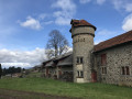
(2) Just before reaching the La Geneste industrial estate, turn right towards Ceuille. Walk uphill to the road. Cross the road at the pedestrian crossing on the right and take the street opposite, which leads to the agricultural college.
(3) Turn right into the college grounds, then go round the college by taking the road on the left leading to Cueille. At the entrance to the hamlet, take the street on the right. Do not continue along the path towards Aux Verts, but take a path on the left to go behind the hamlet, then continue along the road.
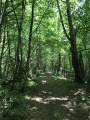
(4) At the junction, opposite the road leading back to the hamlet on the left, take a path on the right towards Vimbelle. The path descends into the woods and crosses a stream several times.
(5) Carry on straight ahead. Pass a path on the right heading towards Aux Verts, which you’ll take on the way back.
(6) At the junction, turn left towards Le Puy de Ceuille, then, just before the D53, take the road on the right to Vimbelle.
(7) Take the departmental road 23 on the right towards Tulle, then take the first path on the right towards Aux Verts and pass the junction from the outward journey again.
(6) Carry on straight ahead.
(5) At the junction, turn left towards “Aux Verts”.
(8) At the junction after Aux Verts, take the road on the left, which goes under the motorway and down into the valley (altitude 246), then take the road on the right.
(9) Leave the road and take a track that climbs to the right towards the Croix du Maugein.
(10) Cross the road and continue along the track opposite. At the junction, take the track on the left which leads back down to the road on the left at a place called Champ de Garau.
(11) Turn right onto the road and leave it immediately to take a track on the left. At the Chemin du Maugein, turn right towards Maugein.
(12) Take the road on the right, then leave it shortly afterwards to take a track on the left towards La Coutausse.
(13) Take the road on the right as far as Le Baladour, passing the viewpoint.
(14) Take a track that runs alongside the A-road on the right.
(15) At Les Espinasses, cross the main road, follow the street to the right and immediately take a path on the left towards La Jarrige.
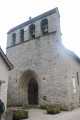
(16) Take the road on the right towards Naves and head for the church (S/E).
 Visorando Member

 Difficult
 Easy

