Following the Solane

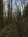
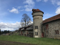
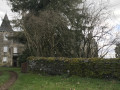
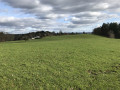
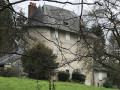
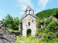
This walk, starting from Naves, mainly follows paths, often through woodland. It offers several views of the Monédières massif and passes by the Manoir de Leyrat and the Château de Bach.

Details

n°3055954
Creation:
Last update:
Last review:
  • Walking
    Activity: Walking
  • ↔
    Distance: 9.53 mi
  • ◔
    Average duration: 5h 25 
  • ▲
    Difficulty: Moderate

  • ⚐
    Back to start: Yes
  • ↗
    Ascent: + 1,188 ft
  • ↘
    Descent: - 1,201 ft

  • ▲
    Highest point: 1,624 ft
  • ▼
    Lowest point: 1,099 ft

Photos

Description of the walk

Park in the car park at Naves Town Hall.

(S/E) Take Rue Abbé Niel towards Tramond, next to the restaurant L’Oustal, and follow the red signposting. Take the first street on the right, then turn left. Continue to L’Escure Haute.

Turn onto the path on the right towards Tramond. Continue to the junction with the Chemin des Métaux.

(1) Continue left along the path until you reach the hamlet of Le Tramond.

(2) In the hamlet, take a track on the right towards Leyrat and continue uphill until you reach the road at the hamlet known as Le Moulin de Leyrat.

(3) Follow the road to the left, then cross it and immediately take the path opposite which crosses the Solane towards Leyrat. On reaching Leyrat, follow the road to the right. You will soon come to a Y-junction in the hamlet of La Croix de Leyrat.

(4) Take the first road on the right towards Le Puy Picard. At the next road (D 53), turn right for a few metres until you reach a crossroads with a footpath.

(5) Take this path to the right and head down towards Moussours. Enter a woodland and cross a stream. In the hamlet of Moussours, continue along the road until you reach a junction with another path.

(6) Leave the road and take the track on the left, turning at an angle of almost 180°. Carry on through the woods and, at the three-way junction, keep left. Pass under the power line and reach the houses at Bois des Combes. Continue slightly to the left; on leaving the woods, you’ll reach the hamlet of La Maisonneuve, then the Y-junction with the D53.

(7) Take a quick first turn right then left to join the Route de Coustelade. Follow the power line, pass underneath it and reach the edge of the Bois du Merle. Stay on this road to reach the Bois la Gendre junction.

(8) Cross the bridge over the motorway and head up the road opposite leading to Bassaler. Turn right in the village and continue along the track until you reach a junction.

(9) Turn left towards Bach to reach the château.

(10) Take a moment here to enjoy the view of the Massif des Monédières before heading back the way you came to return to the previous junction.

(9) Take the path on the left, running parallel to the motorway, to return to the Bois la Gendre crossroads.

(8) Turn left towards Faugères and head for the cemetery.

(11) Turn left towards the hamlet of La Conche. Leave Faugères on your left and continue straight on. At the entrance to this hamlet, take the road on the left which climbs up to the village. Turn left onto the track leading towards the motorway. As you approach the motorway, turn right, cross the D58 road and enter the village of La Geneste.

(12) Walk right through the village. After a sharp bend to the right, the road continues along a track leading to the La Geneste industrial estate. Cross the road and take the track opposite, which runs alongside the Vigne stream.

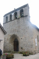
(13) From the industrial estate, follow the track to the D53 road and take this on the right towards Naves to reach the car park next to the church (S/E).

Waypoints

  1. S/E : mi 0 - alt. 1,339 ft - Car park at Naves church
  2. 1 : mi 0.27 - alt. 1,398 ft - Chemin des Métaux junction.
  3. 2 : mi 0.99 - alt. 1,355 ft - Le Tramond
  4. 3 : mi 1.61 - alt. 1,115 ft - Route du Moulin de Leyrat
  5. 4 : mi 2.19 - alt. 1,339 ft - The hamlet of La Croix de Leyrat
  6. 5 : mi 2.87 - alt. 1,434 ft - Le Puy Picard
  7. 6 : mi 3.78 - alt. 1,217 ft - Hairpin bend to the left
  8. 7 : mi 4.64 - alt. 1,411 ft - Crossing the D53
  9. 8 : mi 5.33 - alt. 1,476 ft - Bois La Gendre junction
  10. 9 : mi 6.05 - alt. 1,526 ft - Castle junction
  11. 10 : mi 6.33 - alt. 1,604 ft - Bach Castle
  12. 11 : mi 7.42 - alt. 1,355 ft - Faugères cemetery
  13. 12 : mi 8.19 - alt. 1,535 ft - La Geneste
  14. 13 : mi 8.79 - alt. 1,371 ft - La Geneste industrial estate
  15. S/E : mi 9.53 - alt. 1,335 ft - Car park at Naves church

Notes

A slightly noisy stretch near the motorway. The Naves area has plenty of signposts to help you find your way, in addition to the trail markings.

Worth a visit

Reviews and comments

4.2 / 5
Based on 2 reviews

Reliability of the description
4 / 5
Ease of following the route
5 / 5
Route interest
3.5 / 5
FLOCH
FLOCH ★

Thank you for this information.
A private message has been sent to the author.

Machine-translated

Eddy19
Eddy19
• Edited:

A lovely walk – I did mine in torrential rain, but that didn’t spoil my enjoyment!
However, there is one important point to bear in mind: between points 11 and 12, near Faugères, the route takes a path that runs through private property. I managed to get through this time by having a friendly chat with the owner, but it would be wise to alter the route so that it joins Rue des Arènes after point 11 – either by heading straight down through Faugères cemetery, or by continuing along the suggested route but turning right at the Faugères crossroads. Once you reach Rue des Arènes, simply follow it to point 12.

Apart from this point, the walk is very pleasant, with much of it under the trees – ideal on rainy days!

Machine-translated

RAND19
RAND19

Overall rating : 4 / 5

Date of your route : Jun 06, 2021
Reliability of the description : ★★★★☆ Good
Ease of following the route : ★★★★★ Very good
Route interest : ★★★☆☆ Average
Very busy route : No

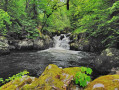
An easy walk, not particularly interesting apart from getting a good breath of fresh air. The Solane springs are well worth a look – the prettiest spot on this route.
The signposting is excellent – well done! Even with the best will in the world, you can still manage to get lost when you reach the industrial estate… phew, thank goodness for the sat-nav – it’s keeping an eye on things, because the end of the route is lovely and it would be a shame to end up on the road!!!
Thanks for sharing

Machine-translated

Pierrot874
Pierrot874

Overall rating : 4.3 / 5

Date of your route : Jul 04, 2020
Reliability of the description : ★★★★☆ Good
Ease of following the route : ★★★★★ Very good
Route interest : ★★★★☆ Good
Very busy route : No

A lovely walk. However, for future walkers, the Puy Picard is now called the Puy des Horts (according to the signposts on the ground).

In any case, it was a lovely walk that I did with my daughter and the dog! There are plenty of water spots along the way so the dog can have a drink and a swim.

Machine-translated

Other walks in the area

For more walks, use our search engine .

The GPS track and description are the property of this route's author. Please do not copy them without permission.