Ascent of Mount Rysy

A magnificent hike in the Slovak Tatras, right on the border with Poland, offering splendid panoramic views across the entire mountain range in both countries. Dotted with numerous lakes, the route is well-marked and fairly easy. Only the final section leading to the summit of Mount Rysy is challenging. The return journey follows the same route.

Details

n°2450573
Creation:
Last update:
Last review:
  • Walking
    Activity: Walking
  • ↔
    Distance: 11.81 mi
  • ◔
    Duration according to the author: 7 hrs 
  • ▲
    Difficulty: Very difficult

  • ⚐
    Back to start: Yes
  • ↗
    Ascent: + 4,160 ft
  • ↘
    Descent: - 4,157 ft

  • ▲
    Highest point: 8,110 ft
  • ▼
    Lowest point: 4,144 ft

Photos

Description of the walk

On a large circular route, before the hamlet of Popradské Pleso, leave your car by the side of the road.

(S/E) Take the small road, closed to traffic, on the left as you come from Strbské Pleso. Drive up through the forest along this small road, which is part of the National Park, via a series of wide bends. You’ll reach a junction with a path leading to Popradské Pleso Lake.

(1) Ignore this path and continue along the road. You’ll reach another junction at the entrance to the holiday village situated on the lakeshore.

(2) Take the lovely path on the left which climbs through the forest. As you gain altitude, the forest thins out and gives way to shrubs, flowers and rocks. Cross the river Zabi Potok and shortly afterwards you’ll reach a Y-junction.

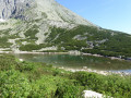
(3) Continue to the right, still climbing, and cross the Zabi Potok river again. Gradually, the vegetation disappears, giving way to a very rocky landscape. Carry on climbing along numerous bends on this barren slope until you reach Lake Velké Zabie pleso Mengusovské. There are stunning views of this lake and its islands. Head towards it if you want to soak up the sun and take a break.

(4) Join the path over the rocks after the lake and continue the ascent, which becomes increasingly steep. You’ll reach a mountain hut that also serves as a bar.

(5) Continue along the path to the left of the building. Climb a very steep slope, verging on rock climbing, to the summit of Mount Rysy.

(6) Begin the descent along the same route back to Popradské Pleso lake.

(2) Turn left onto the road, then take the path that circles the lake. Pass the tourist facilities and join the Tatranska Magistrala. Ignore the two turnings to the left and continue to follow the lakeshore to its tip.

(7) Leave the lake behind and continue straight on until you reach a group of chapels and various beautifully decorated wooden crosses.

(8) Turn right to return to the first junction you passed earlier.

(1) Turn left back onto the road and follow it downhill to reach the car park in the hamlet of Popradské Pleso (S/E).

Waypoints

  1. S/E : mi 0 - alt. 4,144 ft - Car park at the hamlet of Popradské Pleso
  2. 1 : mi 2 - alt. 4,921 ft - Junction of the circular lake loop
  3. 2 : mi 2.41 - alt. 5,007 ft - Start of the trail
  4. 3 : mi 3.15 - alt. 5,335 ft - Turn right at the junction
  5. 4 : mi 4.27 - alt. 6,352 ft - Lake Velké Zabie pleso Mengusovské
  6. 5 : mi 5.13 - alt. 7,336 ft - Mountain hut
  7. 6 : mi 5.66 - alt. 8,100 ft - Summit of Mount Rysy
  8. 7 : mi 9.34 - alt. 4,938 ft - End of the Lake Tour
  9. 8 : mi 9.58 - alt. 5,013 ft - Chapel and symbolic cemetery
  10. S/E : mi 11.81 - alt. 4,144 ft - Car park at the hamlet of Popradské Pleso

Notes

Please note that you’ll need to walk 3.5 km along the road to reach the start of the trail and around 3 km on the way back. Bear this in mind when calculating the time required.

Worth a visit

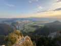
(6) Mount Rysy: the summit of Mount Rysy offers a 360° view across the entire Slovak and Polish Tatras. A few lakes nestle in the hollows, adding their deep blue to the already stunning colours.
(2) On the way back: weather permitting, you can have a swim in the lake, even though the water is very cold.
(8) Visit the symbolic cemetery and the chapel.

Reviews and comments

5 / 5
Based on 1 review

Reliability of the description
5 / 5
Ease of following the route
5 / 5
Route interest
5 / 5
tomtomgo
tomtomgo

Overall rating : 5 / 5

Date of your route : Jul 26, 2026
Reliability of the description : ★★★★★ Very good
Ease of following the route : ★★★★★ Very good
Route interest : ★★★★★ Very good
Very busy route : Yes

a very busy motorway

Machine-translated

Other walks in the area

For more walks, use our search engine .

The GPS track and description are the property of this route's author. Please do not copy them without permission.