From the Schronisko refuge to Sliezski Dom

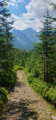
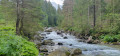
This is the key stage of the crossing and by far the most demanding. After a start to the route requiring a detour via the road, the trail enters a wooded valley and follows a river before tackling the long climb to the heights of the Tatras. The end of the stage presents the bulk of the difficulty, with an elevation gain of around 1,000 metres over just 3 km.

Covering 21 km with 1,200 m of ascent, this day’s walk requires a very good level of fitness.

This walk is part of a multi-day hike: Crossing the High Tatras from Zakopane to Starý Smokovec

Details

56839534
Creation:
Last update:
Last review:
  • Walking
    Activity: Walking
  • ↔
    Distance: 13.21 mi
  • ◔
    Average duration: 9h 30 
  • ▲
    Difficulty: Very difficult

  • ⚐
    Back to start: No
  • ↗
    Ascent: + 3,967 ft
  • ↘
    Descent: - 1,946 ft

  • ▲
    Highest point: 6,978 ft
  • ▼
    Lowest point: 3,186 ft
  • ⚐ Country: Poland
  • ⚑
    Start: N 49.233638° / E 20.095575°
  • ⚑
    End: N 49.156113° / E 20.156945°
  • Hour-by-hour weather

Photos

Description of the walk

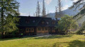
(S) From the Schronisko mountain hut, join the main path and then follow the track down towards the road. Do not try to cut straight through the forest towards the border: the vegetation there is particularly dense and there are several private properties in this area. The detour is therefore necessary.

(1) Continue along the main path until you reach the road.

(2) Follow the road as it continues to descend.

(3) Keep to the right at the area with shops to reach the valley. The route then continues for some time alongside the river and through the forest. This section, which is relatively easy going, contrasts sharply with the rest of the stage.

(4) Gradually leave the valley behind and begin the main climb of the day. From this point, the route gains altitude rapidly: there is a climb of nearly 1,000 metres over approximately 3 km. Continue the climb to Litvorové pleso.

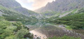
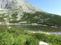
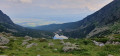
(5) Carry on towards Zamrznuté pleso, a high-altitude lake set in a much more rocky landscape.

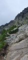
(6) Go round the lake on the right and continue towards Zamrznutý kotol. Then take a path towards Poľský hrebeň. The final ascent is very steep and features large steps that make progress easier. Reach the pass, the highest point of the stage.

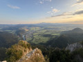
(7) Cross over onto the Slovakian side towards Sliezsky Dom (south-southeast). The first part of the descent is steep and particularly impressive. Caution is advised for those prone to vertigo. Continue the descent to the Sliezsky Dom hotel (E).

Waypoints

  1. S : mi 0 - alt. 3,409 ft - Schronisko mountain hut
  2. 1 : mi 0.49 - alt. 3,609 ft - Main path
  3. 2 : mi 2.28 - alt. 3,241 ft - Poland–Slovakia border
  4. 3 : mi 3.14 - alt. 3,189 ft - Shops
  5. 4 : mi 9.14 - alt. 4,281 ft - Start of the ascent
  6. 5 : mi 10.59 - alt. 6,007 ft - Litvorové pleso
  7. 6 : mi 11.06 - alt. 6,575 ft - Zamrznuté pleso
  8. 7 : mi 11.37 - alt. 6,962 ft - Poľský hrebeň (2 200 m)
  9. E : mi 13.21 - alt. 5,407 ft - Sliezsky Dom Hotel

Notes

This stage is long and involves a significant elevation gain. Make sure you have plenty of water and food, and set off early enough to allow a comfortable margin. The descent on the final part of the route can be dizzying for those prone to vertigo, as there are plenty of rocks.

Walking poles are useful, both for the ascent and the descent.

The start of the route requires a detour: do not attempt to reach the route directly by crossing the forest and the private property marked in this area.

Accommodation at the Sliezsky Dom hotel (E). Book in advance.

Other walks in the area

For more walks, use our search engine .

The GPS track and description are the property of this route's author. Please do not copy them without permission.