


(S) From Sliezski Dom, take the descending route, following the path towards Starý Smokovec. Continue the descent for approximately 7 km. The route gradually loses nearly 700 m in altitude as it reaches the valley. You will then arrive at Starý Smokovec (E).
From Sliezski Dom to Starý Smokovec


After the challenging stage the previous day, this third and final day is much shorter. It takes you down from the heights of the Tatras, gradually reaching the valley and Starý Smokovec.
The route is just 7 km long, with only 30 m of ascent and 700 m of descent.
This walk is part of a multi-day hike: Crossing the High Tatras from Zakopane to Starý Smokovec
Details
Creation:
Last update:
Last review:
–
–
-
 Activity: Walking
 -
 Distance: 4.38 mi
 -
 Average duration: 2h 05
 -
 Difficulty: Easy
 -
-
 Back to start: No
 -
 Ascent: + 102 ft
 -
 Descent: - 2,274 ft
 -
-
 Highest point: 5,574 ft
 -
 Lowest point: 3,402 ft
-
 Country:
Slovakia
Country:
Slovakia
-
 Start: N 49.155712° / E 20.157119°
 -
 End: N 49.139164° / E 20.222735°
 -


 Hour-by-hour weather
Photos

Description of the walk
Waypoints
- S : mi 0 - alt. 5,574 ft
- E : mi 4.38 - alt. 3,409 ft
Notes
There is a railway station in the destination town.
Other walks in the area
Zelene Pleso Route
 Visorando Member
 12.56 mi
+3,819 ft
-4,035 ft
10 hrs
12.56 mi
+3,819 ft
-4,035 ft
10 hrs
 Very difficult
Departure from Slovakia
Very difficult
Departure from Slovakia
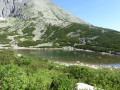
Zelene Pleso trail is a beautiful route in the High Tatras of Slovakia, that begins in Skalnate Pleso and takes you to the Green Lake Mountain Chalet. The route has impressive scenic views and numerous tracks you can use to return.
From the Schronisko refuge to Sliezski Dom
 13.21 mi
+3,967 ft
-1,946 ft
9h 30
Very difficult
Departure from Poland
13.21 mi
+3,967 ft
-1,946 ft
9h 30
Very difficult
Departure from Poland
This is the key stage of the crossing and by far the most demanding. After a start to the route requiring a detour via the road, the trail enters a wooded valley and follows a river before tackling the long climb to the heights of the Tatras. The end of the stage presents the bulk of the difficulty, with an elevation gain of around 1,000 metres over just 3 km.
Covering 21 km with 1,200 m of ascent, this day’s walk requires a very good level of fitness.
From Zakopane to the Schronisko mountain refuge
 6.86 mi
+1,709 ft
-1,660 ft
4h 40
6.86 mi
+1,709 ft
-1,660 ft
4h 40
 Moderate
Departure from Poland
Moderate
Departure from Poland
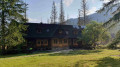
This first stage allows you to gradually leave the Zakopane area behind and enter the wooded areas of the Tatra National Park. A relatively balanced day’s walk before the much more demanding mountain stage the following day.
Crossing the High Tatras from Zakopane to Starý Smokovec
24.49 mi
+6,030 ft
-5,879 ft
3 days
 Difficult
Departure from Poland
Difficult
Departure from Poland
A three-stage traverse of the High Tatras, starting from the heights of Zakopane in Poland and ending in Starý Smokovec in Slovakia.
The route begins with a first day spent mainly in woodland, leading to the Schronisko mountain hut. The second stage, which is much more demanding, forms the heart of the trek: after a long walk through the valley and the forest, a particularly steep climb takes you up to the heights of the Tatras and across the Slovak border before reaching the Sliezski Dom hotel. The final day, which is considerably shorter, takes you back down to Starý Smokovec.
A hike full of contrasts, with the second day suited to hikers in very good physical condition.
Trzy Korony from Sromowce Niżne via the Wąwóz Szopczański
 4.26 mi
+1,736 ft
-1,736 ft
3h 30
Moderate
Departure from Poland
4.26 mi
+1,736 ft
-1,736 ft
3h 30
Moderate
Departure from Poland
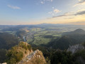
Starting from Sromowce Niżne, in Lesser Poland, this circular route takes you to the Trzy Korony, the ‘Three Crowns’, whose limestone peaks rise up in the heart of the Pieniny National Park. The ascent begins in the Wąwóz Szopczański, a deep gorge flanked by two high white cliffs, then continues through the forest along a long path of steps to the Przełęcz Szopka pass, where the view already stretches as far as the Tatra Mountains. A final rocky outcrop leads to Okrąglica and its metal walkway clinging to the rock face, suspended above the Dunajec gorge, its villages and its patchwork of fields. The return route winds down the other side, through the Polana Kosarzyska clearing, before plunging back into the forest and returning to the village.
For more walks, use our search engine .
The GPS track and description are the property of this route's author. Please do not copy them without permission.

