The Serre de Minuit, setting off from La Chaudière

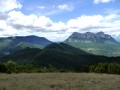
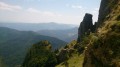
A lovely, easy walk at the foot of the Grand-Delmas with views of the Trois Becs, the Vercors, the Dévoluy…

Details

47218909
Creation:
Last update:
Last review:
  • Walking
    Activity: Walking
  • ↔
    Distance: 7.71 mi
  • ◔
    Average duration: 5h 05 
  • ▲
    Difficulty: Moderate

  • ⚐
    Back to start: Yes
  • ↗
    Ascent: + 1,726 ft
  • ↘
    Descent: - 1,696 ft

  • ▲
    Highest point: 3,724 ft
  • ▼
    Lowest point: 2,713 ft

Description of the walk

To reach the start, about 2 km before reaching the Col de La Chaudière on the Saillans side, turn left towards the village of La Chaudière. Park in the car park at the entrance to the village on the left.

(S/E) Walk straight through the village, then leave the path heading towards the Chapelle des Sadous and head down to the right towards the stream. Cross it via a small wooden bridge and head back up towards the hamlet of Les Hoirs.

(1) In front of the house in Les Hoirs, take the path leading uphill to the right. Please note: this path is not signposted and a section near a cultivated field is barely marked. Join the track (GR® 965) which runs at the foot of the clearly visible Trois Becs.

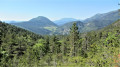
(2) Follow it to the left towards the village of Rochefourchat (a small village in the Drôme which holds the distinction of being the least populated commune in France, with just one inhabitant recorded in the 2009 census). It is situated at the foot of the Grand Delmas and the Montagne de Couspeau. To the west, the view gradually opens up to reveal the Obiou, the Grand-Ferrand, the Rocher Rond and other peaks of the Dévoluy and the Vercors. Ignore the side trails and, after about 4.5 km, you’ll reach the clearly marked trail junction at “Serre de Minuit”.

(3) Turn left, leaving the path towards Rochefourchat to head for La Chaudière . Note the few larch trees which add a splash of colour to the forest in autumn. Pass by the foot of a building, then above several clusters of houses. A few metres further on, you’ll reach a three-way junction.

(4) Turn right towards Col de Bauras, cross the stream and climb up to the pass with views of the Trois Becs.

(5) Continue to the right, towards La Chaudière, and join a track. Follow it to the right and arrive at Les Hoirs at the fork you passed on the way out.

(1) Head right and follow the route back along the same path as on the way there to the village of La Chaudière (S/E).

Waypoints

  1. S/E : mi 0 - alt. 2,881 ft - La Chaudière car park
  2. 1 : mi 0.52 - alt. 2,838 ft - Les Hoirs. Junction marking the start of the circular route - Courance (rivière) à finaliser
  3. 2 : mi 0.96 - alt. 3,212 ft - Track, GR695 of the Tour de la Vallée de la Roanne
  4. 3 : mi 3.79 - alt. 3,412 ft - Serre de Minuit
  5. 4 : mi 5.39 - alt. 2,795 ft - Three-Way Junction
  6. 5 : mi 6.9 - alt. 2,867 ft - Col de Bauras
  7. S/E : mi 7.71 - alt. 2,881 ft - La Chaudière car park

Notes

The narrow, somewhat uncomfortable path at the start improves very quickly.

Worth a visit

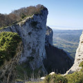
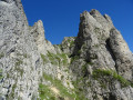
Stunning cliffs on the eastern side of the Trois Becs right from the start.

Always be cautious and plan ahead when you're outdoors. Visorando and the author of this route cannot be held responsible for any accidents occurring on this route.

The GR® and PR® markings are the intellectual property of the Fédération Française de Randonnée Pédestre.

Reviews and comments

3.8 / 5
Based on 3 reviews

Reliability of the description
3.7 / 5
Ease of following the route
3.7 / 5
Route interest
4 / 5
randodromeardeche
randodromeardeche

Overall rating : 4 / 5

Date of your route : Oct 20, 2025
Reliability of the description : ★★★★☆ Good
Ease of following the route : ★★★★☆ Good
Route interest : ★★★★☆ Good
Very busy route : Yes

Small correction to point 1: after passing through the gate, take the path on the right (marked with a cross) and go to a wooden gate. Go through it and cross the slightly uphill field, staying close to the fence to reach point 2 (without difficulty). This avoids passing close to the vegetable garden.

Machine-translated

Danielle / Emmanuel / Shakti

Overall rating : 3.7 / 5

Date of your route : May 01, 2025
Reliability of the description : ★★★☆☆ Average
Ease of following the route : ★★★★☆ Good
Route interest : ★★★★☆ Good
Very busy route : No

A lovely walk offering magnificent views of the Vercors, Devoluy and the 3 Becs.
There are plenty of tracks, but the views are stunning all the way along, which makes up for it.
It’s difficult to follow the route description from 1 to 2; the unmarked section needs to be followed using a GPS.
A fairly easy walk.

Machine-translated

filou
filou

Overall rating : 3.7 / 5

Date of your route : Jan 24, 2025
Reliability of the description : ★★★★☆ Good
Ease of following the route : ★★★☆☆ Average
Route interest : ★★★★☆ Good
Very busy route : No

An easy walk, lovely views, a bit too much of a track, but the views make up for it!!
Be careful, though – points 1 and 2 are on private property, with a few electric fences and wires in place for livestock.
I think the route will need to be altered in future! There’s no one around at this time of year, but it’s best avoided in summer!

Machine-translated

monique delunel
monique delunel

Not yet completed

Machine-translated

Other walks in the area

For more walks, use our search engine .

The GPS track and description are the property of this route's author. Please do not copy them without permission.