Country:

 City:


From Saillans heading towards the Col de la Chaudière, 800 m after the turn-off to the village of La Chaudière, look out for information boards under the trees on the right and a few parking spaces on either side of the road just before a left-hand bend.
Coming from the Col de la Chaudière, the car park is just past kilometre marker 10, behind the right-hand bend.
(S/E) The start is to the right of the information signs, following a gently ascending track. After 100 m, take a sharp left (cairn). From there, the path is sparsely signposted but obvious, with no further junctions, and is marked on the OSM base map. The climb is steep. After just under an hour, as you approach the cliffs, a small outcrop on the left offers a spot to take a break with unobstructed views. Next, at the scree slope below the Pas de la Picourère, keep to the left and ignore the tracks on the right which lead to the foot of the cliffs. The route is marked by old blue markers.
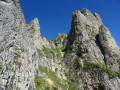
(1) Above the Pas de la Picourère, you join the classic Trois Becs circuit. Head right and climb to the summit of Roche Courbe.
(2) Carry on and enjoy a few off-trail viewpoints offering fine views of the cliffs.
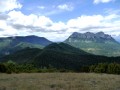
(3) On the descent from Roche Courbe, as you emerge from the forest, don’t miss the viewpoint on the right. The view of Roche Courbe is breathtaking. Back on the path, continue towards the Rocher de la Laveuse.
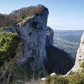
(4) At the junction with theGR®® (signpost), head back up the path towards the Pas de la Motte for 100 metres (a round trip) to reach the cliff edge. The Œil de la Laveuse is a surprising sight , with Saillans lying below. You can continue with caution along the cliff edge to the left to see an impressive canyon.
(4) Back at the signpost, head down theGR®® which quickly turns into a steep track.
(5) At the junction with a wide track, turn left.
(6) At the Virage du Pré de l’Âne (signposted), head up to the left to the Pas de Siara.
The rocks on the right are the perfect spot for a lunch break.
Continue along the main path to the left.
(7) You’ll soon reach a junction. Turn left onto the recently re-graded and realigned ascending path (the IGN map is no longer up to date).
(8) At the junction at the edge of the forest, turn right to reach the summit of the Veyou.
(9) Carry on to reach the summit of the Signal.
(10) Carry on until you finally reach the Pas de la Picourère.
(1) At the Pas, take the ascent route to the right. Take particular care when descending the rocky outcrops and the stony terraces of the Pas (S/E).


 Visorando Member
 Moderate

 Extremely difficult
 Easy
 Local authority