Slag heaps 2, 3 and 122 in the ‘Pays à part’ region

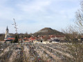
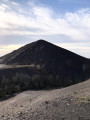
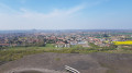
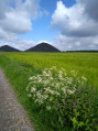
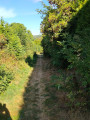
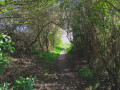
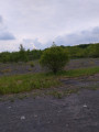
A route that will take you to the foot of slag heap 122 (known as the ‘Volcan’ slag heap). You’ll walk up old ‘cavaliers’ (paths that linked the pits together), where flora and fauna have reclaimed their place, and climb one of the twin slag heaps of the ‘Pays à part’, rising to an altitude of 180 metres (offering a magnificent view).

Details

1209781
Creation:
Last update:
Last review:
  • Walking
    Activity: Walking
  • ↔
    Distance: 6.26 mi
  • ◔
    Average duration: 3h 15 
  • ▲
    Difficulty: Moderate

  • ⚐
    Back to start: Yes
  • ↗
    Ascent: + 446 ft
  • ↘
    Descent: - 420 ft

  • ▲
    Highest point: 561 ft
  • ▼
    Lowest point: 148 ft

Photos

Description of the walk

Park at the foot of the Terril Volcan, at the junction of Rue de Béthune and Route d’Houchin in Haillicourt.

(S/E) Take the path heading north, in the opposite direction to theGRP®. Follow the path to the edge of the woods at the junction with the Falandes slag heap.

(1) Turn left; you’ll then enter a flat slag heap offering a view of the Terril Volcan.
Continue along this path to return to the road leading towards the slag heap.

(2) Turn left onto Rue des Fauvettes, then continue along Rue Diderot. Turn left onto Rue du Général Koenig to return to the starting point.

(S/E) This time, turn right onto the path heading south without following the GRP®.
The bridleway descends to the D188.

(3) Cross the road and continue along the same path opposite.
Join the D86 E4, cross it and, via the footbridge opposite, head into the Bois des Glachoires.

(4) Turn right onto a narrower path that climbs into the woods. Leave the bridle path here to reach a car park.

(5) Turn left onto the path towards the twin slag heaps to reach the crossroads at the foot of the first slag heap.

(6) Walk round the first slag heap on the left; you’ll come to a flight of steps leading to the top.

(7) Go back down the same flight of steps. Turn right to pass between the twin slag heaps and return to the previous crossroads.

(6) Follow the same route as on the way there to return to the crossroads by the car park.

(5) Keep to the right on the footbridges from start to finish, without going through the small wood, to return to the car park on Rue du Général Koenig (S/E).

Waypoints

  1. S/E : mi 0 - alt. 157 ft - Car park on Rue du Général Koenig
  2. 1 : mi 0.54 - alt. 161 ft - Junction of the path with the Falandes slag heap
  3. 2 : mi 1.11 - alt. 148 ft - Rue des Fauvettes
  4. 3 : mi 1.95 - alt. 164 ft - D188
  5. 4 : mi 2.6 - alt. 233 ft - Glachoires Wood junction
  6. 5 : mi 3.12 - alt. 246 ft - Entrance to the Twin Slurry Heaps site
  7. 6 : mi 3.32 - alt. 266 ft - Crossroads at the foot of slag heap no. 2
  8. 7 : mi 3.85 - alt. 554 ft - Top of slag heap no. 2
  9. S/E : mi 6.26 - alt. 157 ft - Car park on Rue du Général Koenig

Notes

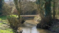
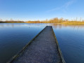
There’s plenty to see along the footbridges or at the top of the slag heap. Don’t forget your binoculars.
Make sure you wear sturdy shoes.

Worth a visit

The “volcanic” slag heap is so called because it’s still smouldering, so you may spot fumaroles at the summit. Access to it is, in fact, prohibited. On its southern slope, vines have been planted (yes, really! You’re not dreaming).
The ‘cavaliers’ (old mining tracks) are often at a higher elevation, where you can spot animal and plant species specific to this environment.
The twin slag heaps of the ‘Pays à part’ are the tallest in the mining basin after those at Loos-en-Gohelle. They offer an exceptional view.

Special note: if you want to take part in the ‘Défi Terril Unesco’ (51 slag heaps to climb) or just for fun, you can take a selfie at the top of the slag heap and share it using #defiterril and @defiterril on Instagram or by email at defiterril@gmail.com
You can also add a stone to the cairn at the top of the slag heap.

Reviews and comments

4.3 / 5
Based on 3 reviews

Reliability of the description
4.3 / 5
Ease of following the route
4 / 5
Route interest
4.7 / 5
JGABIN
JGABIN

Overall rating : 4.7 / 5

Date of your route : May 21, 2020
Reliability of the description : ★★★★★ Very good
Ease of following the route : ★★★★☆ Good
Route interest : ★★★★★ Very good
Very busy route : Yes

A peaceful stroll in the shade of the trees.
A lovely discovery of the slag heap
I reckon the distance is closer to 12 km than 10!?

Machine-translated

4641881059
4641881059

Overall rating : 4 / 5

Date of your route : May 18, 2020
Reliability of the description : ★★★★☆ Good
Ease of following the route : ★★★★☆ Good
Route interest : ★★★★☆ Good
Very busy route : No

A lovely route that gave me the chance to discover these two slag heaps, which I hadn’t known about but which are interesting.
The route description is good. It’s not an easy decision to make at (5), as there are two options;
I left the site in a deserted area, though not on Rue de Courrières, but I soon found my way back onto Rue de Noeux.
All in all, it’s good.

Machine-translated

henri57
henri57 ★

Hello,

@flomariachi

Thanks

See you soon

Machine-translated

flomariachi
flomariachi

Hello,
Thanks for the information! I’ve made a couple of changes to make the route easier for future walkers

Machine-translated

nordic walking ercan

Overall rating : 4.3 / 5

Date of your route : Apr 08, 2019
Reliability of the description : ★★★★☆ Good
Ease of following the route : ★★★★☆ Good
Route interest : ★★★★★ Very good

We did this route on Saturday morning. A very beautiful spot.
The only thing is that the starting point is hard to find
No sat-nav could locate Rue du Gal Koenig, either in Bruay-la-Buissière or in Haillicourt
As a result, we parked on Rue Georges Vasseur near the Salle de la Lampisterie
The orange signposting for the ‘Les Chamois’ route is also missing. Please note that it states ‘you will climb the twin slag heaps’, whereas it is possible to climb just one (advice from the rangers we met).
Otherwise, we enjoyed it and will certainly do this route again now that we’ve found our way.

Machine-translated

Other walks in the area

For more walks, use our search engine .

The GPS track and description are the property of this route's author. Please do not copy them without permission.